TopoQuest Logo
Do you find TopoQuest useful?
Help keep TopoQuest running and adding new maps/features by donating!
Bitcoin:  19c7KJd3qBynnjoSw5npx9KScwjBe4ifkT
Litecoin:  LXs6TkuXGGXo1vDsWCkWVdjQX94eUKd6ui
Home View Maps Find Maps Find Places Resources & Links


Middle Point, Ohio Topographic Map

USGS Map Title: Middle Point, OH
USGS Map MRC: 40084G4
DRG (GeoTIFF) Download: o40084g4.tif


Neighboring USGS Topographic Map Quads:


  Scott, OH  
40084H5
 

  Wetsel, OH  
40084H4
 

  Ottoville, OH  
40084H3
 

  Van Wert, OH  
40084G5
 

  Middle Point, OH  
40084G4
 

  Delphos, OH  
40084G3
 

  Mendon, OH  
40084F5
 

  Elgin, OH  
40084F4
 

  Spencerville, OH  
40084F3


Map MRC Location:

N41°
W85°
N41°
W84°
H8 H7 H6 H5 H4 H3 H2 H1
G8 G7 G6 G5 G4 G3 G2 G1
F8 F7 F6 F5 F4 F3 F2 F1
E8 E7 E6 E5 E4 E3 E2 E1
D8 D7 D6 D5 D4 D3 D2 D1
C8 C7 C6 C5 C4 C3 C2 C1
B8 B7 B6 B5 B4 B3 B2 B1
A8 A7 A6 A5 A4 A3 A2 A1
N40°
W85°
N40°
W84°

Middle Point, OH USGS 1:24K Topographic Map Preview:
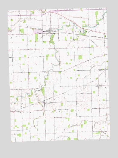
Middle Point, OH USGS Topographic Map
Click on map above to begin viewing in our Map Viewer.

This topographic map contains these locations and features:
Feature Name Type Latitude Longitude GNIS ID View Map
Auglaize School (historical)SchoolN40.7995°W84.4755°1053741View Map
Baer FarmsLocaleN40.8656°W84.4233°2707399View Map
Brumback Library Middle Point BranchBuildingN40.8542°W84.4461°2707380View Map
Buckeye School (historical)SchoolN40.8595°W84.3977°1069579View Map
Dover School (historical)SchoolN40.8523°W84.4677°1053739View Map
Evans DitchCanalN40.7998°W84.4466°1068844View Map
Evans DitchCanalN40.7539°W84.4752°1068845View Map
Grassy CreekStreamN40.7573°W84.3855°1041063View Map
Grove Church (historical)ChurchN40.8298°W84.4997°1053740View Map
Hempfling Dairy FarmsLocaleN40.8553°W84.3956°2582425View Map
Horeb CemeteryCemeteryN40.8006°W84.4341°1041791View Map
Horeb Church (historical)ChurchN40.8009°W84.4325°1053737View Map
Kimmet DitchCanalN40.8203°W84.4100°1068847View Map
King CemeteryCemeteryN40.8664°W84.4361°1042264View Map
King School (historical)SchoolN40.8700°W84.4369°1053736View Map
LandeckPopulated PlaceN40.8012°W84.3880°1056394View Map
Landeck Elementary SchoolSchoolN40.8014°W84.3872°1049717View Map
Landneck Post Office (historical)Post OfficeN40.8000°W84.3888°1957996View Map
Lincolnview East Elementary SchoolSchoolN40.8523°W84.4477°1053827View Map
Lindeman School (historical)SchoolN40.8306°W84.3983°1053735View Map
Middle PointPopulated PlaceN40.8556°W84.4472°1077349View Map
Middle PointCapeN40.8534°W84.4466°1066338View Map
Middle Point Fire Department / Middle Point Emergency Medical ServicesBuildingN40.8553°W84.4455°2549815View Map
Middle Point Police DepartmentBuildingN40.8549°W84.4458°2732415View Map
Middle Point Post OfficePost OfficeN40.8556°W84.4472°2081237View Map
Morris DitchCanalN40.8064°W84.4658°1068850View Map
Prairie School (historical)SchoolN40.7687°W84.4166°1053738View Map
Pugh School (historical)SchoolN40.7714°W84.4858°1053742View Map
Ridge Township Stone QuarryMineN40.8561°W84.4969°2635312View Map
Ringwald Egg RanchLocaleN40.8742°W84.4253°2707401View Map
Saint John the Baptist Catholic ChurchChurchN40.8009°W84.3875°1062495View Map
Saint Johns CemeteryCemeteryN40.8000°W84.3874°1699324View Map
Saint Johns School (historical)SchoolN40.8014°W84.3872°1807374View Map
Salem United Presbyterian ChurchChurchN40.7828°W84.4566°1062512View Map
Spice RunStreamN40.8645°W84.4830°1046526View Map
Summerset School (historical)SchoolN40.8303°W84.4358°1068247View Map
Township of JenningsCivilN40.7503°W84.4266°1087090View Map
Township of WashingtonCivilN40.8596°W84.3986°1087096View Map
Van-Del Drive-InLocaleN40.8692°W84.4378°2633274View Map
VenedociaPopulated PlaceN40.7864°W84.4569°1056558View Map
Venedocia CemeteryCemeteryN40.7864°W84.4619°1807438View Map
Venedocia Post Office (historical)Post OfficeN40.7861°W84.4569°2081244View Map
Village of Middle PointCivilN40.8559°W84.4463°2399331View Map
Village of VenedociaCivilN40.7852°W84.4559°2400052View Map
Whites DitchCanalN40.8423°W84.4225°1068854View Map
Wolf DitchCanalN40.7714°W84.4677°1048040View Map
Wright CemeteryCemeteryN40.7545°W84.4355°1048156View Map

Note: Coordinates in the location and feature list above are referenced to NAD83 datum.


Copyright (C) 2008-2025 Ryan Niemi / Sunset Dynamics ... All Rights Reserved