TopoQuest Logo
Do you find TopoQuest useful?
Help keep TopoQuest running and adding new maps/features by donating!
Bitcoin:  19c7KJd3qBynnjoSw5npx9KScwjBe4ifkT
Litecoin:  LXs6TkuXGGXo1vDsWCkWVdjQX94eUKd6ui
Home View Maps Find Maps Find Places Resources & Links


Middleburg, Tennessee Topographic Map

USGS Map Title: Middleburg, TN
USGS Map MRC: 35089B1
DRG (GeoTIFF) Download: o35089b1.tif


Neighboring USGS Topographic Map Quads:


  Whiteville, TN  
35089C2
 

  Bolivar West, TN  
35089C1
 

  Bolivar East, TN  
35088C8
 

  Hickory Valley, TN  
35089B2
 

  Middleburg, TN  
35089B1
 

  Hebron, TN  
35088B8
 

  Grand Junction, TN  
35089A2
 

  Saulsbury, TN  
35089A1
 

  Middleton, TN  
35088A8


Map MRC Location:

N36°
W90°
N36°
W89°
H8 H7 H6 H5 H4 H3 H2 H1
G8 G7 G6 G5 G4 G3 G2 G1
F8 F7 F6 F5 F4 F3 F2 F1
E8 E7 E6 E5 E4 E3 E2 E1
D8 D7 D6 D5 D4 D3 D2 D1
C8 C7 C6 C5 C4 C3 C2 C1
B8 B7 B6 B5 B4 B3 B2 B1
A8 A7 A6 A5 A4 A3 A2 A1
N35°
W90°
N35°
W89°

Middleburg, TN USGS 1:24K Topographic Map Preview:
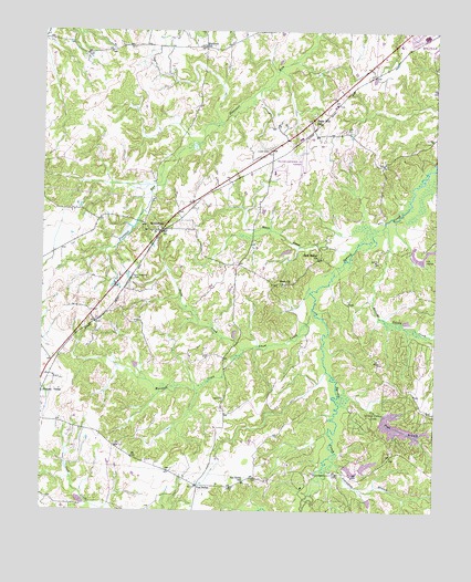
Middleburg, TN USGS Topographic Map
Click on map above to begin viewing in our Map Viewer.

This topographic map contains these locations and features:
Feature Name Type Latitude Longitude GNIS ID View Map
Avent CemeteryCemeteryN35.1537°W89.0676°1648555View Map
Bolivar Division (historical)CensusN35.2376°W89.0084°1648745View Map
Clifft CemeteryCemeteryN35.2242°W89.0278°1648558View Map
Commissioner District 2CivilN35.1989°W89.0053°2463928View Map
Commissioner District 4CivilN35.1770°W89.1189°2464043View Map
Covington BranchStreamN35.1390°W89.0331°1281436View Map
Daily CreekStreamN35.1670°W89.0609°1269511View Map
Enon ChurchChurchN35.1845°W89.0467°1283810View Map
Gin Pond BranchStreamN35.1548°W89.0273°1285452View Map
Good Shepherd CemeteryCemeteryN35.1854°W89.0959°1648559View Map
Grand Valley Dam Number TwoDamN35.1451°W89.0001°1301608View Map
Grand Valley Fire DepartmentBuildingN35.1396°W89.0139°2653889View Map
Grand Valley LakeReservoirN35.1470°W89.0110°1307067View Map
Grand Valley Lake Number One DamDamN35.1518°W89.0167°1301628View Map
Hamer CreekStreamN35.1926°W89.0265°1286641View Map
Marshall CreekStreamN35.1670°W89.0609°1269778View Map
Mathews SchoolSchoolN35.2465°W89.0745°1292928View Map
Messiah’s Spiritual Body ChurchChurchN35.2434°W89.0111°2701843View Map
MiddleburgPopulated PlaceN35.1979°W89.0876°1293710View Map
Middleburg Baptist ChurchChurchN35.1981°W89.0884°1319767View Map
Middleburg School (historical)SchoolN35.1979°W89.0903°1319768View Map
New Bethel Baptist ChurchChurchN35.1915°W89.0376°1295424View Map
Snow CreekStreamN35.1776°W89.0392°1270781View Map
Spring Creek Ranch Lake Number OneReservoirN35.1358°W89.0265°1301598View Map
Spring Creek Ranch Lake Number One DamDamN35.1368°W89.0301°1301597View Map
Spring Creek Ranch Lake Number TwoReservoirN35.1371°W89.0212°1301595View Map
Spring Creek Ranch Lake Number Two DamDamN35.1368°W89.0201°1301596View Map
Sugar HillPopulated PlaceN35.2268°W89.0401°1647503View Map
Sugar Hill SchoolSchoolN35.2262°W89.0381°1271682View Map
Ussery CemeteryCemeteryN35.2190°W89.0539°1648551View Map
Van BurenPopulated PlaceN35.1315°W89.0753°1273355View Map
Van Buren SchoolSchoolN35.1326°W89.0606°1273356View Map
Welcome Ussery CreekStreamN35.1984°W89.0151°1274086View Map
William L Whitehurst FieldAirportN35.2132°W89.0423°1301320View Map

Note: Coordinates in the location and feature list above are referenced to NAD83 datum.


Copyright (C) 2008-2024 Ryan Niemi / Sunset Dynamics ... All Rights Reserved