TopoQuest Logo
Do you find TopoQuest useful?
Help keep TopoQuest running and adding new maps/features by donating!
Bitcoin:  19c7KJd3qBynnjoSw5npx9KScwjBe4ifkT
Litecoin:  LXs6TkuXGGXo1vDsWCkWVdjQX94eUKd6ui
Home View Maps Find Maps Find Places Resources & Links


Bolivar West, Tennessee Topographic Map

USGS Map Title: Bolivar West, TN
USGS Map MRC: 35089C1
DRG (GeoTIFF) Download: o35089c1.tif


Neighboring USGS Topographic Map Quads:


  Hillville, TN  
35089D2
 

  Mercer, TN  
35089D1
 

  Teague, TN  
35088D8
 

  Whiteville, TN  
35089C2
 

  Bolivar West, TN  
35089C1
 

  Bolivar East, TN  
35088C8
 

  Hickory Valley, TN  
35089B2
 

  Middleburg, TN  
35089B1
 

  Hebron, TN  
35088B8


Map MRC Location:

N36°
W90°
N36°
W89°
H8 H7 H6 H5 H4 H3 H2 H1
G8 G7 G6 G5 G4 G3 G2 G1
F8 F7 F6 F5 F4 F3 F2 F1
E8 E7 E6 E5 E4 E3 E2 E1
D8 D7 D6 D5 D4 D3 D2 D1
C8 C7 C6 C5 C4 C3 C2 C1
B8 B7 B6 B5 B4 B3 B2 B1
A8 A7 A6 A5 A4 A3 A2 A1
N35°
W90°
N35°
W89°

Bolivar West, TN USGS 1:24K Topographic Map Preview:
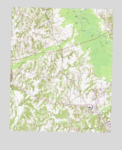
Bolivar West, TN USGS Topographic Map
Click on map above to begin viewing in our Map Viewer.

This topographic map contains these locations and features:
Feature Name Type Latitude Longitude GNIS ID View Map
Bartlett ChapelChurchN35.3492°W89.0962°1276402View Map
Bartlett Chapel CemeteryCemeteryN35.3356°W89.0803°1276403View Map
Bethelehem Baptist ChurchChurchN35.3009°W89.0470°1319739View Map
Bethlehem ChurchChurchN35.3679°W89.1109°1305164View Map
Bethlehem SchoolSchoolN35.3012°W89.0476°1277176View Map
Bolivar Church of ChristChurchN35.2570°W89.0023°1319741View Map
Bolivar Elementary SchoolSchoolN35.2617°W89.0020°1319744View Map
Bolivar Junior High SchoolSchoolN35.2523°W89.0009°1319746View Map
Brushy PondLakeN35.3602°W89.0434°1278714View Map
Central High SchoolSchoolN35.2584°W89.0009°1319747View Map
City of BolivarCivilN35.2656°W89.0148°2403890View Map
Clear CreekStreamN35.3601°W89.0392°1280659View Map
Clover CreekStreamN35.3723°W89.0409°1305988View Map
Clover LakesLakeN35.3660°W89.0412°1280778View Map
Commissioner District 1CivilN35.3323°W89.0742°2464240View Map
Green Grove ChurchChurchN35.2817°W89.0820°1286090View Map
Green Grove School (historical)SchoolN35.2815°W89.0809°1319756View Map
Hardeman County Golf CourseLocaleN35.2834°W89.0120°1319757View Map
Hardeman County LandfillLocaleN35.2842°W89.0569°2677860View Map
Norment CemeteryCemeteryN35.3348°W89.1214°1295830View Map
Nuckolls CemeteryCemeteryN35.2645°W89.0009°1296011View Map
Oak Dain CreekStreamN35.2915°W89.1248°1296048View Map
Parker CemeteryCemeteryN35.3676°W89.0751°1296802View Map
Parrans ChapelChurchN35.2767°W89.0551°1296875View Map
Pirtle PondLakeN35.3405°W89.0053°1297706View Map
Potters CreekStreamN35.2542°W89.0348°1298359View Map
Round PondLakeN35.3650°W89.0380°1300173View Map
Saint Marys Catholic ChurchChurchN35.2565°W89.0062°1319777View Map
Short CreekStreamN35.3509°W89.0287°1270185View Map
Turkey PondLakeN35.3716°W89.0467°1273030View Map
Western Mental Health InstituteHospitalN35.2751°W89.0267°1648109View Map

Note: Coordinates in the location and feature list above are referenced to NAD83 datum.


Copyright (C) 2008-2024 Ryan Niemi / Sunset Dynamics ... All Rights Reserved