TopoQuest Logo
Do you find TopoQuest useful?
Help keep TopoQuest running and adding new maps/features by donating!
Bitcoin:  19c7KJd3qBynnjoSw5npx9KScwjBe4ifkT
Litecoin:  LXs6TkuXGGXo1vDsWCkWVdjQX94eUKd6ui
Home View Maps Find Maps Find Places Resources & Links


Middleburgh, New York Topographic Map

USGS Map Title: Middleburgh, NY
USGS Map MRC: 42074E3
DRG (GeoTIFF) Download: o42074e3.tif


Neighboring USGS Topographic Map Quads:


  Cobleskill, NY  
42074F4
 

  Schoharie, NY  
42074F3
 

  Gallupville, NY  
42074F2
 

  Breakabeen, NY  
42074E4
 

  Middleburgh, NY  
42074E3
 

  Rensselaerville, NY  
42074E2
 

  Gilboa, NY  
42074D4
 

  Livingstonville, NY  
42074D3
 

  Durham, NY  
42074D2


Map MRC Location:

N43°
W75°
N43°
W74°
H8 H7 H6 H5 H4 H3 H2 H1
G8 G7 G6 G5 G4 G3 G2 G1
F8 F7 F6 F5 F4 F3 F2 F1
E8 E7 E6 E5 E4 E3 E2 E1
D8 D7 D6 D5 D4 D3 D2 D1
C8 C7 C6 C5 C4 C3 C2 C1
B8 B7 B6 B5 B4 B3 B2 B1
A8 A7 A6 A5 A4 A3 A2 A1
N42°
W75°
N42°
W74°

Middleburgh, NY USGS 1:24K Topographic Map Preview:
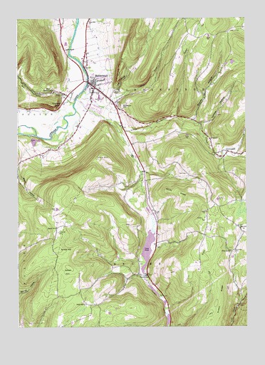
Middleburgh, NY USGS Topographic Map
Click on map above to begin viewing in our Map Viewer.

This topographic map contains these locations and features:
Feature Name Type Latitude Longitude GNIS ID View Map
Armlin HillSummitN42.5315°W74.3529°942566View Map
Armlin Hill CemeteryCemeteryN42.5386°W74.3526°942565View Map
Barkman CemeteryCemeteryN42.5736°W74.2656°2554548View Map
Barkman CemeteryCemeteryN42.5855°W74.2647°2554550View Map
Bohringers Fruit FarmLocaleN42.5875°W74.3597°2516828View Map
Borthwick CemeteryCemeteryN42.5405°W74.2533°2554546View Map
Brookie HollowValleyN42.5842°W74.2789°944838View Map
Cotton Hill CemeteryCemeteryN42.6197°W74.2588°947529View Map
Dutton RidgeRidgeN42.5109°W74.2649°948882View Map
East HillSummitN42.5329°W74.2715°949112View Map
East Hill ChurchChurchN42.5398°W74.2526°949122View Map
FranklintonPopulated PlaceN42.5209°W74.3035°950635View Map
Franklinton CemeteryCemeteryN42.5204°W74.3092°2554543View Map
Gates HillSummitN42.5240°W74.3465°950945View Map
Gates Hill ChurchChurchN42.5092°W74.3379°950947View Map
Highwinds FarmLocaleN42.5600°W74.2519°2555064View Map
Hony HillSummitN42.5692°W74.3276°953155View Map
HunterslandPopulated PlaceN42.5709°W74.2596°953487View Map
Huntersland School CemeteryCemeteryN42.5694°W74.2519°2554549View Map
Huntersland Volunteer Fire DepartmentBuildingN42.5694°W74.2542°2718719View Map
Laughton HollowValleyN42.5823°W74.2749°955078View Map
Line CreekStreamN42.5904°W74.3435°955416View Map
Little Schoharie CreekStreamN42.5920°W74.3424°955683View Map
Mattice CemeteryCemeteryN42.5747°W74.3643°956675View Map
MiddleburghPopulated PlaceN42.5987°W74.3329°957144View Map
Middleburgh Central SchoolSchoolN42.5967°W74.3338°2493619View Map
Middleburgh Elementary SchoolSchoolN42.5933°W74.3302°2668881View Map
Middleburgh Emergency Volunteer Ambulance CorpsBuildingN42.5927°W74.3188°2720142View Map
Middleburgh Fire DepartmentBuildingN42.5997°W74.3331°2493620View Map
Middleburgh LibraryBuildingN42.5970°W74.3320°2493617View Map
Mill ValleyValleyN42.5945°W74.3502°957286View Map
Pilgrim Holiness ChurchChurchN42.6122°W74.3484°2616233View Map
Pine GrovePopulated PlaceN42.5306°W74.2582°972944View Map
Red Maple FarmLocaleN42.5914°W74.3150°2555063View Map
Reformed Church of MiddleburghChurchN42.6050°W74.3375°2493622View Map
Saint Catherines Roman Catholic ChurchChurchN42.5970°W74.3310°2493621View Map
Saint Mark's Christian SchoolSchoolN42.5991°W74.3347°2669094View Map
Saint Mark's Lutheran ChurchChurchN42.5990°W74.3350°2493618View Map
School Number 5 (historical)SchoolN42.5404°W74.3532°975400View Map
Stony CreekStreamN42.5954°W74.3385°966551View Map
Taylor CemeteryCemeteryN42.5620°W74.2827°967082View Map
The CliffCliffN42.6059°W74.3182°967217View Map
The GorgeValleyN42.5960°W74.3216°967247View Map
The VlaieLakeN42.5314°W74.3040°967350View Map
Town of BroomeCivilN42.5027°W74.2923°978760View Map
Town of MiddleburghCivilN42.6070°W74.3196°979212View Map
Village of MiddleburghCivilN42.5980°W74.3298°2390979View Map
Vromans NoseCliffN42.5890°W74.3543°968611View Map
West MiddleburghPopulated PlaceN42.5956°W74.3532°970797View Map
Windy RidgeRidgeN42.5545°W74.2887°971479View Map

Note: Coordinates in the location and feature list above are referenced to NAD83 datum.


Copyright (C) 2008-2025 Ryan Niemi / Sunset Dynamics ... All Rights Reserved