TopoQuest Logo
Do you find TopoQuest useful?
Help keep TopoQuest running and adding new maps/features by donating!
Bitcoin:  19c7KJd3qBynnjoSw5npx9KScwjBe4ifkT
Litecoin:  LXs6TkuXGGXo1vDsWCkWVdjQX94eUKd6ui
Home View Maps Find Maps Find Places Resources & Links


Livingstonville, New York Topographic Map

USGS Map Title: Livingstonville, NY
USGS Map MRC: 42074D3
DRG (GeoTIFF) Download: o42074d3.tif


Neighboring USGS Topographic Map Quads:


  Breakabeen, NY  
42074E4
 

  Middleburgh, NY  
42074E3
 

  Rensselaerville, NY  
42074E2
 

  Gilboa, NY  
42074D4
 

  Livingstonville, NY  
42074D3
 

  Durham, NY  
42074D2
 

  Prattsville, NY  
42074C4
 

  Ashland, NY  
42074C3
 

  Hensonville, NY  
42074C2


Map MRC Location:

N43°
W75°
N43°
W74°
H8 H7 H6 H5 H4 H3 H2 H1
G8 G7 G6 G5 G4 G3 G2 G1
F8 F7 F6 F5 F4 F3 F2 F1
E8 E7 E6 E5 E4 E3 E2 E1
D8 D7 D6 D5 D4 D3 D2 D1
C8 C7 C6 C5 C4 C3 C2 C1
B8 B7 B6 B5 B4 B3 B2 B1
A8 A7 A6 A5 A4 A3 A2 A1
N42°
W75°
N42°
W74°

Livingstonville, NY USGS 1:24K Topographic Map Preview:
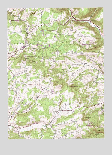
Livingstonville, NY USGS Topographic Map
Click on map above to begin viewing in our Map Viewer.

This topographic map contains these locations and features:
Feature Name Type Latitude Longitude GNIS ID View Map
BatesPopulated PlaceN42.4465°W74.2743°943157View Map
Bates Hollow Church CemeteryCemeteryN42.4460°W74.2746°2554572View Map
Black BrookStreamN42.4742°W74.3485°944080View Map
Broome CenterPopulated PlaceN42.4631°W74.3513°944893View Map
Broome Volunteer Fire DepartmentBuildingN42.4860°W74.2671°2718720View Map
East Conesville CemeteryCemeteryN42.4267°W74.3357°2554575View Map
Ellis CemeteryCemeteryN42.4573°W74.2964°949522View Map
High KnobSummitN42.4284°W74.3126°952741View Map
Hubbard HillSummitN42.4490°W74.3438°953356View Map
Keyserkill CemeteryCemeteryN42.4818°W74.3485°954579View Map
Lake CreekStreamN42.4859°W74.2696°954906View Map
Leonard HillSummitN42.4506°W74.3526°955213View Map
LivingstonvillePopulated PlaceN42.4876°W74.2685°955753View Map
Livingstonville CemeteryCemeteryN42.4842°W74.2676°2554574View Map
Livingstonville Presbyterian CemeteryCemeteryN42.4880°W74.2675°2554573View Map
ManorkillPopulated PlaceN42.3895°W74.3221°956379View Map
Manorkill Rural CemeteryCemeteryN42.3894°W74.3267°2554577View Map
Richtmyer PeakSummitN42.3756°W74.2635°962485View Map
School Number 12 (historical)SchoolN42.4454°W74.2896°975015View Map
School Number 3 (historical)SchoolN42.4020°W74.3065°975243View Map
School Number 6 (historical)SchoolN42.4459°W74.2540°975463View Map
School Number 8 (historical)SchoolN42.4290°W74.2610°975580View Map
School Number 9 (historical)SchoolN42.4523°W74.3310°975621View Map
Scott Patent CemeteryCemeteryN42.4567°W74.2750°2554578View Map
Scott Patent ChurchChurchN42.4570°W74.2826°964681View Map
Scott Patent HillSummitN42.4545°W74.2524°970589View Map
Steenburg MountainSummitN42.3945°W74.2749°966331View Map
Town of ConesvilleCivilN42.3968°W74.3356°978859View Map

Note: Coordinates in the location and feature list above are referenced to NAD83 datum.


Copyright (C) 2008-2024 Ryan Niemi / Sunset Dynamics ... All Rights Reserved