TopoQuest Logo
Do you find TopoQuest useful?
Help keep TopoQuest running and adding new maps/features by donating!
Bitcoin:  19c7KJd3qBynnjoSw5npx9KScwjBe4ifkT
Litecoin:  LXs6TkuXGGXo1vDsWCkWVdjQX94eUKd6ui
Home View Maps Find Maps Find Places Resources & Links


Middlefield, Ohio Topographic Map

USGS Map Title: Middlefield, OH
USGS Map MRC: 41081D1
DRG (GeoTIFF) Download: o41081d1.tif


Neighboring USGS Topographic Map Quads:


  Chardon, OH  
41081E2
 

  East Claridon, OH  
41081E1
 

  Windsor, OH  
41080E8
 

  Burton, OH  
41081D2
 

  Middlefield, OH  
41081D1
 

  West Farmington, OH  
41080D8
 

  Mantua, OH  
41081C2
 

  Garrettsville, OH  
41081C1
 

  Southington, OH  
41080C8


Map MRC Location:

N42°
W82°
N42°
W81°
H8 H7 H6 H5 H4 H3 H2 H1
G8 G7 G6 G5 G4 G3 G2 G1
F8 F7 F6 F5 F4 F3 F2 F1
E8 E7 E6 E5 E4 E3 E2 E1
D8 D7 D6 D5 D4 D3 D2 D1
C8 C7 C6 C5 C4 C3 C2 C1
B8 B7 B6 B5 B4 B3 B2 B1
A8 A7 A6 A5 A4 A3 A2 A1
N41°
W82°
N41°
W81°

Middlefield, OH USGS 1:24K Topographic Map Preview:
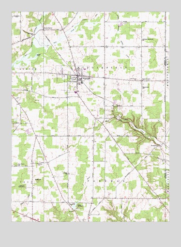
Middlefield, OH USGS Topographic Map
Click on map above to begin viewing in our Map Viewer.

This topographic map contains these locations and features:
Feature Name Type Latitude Longitude GNIS ID View Map
A J Jordak Elementary SchoolSchoolN41.4623°W81.0709°1057761View Map
Airwolf HeliportAirportN41.4501°W81.0501°1082240View Map
Berkshire Industrial ParkLocaleN41.4606°W81.1058°2546917View Map
Bonner Industrial ParkLocaleN41.4628°W81.0539°2546919View Map
BundysburgPopulated PlaceN41.4201°W81.0081°1060905View Map
Bundysburg Post Office (historical)Post OfficeN41.4195°W81.0081°1988330View Map
Burroughs CemeteryCemeteryN41.4096°W81.1045°1038548View Map
Burton Industrial ParkLocaleN41.4669°W81.1011°2546918View Map
Burton StationPopulated PlaceN41.4892°W81.1004°1056742View Map
Burton Station Post Office (historical)Post OfficeN41.4889°W81.0998°1988331View Map
Camp ChickagamiLocaleN41.3848°W81.0729°1038673View Map
Cardinal High SchoolSchoolN41.4659°W81.0673°1057759View Map
Cardinal Middle SchoolSchoolN41.4634°W81.0715°1057760View Map
Cornerstone Bible ChurchChurchN41.4630°W81.1063°2612100View Map
Geauga County AirportAirportN41.4490°W81.0677°1082855View Map
Geauga Industrial ParkLocaleN41.4533°W81.0689°2546920View Map
Harrington Square HeliportAirportN41.4617°W81.0854°1082856View Map
Hayes CornersPopulated PlaceN41.4589°W81.0226°1056319View Map
Hayes Corners CemeteryCemeteryN41.4593°W81.0270°1041423View Map
Hayes Road SchoolSchoolN41.4542°W81.0220°1041424View Map
Hosmer Airfield (historical)AirportN41.4314°W81.1148°1074892View Map
John's Country NurseryBuildingN41.4392°W81.0631°2652225View Map
Lake EstabrookLakeN41.3842°W81.0750°1040234View Map
Larry Peairs Memorial LakeReservoirN41.4434°W81.0548°1079344View Map
Larry Peairs Memorial Lake DamDamN41.4434°W81.0548°1079343View Map
Maple GrovePopulated PlaceN41.4001°W81.1082°1062874View Map
Mapleview SchoolSchoolN41.4864°W81.1082°1042978View Map
MiddlefieldPopulated PlaceN41.4620°W81.0737°1061515View Map
Middlefield Center CemeteryCemeteryN41.4631°W81.0673°1963343View Map
Middlefield Fire Department Station 1BuildingN41.4636°W81.0738°2550246View Map
Middlefield Police DepartmentBuildingN41.4638°W81.0739°2732524View Map
Middlefield Post OfficePost OfficeN41.4626°W81.0498°1988368View Map
Middlfield Post OfficePost OfficeN41.4626°W81.0734°1988369View Map
Moss FarmLocaleN41.3864°W81.0408°2547148View Map
Northeast Middlefield SchoolSchoolN41.4831°W81.0223°1043979View Map
Overlook CemeteryCemeteryN41.3762°W81.0698°1044245View Map
Parkman SchoolSchoolN41.4037°W81.0807°1044308View Map
Pauls Airport (historical)AirportN41.4283°W81.0638°1082858View Map
Shrine of Maria-PochLocaleN41.3959°W81.1145°1080194View Map
Sperry PondLakeN41.4737°W81.1054°1058038View Map
SugarloafSummitN41.4001°W81.1040°1066996View Map
Tare CreekStreamN41.4762°W81.1098°1067002View Map
Township of MiddlefieldCivilN41.4641°W81.0485°1086155View Map
Township of ParkmanCivilN41.3869°W81.0513°1086159View Map
Troy Church SchoolSchoolN41.4084°W81.1198°1047172View Map
Village of MiddlefieldCivilN41.4604°W81.0735°2399332View Map
Welshfield Post Office (historical)Post OfficeN41.3876°W81.0582°1988364View Map
Wilkum CreekStreamN41.4744°W81.1048°2760756View Map
Yoder CemeteryCemeteryN41.4167°W81.0806°1963358View Map
Zaylor FarmLocaleN41.3861°W81.0528°2547147View Map

Note: Coordinates in the location and feature list above are referenced to NAD83 datum.


Copyright (C) 2008-2025 Ryan Niemi / Sunset Dynamics ... All Rights Reserved