TopoQuest Logo
Do you find TopoQuest useful?
Help keep TopoQuest running and adding new maps/features by donating!
Bitcoin:  19c7KJd3qBynnjoSw5npx9KScwjBe4ifkT
Litecoin:  LXs6TkuXGGXo1vDsWCkWVdjQX94eUKd6ui
Home View Maps Find Maps Find Places Resources & Links


Burton, Ohio Topographic Map

USGS Map Title: Burton, OH
USGS Map MRC: 41081D2
DRG (GeoTIFF) Download: o41081d2.tif


Neighboring USGS Topographic Map Quads:


  Chesterland, OH  
41081E3
 

  Chardon, OH  
41081E2
 

  East Claridon, OH  
41081E1
 

  South Russell, OH  
41081D3
 

  Burton, OH  
41081D2
 

  Middlefield, OH  
41081D1
 

  Aurora, OH  
41081C3
 

  Mantua, OH  
41081C2
 

  Garrettsville, OH  
41081C1


Map MRC Location:

N42°
W82°
N42°
W81°
H8 H7 H6 H5 H4 H3 H2 H1
G8 G7 G6 G5 G4 G3 G2 G1
F8 F7 F6 F5 F4 F3 F2 F1
E8 E7 E6 E5 E4 E3 E2 E1
D8 D7 D6 D5 D4 D3 D2 D1
C8 C7 C6 C5 C4 C3 C2 C1
B8 B7 B6 B5 B4 B3 B2 B1
A8 A7 A6 A5 A4 A3 A2 A1
N41°
W82°
N41°
W81°

Burton, OH USGS 1:24K Topographic Map Preview:
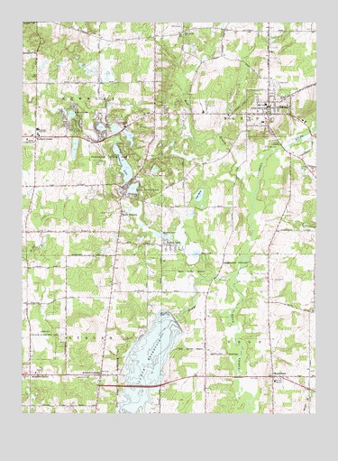
Burton, OH USGS Topographic Map
Click on map above to begin viewing in our Map Viewer.

This topographic map contains these locations and features:
Feature Name Type Latitude Longitude GNIS ID View Map
Akron City ReservoirReservoirN41.3844°W81.2036°1078936View Map
Amish CemeteryCemeteryN41.4106°W81.1254°1963325View Map
Auburn CenterPopulated PlaceN41.3873°W81.2462°1064355View Map
Auburn Center CemeteryCemeteryN41.3881°W81.2457°1963326View Map
Auburn CornersPopulated PlaceN41.3873°W81.2162°1064356View Map
Auburn Elementary SchoolSchoolN41.3867°W81.2451°1057753View Map
Auburn State Wildlife AreaParkN41.3989°W81.2401°1037531View Map
Auburn Volunteer Fire DepartmentBuildingN41.3880°W81.2482°2550555View Map
Beach TrailTrailN41.4578°W81.2101°1961313View Map
Berkshire High SchoolSchoolN41.4739°W81.1465°1057757View Map
Blue Jay OrchardLocaleN41.3822°W81.1686°2515668View Map
Brannon FieldAirportN41.4542°W81.2454°1082890View Map
Bridge CreekStreamN41.3751°W81.2037°1038301View Map
Bridge Creek DamDamN41.4067°W81.1865°1078935View Map
Bucks AirportAirportN41.4482°W81.2344°1082889View Map
BurtonPopulated PlaceN41.4706°W81.1451°1048570View Map
Burton County WetlandsParkN41.4362°W81.1748°1983626View Map
Burton Elementary SchoolSchoolN41.4684°W81.1476°1057758View Map
Burton LakePopulated PlaceN41.4287°W81.1868°1048571View Map
Burton LakeLakeN41.4319°W81.1897°1038553View Map
Burton Police DepartmentBuildingN41.4718°W81.1462°2732951View Map
Burton Village Historic DistrictParkN41.4717°W81.1451°1069138View Map
Burton Volunteer Fire DepartmentBuildingN41.4729°W81.1458°2550214View Map
Deer Lake Mobile ParkPopulated PlaceN41.4722°W81.1892°2508946View Map
East Branch Cuyahoga RiverStreamN41.4403°W81.1515°1039938View Map
Emerald LakeLakeN41.4626°W81.2093°1961314View Map
Erie TrailTrailN41.4626°W81.2057°1961315View Map
Fern LakeLakeN41.4412°W81.1733°1057755View Map
Fire RunStreamN41.3934°W81.2040°1048415View Map
Free Will Baptist Church of AuburnChurchN41.3881°W81.2440°1069141View Map
Geauga CountyCivilN41.4995°W81.1787°1074040View Map
Great Lakes Industrial ParkLocaleN41.3839°W81.1811°2547137View Map
Greens CrossingLocaleN41.4328°W81.2482°1057754View Map
Hopsons CreekStreamN41.4628°W81.1659°1067577View Map
Iroquois TrailTrailN41.4523°W81.2084°1961316View Map
Kiwanis LakeLakeN41.4707°W81.2289°1042310View Map
Lake KelsoLakeN41.4447°W81.1746°1061137View Map
Little Punderson LakeLakeN41.4468°W81.2028°1070819View Map
Lower CemeteryCemeteryN41.4603°W81.1462°1042805View Map
Mohawk TrailTrailN41.4528°W81.2137°1961317View Map
Mushers TrailTrailN41.4598°W81.2257°1961318View Map
Newbury Business ParkLocaleN41.4694°W81.1958°2546916View Map
Newbury CenterPopulated PlaceN41.4634°W81.2443°1071099View Map
Newbury Center CemeteryCemeteryN41.4617°W81.2437°1963345View Map
Newbury Fire - Emergency Medical Services DepartmentBuildingN41.4626°W81.2428°2550230View Map
Newbury High SchoolSchoolN41.4656°W81.2434°1057756View Map
Patch CemeteryCemeteryN41.3940°W81.1719°1963349View Map
Pine LakeLakeN41.4598°W81.2276°1961319View Map
Pleasant Hill CemeteryCemeteryN41.4970°W81.1793°1963350View Map
Pleasant Hill ChurchChurchN41.4967°W81.1818°1044564View Map
Popes CornersPopulated PlaceN41.3870°W81.1720°1063428View Map
Punderson Golf CourseLocaleN41.4528°W81.2173°1961320View Map
Punderson LakeLakeN41.4539°W81.2066°1044798View Map
Punderson Manor HouseBuildingN41.4512°W81.2079°1961321View Map
Punderson State ParkParkN41.4564°W81.2137°1066912View Map
Restful LakeLakeN41.4665°W81.2163°1044951View Map
Richards CemeteryCemeteryN41.4119°W81.2309°1963353View Map
Russell County ParkParkN41.4228°W81.1601°1983627View Map
Saint Helens SchoolSchoolN41.4667°W81.2068°1045479View Map
Sawyer BrookStreamN41.3764°W81.1512°1045985View Map
Sawyer BrookStreamN41.3751°W81.1284°1045986View Map
Shadyside CemeteryCemeteryN41.3867°W81.2201°1046114View Map
Slitor CemeteryCemeteryN41.4262°W81.1426°1963355View Map
Smith CrossingLocaleN41.4806°W81.2440°1071100View Map
Snow LakeLakeN41.4261°W81.1757°1058027View Map
South NewburyPopulated PlaceN41.4392°W81.2079°1065352View Map
South Newbury CemeteryCemeteryN41.4453°W81.2076°1963356View Map
South Newbury Post Office (historical)Post OfficeN41.4389°W81.2082°1988350View Map
Steele CrossingLocaleN41.4259°W81.1451°1071102View Map
Stump LakeLakeN41.4633°W81.2043°1961322View Map
Township of AuburnCivilN41.3864°W81.2444°1086147View Map
Township of BurtonCivilN41.4633°W81.1450°1086149View Map
Township of NewburyCivilN41.4626°W81.2439°1086158View Map
Township of TroyCivilN41.3866°W81.1451°1086162View Map
Troy CemeteryCemeteryN41.3862°W81.1488°1047170View Map
Troy Elementary SchoolSchoolN41.3856°W81.1412°1047173View Map
Troy Fire and Emergency Medical Services DepartmentBuildingN41.3866°W81.1384°2550232View Map
Troy Oaks HomesPopulated PlaceN41.3819°W81.1869°2513643View Map
United Community ChurchChurchN41.4617°W81.2451°1047350View Map
Village of BurtonCivilN41.4708°W81.1456°2397507View Map
Webster CrossingLocaleN41.4631°W81.2140°1071101View Map
Welsh HillSummitN41.3826°W81.1784°1067579View Map
WelshfieldPopulated PlaceN41.3870°W81.1423°1061727View Map
Welton CemeteryCemeteryN41.4753°W81.1409°1047678View Map
West Branch Cuyahoga RiverStreamN41.4403°W81.1518°1067043View Map

Note: Coordinates in the location and feature list above are referenced to NAD83 datum.


Copyright (C) 2008-2025 Ryan Niemi / Sunset Dynamics ... All Rights Reserved