TopoQuest Logo
Do you find TopoQuest useful?
Help keep TopoQuest running and adding new maps/features by donating!
Bitcoin:  19c7KJd3qBynnjoSw5npx9KScwjBe4ifkT
Litecoin:  LXs6TkuXGGXo1vDsWCkWVdjQX94eUKd6ui
Home View Maps Find Maps Find Places Resources & Links


Midway, Kentucky Topographic Map

USGS Map Title: Midway, KY
USGS Map MRC: 38084B6
DRG (GeoTIFF) Download: o38084b6.tif


Neighboring USGS Topographic Map Quads:


  Switzer, KY  
38084C7
 

  Stamping Ground, KY  
38084C6
 

  Delaplain, KY  
38084C5
 

  Frankfort East, KY  
38084B7
 

  Midway, KY  
38084B6
 

  Georgetown, KY  
38084B5
 

  Tyrone, KY  
38084A7
 

  Versailles, KY  
38084A6
 

  Lexington West, KY  
38084A5


Map MRC Location:

N39°
W85°
N39°
W84°
H8 H7 H6 H5 H4 H3 H2 H1
G8 G7 G6 G5 G4 G3 G2 G1
F8 F7 F6 F5 F4 F3 F2 F1
E8 E7 E6 E5 E4 E3 E2 E1
D8 D7 D6 D5 D4 D3 D2 D1
C8 C7 C6 C5 C4 C3 C2 C1
B8 B7 B6 B5 B4 B3 B2 B1
A8 A7 A6 A5 A4 A3 A2 A1
N38°
W85°
N38°
W84°

Midway, KY USGS 1:24K Topographic Map Preview:
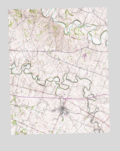
Midway, KY USGS Topographic Map
Click on map above to begin viewing in our Map Viewer.

This topographic map contains these locations and features:
Feature Name Type Latitude Longitude GNIS ID View Map
Aspen Grove Farm (historical)LocaleN38.1667°W84.7225°2558245View Map
Barbeque Spring (historical)SpringN38.2160°W84.7498°2569505View Map
Beals RunStreamN38.1854°W84.7427°486507View Map
Big SpringSpringN38.1567°W84.7430°2558239View Map
Big Spring Church (historical)ChurchN38.1543°W84.7444°2558237View Map
Big Spring Railroad Station (historical)LocaleN38.1541°W84.7444°2558236View Map
Blue Spring BranchStreamN38.2312°W84.6388°487549View Map
Buck Run Baptist Church (historical)ChurchN38.2097°W84.7467°2569518View Map
City of MidwayCivilN38.1536°W84.6784°2404256View Map
Coles BranchStreamN38.1741°W84.7057°2558228View Map
Coles Tavern (historical)LocaleN38.1643°W84.7138°2558244View Map
Davis Depot (historical)LocaleN38.1432°W84.6506°2558229View Map
DavistownPopulated PlaceN38.1415°W84.6516°490679View Map
DuvalPopulated PlaceN38.2465°W84.6413°507896View Map
Elkwood Farm (historical)LocaleN38.1668°W84.6912°2558246View Map
Elliot Farm (historical)LocaleN38.1774°W84.7393°2558253View Map
Lee BranchStreamN38.1706°W84.6899°496153View Map
Lindsay Spring (historical)SpringN38.1413°W84.6452°2558120View Map
Mapleton Farm (historical)LocaleN38.1374°W84.6971°2558221View Map
McConnell RunStreamN38.2398°W84.6927°497799View Map
MidwayPopulated PlaceN38.1509°W84.6838°498164View Map
Midway DivisionCivilN38.1514°W84.7036°1937144View Map
Midway Fire DepartmentBuildingN38.1495°W84.6843°2636336View Map
Nantura Farm (historical)LocaleN38.1341°W84.7190°2558216View Map
Orphans SchoolSchoolN38.1451°W84.6791°500000View Map
Pea RidgeRidgeN38.2398°W84.7183°500310View Map
Pine Grove Farm (historical)LocaleN38.1698°W84.7316°2558247View Map
Pospect Hill Farm (historical)LocaleN38.1614°W84.6936°2558240View Map
Saint Francis MissionChurchN38.2076°W84.6971°502622View Map
Sand LickPopulated PlaceN38.2429°W84.7180°509008View Map
Scott County Fire Department Station 5BuildingN38.2069°W84.6722°2637145View Map
Sherwood Farm (historical)LocaleN38.1704°W84.7399°2558248View Map
Simms SinkBasinN38.1632°W84.7447°2558242View Map
Sodom (historical)Populated PlaceN38.1725°W84.7065°2558250View Map
Spring Garden Farm (historical)LocaleN38.1474°W84.7450°2558233View Map
Spring StationLocaleN38.1540°W84.7438°504150View Map
Spring Station Post Office (historical)Post OfficeN38.1544°W84.7446°2558238View Map
Stockwood Farm (historical)LocaleN38.1720°W84.7397°2558249View Map
Tutts Tavern (historical)LocaleN38.1768°W84.7474°2558251View Map
WatkinsvillePopulated PlaceN38.2431°W84.7263°509324View Map
Waverly Farm (historical)LocaleN38.1737°W84.7186°2558126View Map
Weisenberger Mill (historical)LocaleN38.1276°W84.6364°2558212View Map
White SulphurPopulated PlaceN38.2051°W84.7022°509362View Map
Woodburn Farm (historical)LocaleN38.1401°W84.7400°2558225View Map
Woodford County Fire Department Station 4BuildingN38.1594°W84.6804°2637078View Map
Zebulah ChurchChurchN38.1984°W84.6872°507270View Map

Note: Coordinates in the location and feature list above are referenced to NAD83 datum.


Copyright (C) 2008-2024 Ryan Niemi / Sunset Dynamics ... All Rights Reserved