TopoQuest Logo
Do you find TopoQuest useful?
Help keep TopoQuest running and adding new maps/features by donating!
Bitcoin:  19c7KJd3qBynnjoSw5npx9KScwjBe4ifkT
Litecoin:  LXs6TkuXGGXo1vDsWCkWVdjQX94eUKd6ui
Home View Maps Find Maps Find Places Resources & Links


Stamping Ground, Kentucky Topographic Map

USGS Map Title: Stamping Ground, KY
USGS Map MRC: 38084C6
DRG (GeoTIFF) Download: o38084c6.tif


Neighboring USGS Topographic Map Quads:


  Monterey, KY  
38084D7
 

  New Columbus, KY  
38084D6
 

  Sadieville, KY  
38084D5
 

  Switzer, KY  
38084C7
 

  Stamping Ground, KY  
38084C6
 

  Delaplain, KY  
38084C5
 

  Frankfort East, KY  
38084B7
 

  Midway, KY  
38084B6
 

  Georgetown, KY  
38084B5


Map MRC Location:

N39°
W85°
N39°
W84°
H8 H7 H6 H5 H4 H3 H2 H1
G8 G7 G6 G5 G4 G3 G2 G1
F8 F7 F6 F5 F4 F3 F2 F1
E8 E7 E6 E5 E4 E3 E2 E1
D8 D7 D6 D5 D4 D3 D2 D1
C8 C7 C6 C5 C4 C3 C2 C1
B8 B7 B6 B5 B4 B3 B2 B1
A8 A7 A6 A5 A4 A3 A2 A1
N38°
W85°
N38°
W84°

Stamping Ground, KY USGS 1:24K Topographic Map Preview:
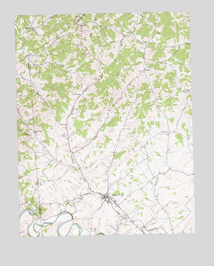
Stamping Ground, KY USGS Topographic Map
Click on map above to begin viewing in our Map Viewer.

This topographic map contains these locations and features:
Feature Name Type Latitude Longitude GNIS ID View Map
Allsup BranchStreamN38.3465°W84.6583°485891View Map
Bond CemeteryCemeteryN38.2995°W84.7097°487656View Map
Caesarea ChurchChurchN38.3523°W84.6972°488577View Map
Cedar Grove Baptist Church (historical)ChurchN38.3227°W84.7496°2569527View Map
Cedar Grove CemeteryCemeteryN38.3034°W84.7330°489197View Map
City of Stamping GroundCivilN38.2697°W84.6830°2405517View Map
Corinth Christian ChurchChurchN38.3304°W84.6266°490109View Map
East Fork McConnell RunStreamN38.2615°W84.6527°491470View Map
Griffith BranchStreamN38.3545°W84.6436°493389View Map
HarmonyPopulated PlaceN38.3673°W84.7380°508189View Map
Harmony Post Office (historical)Post OfficeN38.3680°W84.7384°2567377View Map
Head of CedarLocaleN38.3092°W84.7377°493961View Map
Hess BranchStreamN38.3623°W84.6686°494095View Map
Lecomptes RunStreamN38.2640°W84.7161°496142View Map
Lindsay CemeteryCemeteryN38.2878°W84.7027°496572View Map
Locust ForkStreamN38.2742°W84.6991°496942View Map
LonglickPopulated PlaceN38.3426°W84.6583°508503View Map
Longlick BranchStreamN38.3573°W84.6566°497152View Map
Masonic CemeteryCemeteryN38.2603°W84.6741°497664View Map
MinorsvillePopulated PlaceN38.3295°W84.7036°498423View Map
Minorsville CemeteryCemeteryN38.3376°W84.6916°498424View Map
Oakland Christian Church (historical)ChurchN38.3427°W84.7463°2569596View Map
Riddle CemeteryCemeteryN38.3067°W84.7158°501835View Map
Robey CemeteryCemeteryN38.3259°W84.6499°502078View Map
Scott County Fire Department Station 3BuildingN38.2708°W84.6833°2636416View Map
Sebree BranchStreamN38.2620°W84.7399°503139View Map
SkinnersburgPopulated PlaceN38.3062°W84.6422°503616View Map
Stamping GroundPopulated PlaceN38.2717°W84.6863°504248View Map
Stamping Ground DivisionCivilN38.3405°W84.6472°1937273View Map
Stamping Ground Police DepartmentBuildingN38.2718°W84.6873°2767599View Map
SutervillePopulated PlaceN38.3681°W84.7036°509167View Map
Sutterville Post Office (historical)Post OfficeN38.3685°W84.7032°2558394View Map

Note: Coordinates in the location and feature list above are referenced to NAD83 datum.


Copyright (C) 2008-2025 Ryan Niemi / Sunset Dynamics ... All Rights Reserved