TopoQuest Logo
Do you find TopoQuest useful?
Help keep TopoQuest running and adding new maps/features by donating!
Bitcoin:  19c7KJd3qBynnjoSw5npx9KScwjBe4ifkT
Litecoin:  LXs6TkuXGGXo1vDsWCkWVdjQX94eUKd6ui
Home View Maps Find Maps Find Places Resources & Links


Milford, New York Topographic Map

USGS Map Title: Milford, NY
USGS Map MRC: 42074E8
DRG (GeoTIFF) Download: o42074e8.tif


Neighboring USGS Topographic Map Quads:


  Hartwick, NY  
42075F1
 

  Cooperstown, NY  
42074F8
 

  Westford, NY  
42074F7
 

  Mount Vision, NY  
42075E1
 

  Milford, NY  
42074E8
 

  Schenevus, NY  
42074E7
 

  Oneonta, NY  
42075D1
 

  West Davenport, NY  
42074D8
 

  Davenport, NY  
42074D7


Map MRC Location:

N43°
W75°
N43°
W74°
H8 H7 H6 H5 H4 H3 H2 H1
G8 G7 G6 G5 G4 G3 G2 G1
F8 F7 F6 F5 F4 F3 F2 F1
E8 E7 E6 E5 E4 E3 E2 E1
D8 D7 D6 D5 D4 D3 D2 D1
C8 C7 C6 C5 C4 C3 C2 C1
B8 B7 B6 B5 B4 B3 B2 B1
A8 A7 A6 A5 A4 A3 A2 A1
N42°
W75°
N42°
W74°

Milford, NY USGS 1:24K Topographic Map Preview:
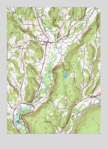
Milford, NY USGS Topographic Map
Click on map above to begin viewing in our Map Viewer.

This topographic map contains these locations and features:
Feature Name Type Latitude Longitude GNIS ID View Map
Burying Ground HillSummitN42.5884°W74.9838°945301View Map
Cherry ValleyValleyN42.5870°W74.9252°969993View Map
Cherry Valley CreekStreamN42.5906°W74.9315°969994View Map
CliffsidePopulated PlaceN42.5140°W74.9824°946872View Map
ClintonvillePopulated PlaceN42.6142°W74.9582°972326View Map
Crumhorn LakeLakeN42.5577°W74.9217°947874View Map
Crumhorn MountainSummitN42.5871°W74.8918°947875View Map
Dutch HillSummitN42.5415°W74.9910°970085View Map
Edson CornersLocaleN42.5842°W74.9782°949402View Map
Eggleston HillSummitN42.6198°W74.9146°949427View Map
Goodyear LakeLakeN42.5076°W74.9816°951346View Map
Hinman HollowValleyN42.5944°W74.9605°952885View Map
Jamaica Dream FarmLocaleN42.5475°W74.8986°2557724View Map
MarylandPopulated PlaceN42.5365°W74.8865°956623View Map
Maryland Baptist ChurchChurchN42.5370°W74.8833°2597901View Map
Maryland CemeteryCemeteryN42.5336°W74.9003°2558754View Map
Maryland CemeteryCemeteryN42.5339°W74.9005°956823View Map
MilfordPopulated PlaceN42.5906°W74.9452°957183View Map
Milford CenterPopulated PlaceN42.5242°W74.9888°957184View Map
Milford Center CemeteryCemeteryN42.5235°W74.9855°2558760View Map
Milford Central SchoolSchoolN42.5896°W74.9508°2597178View Map
Milford Fire DepartmentBuildingN42.5901°W74.9455°2718454View Map
Milford Free LibraryBuildingN42.5888°W74.9468°2598963View Map
Milford Post OfficePost OfficeN42.5888°W74.9468°2598929View Map
Milford United Methodist ChurchChurchN42.5918°W74.9452°2597902View Map
Milford Village CemeteryCemeteryN42.5922°W74.9458°2558772View Map
Morehouse BrookStreamN42.5295°W74.8893°957649View Map
Pine Grove CemeteryCemeteryN42.5295°W74.9714°2558761View Map
Platt CemeteryCemeteryN42.5639°W74.8865°960680View Map
Platt HollowValleyN42.5337°W74.8971°960684View Map
PortlandvillePopulated PlaceN42.5304°W74.9671°961002View Map
Potato CreekStreamN42.5031°W74.9252°961023View Map
Red Ridge HillSummitN42.5648°W74.9685°962314View Map
Saddlebag LakeLakeN42.5345°W74.9567°963212View Map
School Number 2 (historical)SchoolN42.5395°W74.8868°975166View Map
School Number 3 (historical)SchoolN42.5298°W74.9699°975248View Map
School Number 4 (historical)SchoolN42.5251°W74.9907°975326View Map
Sherman CemeteryCemeteryN42.5903°W74.9731°965076View Map
Spencer CemeteryCemeteryN42.5017°W74.9285°2558753View Map
Spring BrookStreamN42.5285°W74.9722°2788138View Map
Town of MilfordCivilN42.5463°W74.9780°979219View Map
Village of MilfordCivilN42.5905°W74.9469°2390982View Map
Waters CemeteryCemeteryN42.5968°W74.9065°968909View Map
Whitney BrookStreamN42.5354°W74.8846°971180View Map

Note: Coordinates in the location and feature list above are referenced to NAD83 datum.


Copyright (C) 2008-2024 Ryan Niemi / Sunset Dynamics ... All Rights Reserved