TopoQuest Logo
Do you find TopoQuest useful?
Help keep TopoQuest running and adding new maps/features by donating!
Bitcoin:  19c7KJd3qBynnjoSw5npx9KScwjBe4ifkT
Litecoin:  LXs6TkuXGGXo1vDsWCkWVdjQX94eUKd6ui
Home View Maps Find Maps Find Places Resources & Links


Millard, Mississippi Topographic Map

USGS Map Title: Millard, MS
USGS Map MRC: 30089F5
DRG (GeoTIFF) Download: o30089f5.tif


Neighboring USGS Topographic Map Quads:


  White Sand, MS  
30089G6
 

  Poplarville, MS  
30089G5
 

  Big Swamp, MS  
30089G4
 

  McNeill, MS  
30089F6
 

  Millard, MS  
30089F5
 

  Savannah, MS  
30089F4
 

  Picayune, MS  
30089E6
 

  Caesar, MS  
30089E5
 

  Necaise, MS  
30089E4


Map MRC Location:

N31°
W90°
N31°
W89°
H8 H7 H6 H5 H4 H3 H2 H1
G8 G7 G6 G5 G4 G3 G2 G1
F8 F7 F6 F5 F4 F3 F2 F1
E8 E7 E6 E5 E4 E3 E2 E1
D8 D7 D6 D5 D4 D3 D2 D1
C8 C7 C6 C5 C4 C3 C2 C1
B8 B7 B6 B5 B4 B3 B2 B1
A8 A7 A6 A5 A4 A3 A2 A1
N30°
W90°
N30°
W89°

Millard, MS USGS 1:24K Topographic Map Preview:
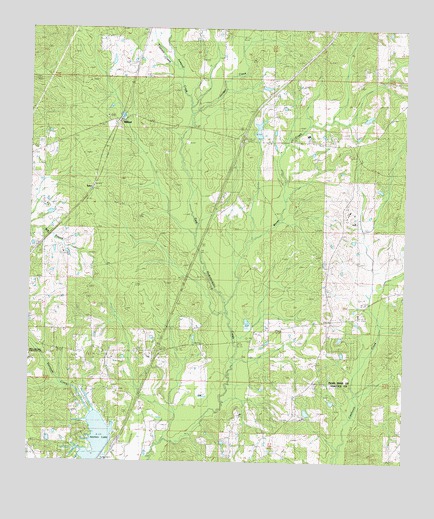
Millard, MS USGS Topographic Map
Click on map above to begin viewing in our Map Viewer.

This topographic map contains these locations and features:
Feature Name Type Latitude Longitude GNIS ID View Map
Anchor LakeReservoirN30.6319°W89.6021°690868View Map
Anchor Lake DamDamN30.6285°W89.5951°680473View Map
Carriere Volunteer Fire Department Station 4 Anchor LakeBuildingN30.6385°W89.6076°2332785View Map
Centre (historical)Populated PlaceN30.7180°W89.5551°688111View Map
Cypress CreekStreamN30.7402°W89.5790°669053View Map
Harts ChapelChurchN30.7491°W89.5620°670994View Map
Interchange 15CrossingN30.6569°W89.5826°691473View Map
Interchange 19CrossingN30.7182°W89.5545°691474View Map
Jumpoff CreekStreamN30.7260°W89.5731°672056View Map
Juniper CreekStreamN30.7257°W89.5731°672061View Map
Martin CemeteryCemeteryN30.6757°W89.5667°673173View Map
MillardPopulated PlaceN30.7224°W89.5984°692074View Map
Moran CreekStreamN30.6710°W89.5603°673799View Map
Pearl River County Sheriff's OfficeBuildingN30.7233°W89.5805°2332910View Map
Rolling Hills Baptist Chapel ChurchChurchN30.6646°W89.5282°2596812View Map
Spiers CemeteryCemeteryN30.6460°W89.5970°678054View Map
Stecil Smith Lake DamDamN30.6735°W89.5001°680477View Map
TylerPopulated PlaceN30.7074°W89.6062°692282View Map

Note: Coordinates in the location and feature list above are referenced to NAD83 datum.


Copyright (C) 2008-2025 Ryan Niemi / Sunset Dynamics ... All Rights Reserved