TopoQuest Logo
Do you find TopoQuest useful?
Help keep TopoQuest running and adding new maps/features by donating!
Bitcoin:  19c7KJd3qBynnjoSw5npx9KScwjBe4ifkT
Litecoin:  LXs6TkuXGGXo1vDsWCkWVdjQX94eUKd6ui
Home View Maps Find Maps Find Places Resources & Links


Caesar, Mississippi Topographic Map

USGS Map Title: Caesar, MS
USGS Map MRC: 30089E5
DRG (GeoTIFF) Download: o30089e5.tif


Neighboring USGS Topographic Map Quads:


  McNeill, MS  
30089F6
 

  Millard, MS  
30089F5
 

  Savannah, MS  
30089F4
 

  Picayune, MS  
30089E6
 

  Caesar, MS  
30089E5
 

  Necaise, MS  
30089E4
 

  Nicholson, MS  
30089D6
 

  Dead Tiger Creek, MS  
30089D5
 

  Kiln, MS  
30089D4


Map MRC Location:

N31°
W90°
N31°
W89°
H8 H7 H6 H5 H4 H3 H2 H1
G8 G7 G6 G5 G4 G3 G2 G1
F8 F7 F6 F5 F4 F3 F2 F1
E8 E7 E6 E5 E4 E3 E2 E1
D8 D7 D6 D5 D4 D3 D2 D1
C8 C7 C6 C5 C4 C3 C2 C1
B8 B7 B6 B5 B4 B3 B2 B1
A8 A7 A6 A5 A4 A3 A2 A1
N30°
W90°
N30°
W89°

Caesar, MS USGS 1:24K Topographic Map Preview:
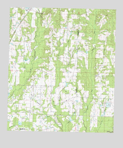
Caesar, MS USGS Topographic Map
Click on map above to begin viewing in our Map Viewer.

This topographic map contains these locations and features:
Feature Name Type Latitude Longitude GNIS ID View Map
Beaver Wood EstatesPopulated PlaceN30.5580°W89.5630°2596695View Map
Belle-Terre Airport (historical)AirportN30.5294°W89.6084°680302View Map
Blacksnake BranchStreamN30.5027°W89.5612°667252View Map
Boardpile BranchStreamN30.5194°W89.5653°667350View Map
Bounds Lake DamDamN30.5052°W89.5917°680454View Map
CaesarPopulated PlaceN30.5844°W89.5467°667903View Map
Caesar ChurchChurchN30.5841°W89.5459°710155View Map
Carriere Volunteer Fire Department Station 3 Sycamore RoadBuildingN30.5592°W89.6178°2332784View Map
Center (historical)Populated PlaceN30.5877°W89.5348°710451View Map
Chester Lee Lake DamDamN30.5052°W89.5517°680453View Map
Clearwater Campground and Recreational Vehicle ParkLocaleN30.5947°W89.5631°2596929View Map
Crosby Lake DamDamN30.5019°W89.5484°680452View Map
Davis BranchStreamN30.5188°W89.5362°669128View Map
Deer Park Phase III Mobile Home ParkPopulated PlaceN30.5491°W89.5355°2596133View Map
Flattop Unity Baptist ChurchChurchN30.5159°W89.5692°2596993View Map
Gibson School (historical)SchoolN30.5755°W89.5789°688130View Map
Gipson CemeteryCemeteryN30.5757°W89.5784°670413View Map
Goodyear Baptist ChurchChurchN30.5133°W89.6233°2596332View Map
H H Pepper Lake DamDamN30.5802°W89.6234°680466View Map
Harmony Baptist ChurchChurchN30.5417°W89.6006°2596637View Map
Hillcrest Road Baptist ChurchChurchN30.6241°W89.6171°2596395View Map
Interchange 10CrossingN30.6007°W89.6187°691472View Map
Lee LakeReservoirN30.5286°W89.5077°689412View Map
Lee Lake DamDamN30.5252°W89.5067°680455View Map
Lee Lake DamDamN30.5269°W89.5167°680456View Map
Lee Lake DamDamN30.5285°W89.5184°680457View Map
Lees Chapel Baptist ChurchChurchN30.5582°W89.5195°689413View Map
Lees Field (historical)AirportN30.5363°W89.5112°680303View Map
LeetownPopulated PlaceN30.5585°W89.5192°689414View Map
Leetown Christian SchoolSchoolN30.5584°W89.5194°2597113View Map
Leetown SchoolSchoolN30.5580°W89.5189°672392View Map
Leetown Volunteer Fire DepartmentBuildingN30.5286°W89.5232°2332774View Map
Lumpkin School (historical)SchoolN30.6030°W89.6128°688136View Map
Mill Creek ChurchChurchN30.5202°W89.6003°673633View Map
Mount Carmel ChurchChurchN30.6041°W89.5745°673952View Map
Parkview Baptist ChurchChurchN30.5586°W89.5829°2596995View Map
Pearson CemeteryCemeteryN30.6116°W89.5401°675551View Map
Playground BranchStreamN30.5630°W89.5676°675962View Map
Salem ChurchChurchN30.5182°W89.6045°677268View Map
Salem School (historical)SchoolN30.5199°W89.6003°688168View Map
Southeast Volunteer Fire Department Station 1 HeadquartersBuildingN30.6047°W89.5739°2332799View Map
Southeast Volunteer Fire Department Station 2BuildingN30.5237°W89.5980°2332800View Map
Stanfield CreekStreamN30.6171°W89.5903°678220View Map
Supervisor District 5CivilN30.5969°W89.6249°712025View Map
West Union Baptist ChurchChurchN30.5963°W89.6153°679532View Map

Note: Coordinates in the location and feature list above are referenced to NAD83 datum.


Copyright (C) 2008-2025 Ryan Niemi / Sunset Dynamics ... All Rights Reserved