TopoQuest Logo
Do you find TopoQuest useful?
Help keep TopoQuest running and adding new maps/features by donating!
Bitcoin:  19c7KJd3qBynnjoSw5npx9KScwjBe4ifkT
Litecoin:  LXs6TkuXGGXo1vDsWCkWVdjQX94eUKd6ui
Home View Maps Find Maps Find Places Resources & Links


Beaver Creek, Oregon Topographic Map

USGS Map Title: Beaver Creek, OR
USGS Map MRC: 43123G4
DRG (GeoTIFF) Download: o43123g4.tif


Neighboring USGS Topographic Map Quads:


  Clay Creek, OR  
43123H5
 

  High Point, OR  
43123H4
 

  Crow, OR  
43123H3
 

  Gunter, OR  
43123G5
 

  Beaver Creek, OR  
43123G4
 

  Letz Creek, OR  
43123G3
 

  Elkton, OR  
43123F5
 

  Putnam Valley, OR  
43123F4
 

  Drain, OR  
43123F3


Map MRC Location:

N44°
W124°
N44°
W123°
H8 H7 H6 H5 H4 H3 H2 H1
G8 G7 G6 G5 G4 G3 G2 G1
F8 F7 F6 F5 F4 F3 F2 F1
E8 E7 E6 E5 E4 E3 E2 E1
D8 D7 D6 D5 D4 D3 D2 D1
C8 C7 C6 C5 C4 C3 C2 C1
B8 B7 B6 B5 B4 B3 B2 B1
A8 A7 A6 A5 A4 A3 A2 A1
N43°
W124°
N43°
W123°

Beaver Creek, OR USGS 1:24K Topographic Map Preview:
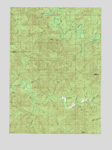
Beaver Creek, OR USGS Topographic Map
Click on map above to begin viewing in our Map Viewer.

This topographic map contains these locations and features:
Feature Name Type Latitude Longitude GNIS ID View Map
Arthur Jones CreekStreamN43.7868°W123.4459°1117055View Map
Beaver CreekStreamN43.7843°W123.4270°1117422View Map
Beaver Creek School (historical)SchoolN43.7840°W123.4240°1117440View Map
Bottle CreekStreamN43.8521°W123.4187°1117961View Map
Buck CreekStreamN43.8432°W123.4020°1118182View Map
Clevenger CreekStreamN43.7790°W123.4095°1119018View Map
Doe CreekStreamN43.8415°W123.3870°1119999View Map
Doe Hollow CreekStreamN43.8572°W123.4378°1130863View Map
Dry CreekStreamN43.7893°W123.4693°1162277View Map
Elk CreekStreamN43.7865°W123.4432°1120438View Map
Elkton-Drain DivisionCivilN43.7596°W123.4937°1938010View Map
Fryingpan CreekStreamN43.8432°W123.4295°1121021View Map
Hall CreekStreamN43.7796°W123.3845°1121519View Map
Hefty CreekStreamN43.7837°W123.3959°1121732View Map
Jeans CreekStreamN43.8665°W123.4554°1130862View Map
Little South Fork Smith RiverStreamN43.7740°W123.4654°1123288View Map
Plank CreekStreamN43.7793°W123.4082°1125463View Map
Redford CreekStreamN43.7785°W123.3756°1125909View Map
Salmonberry CreekStreamN43.7973°W123.4793°1126516View Map
Shitten CreekStreamN43.8615°W123.4943°1130861View Map
South Fork Guard StationLocaleN43.7835°W123.4690°1127288View Map
South Fork Smith RiverStreamN43.7821°W123.4698°1127322View Map
Summit CreekStreamN43.7829°W123.3898°1127715View Map
Woolley Post Office (historical)Post OfficeN43.7860°W123.4248°1166211View Map

Note: Coordinates in the location and feature list above are referenced to NAD83 datum.


Copyright (C) 2008-2025 Ryan Niemi / Sunset Dynamics ... All Rights Reserved