TopoQuest Logo
Do you find TopoQuest useful?
Help keep TopoQuest running and adding new maps/features by donating!
Bitcoin:  19c7KJd3qBynnjoSw5npx9KScwjBe4ifkT
Litecoin:  LXs6TkuXGGXo1vDsWCkWVdjQX94eUKd6ui
Home View Maps Find Maps Find Places Resources & Links


Clay Creek, Oregon Topographic Map

USGS Map Title: Clay Creek, OR
USGS Map MRC: 43123H5
DRG (GeoTIFF) Download: o43123h5.tif


Neighboring USGS Topographic Map Quads:


  Greenleaf, OR  
44123A6
 

  Walton, OR  
44123A5
 

  Noti, OR  
44123A4
 

  Roman Nose Mountain, OR  
43123H6
 

  Clay Creek, OR  
43123H5
 

  High Point, OR  
43123H4
 

  Twin Sisters, OR  
43123G6
 

  Gunter, OR  
43123G5
 

  Beaver Creek, OR  
43123G4


Map MRC Location:

N44°
W124°
N44°
W123°
H8 H7 H6 H5 H4 H3 H2 H1
G8 G7 G6 G5 G4 G3 G2 G1
F8 F7 F6 F5 F4 F3 F2 F1
E8 E7 E6 E5 E4 E3 E2 E1
D8 D7 D6 D5 D4 D3 D2 D1
C8 C7 C6 C5 C4 C3 C2 C1
B8 B7 B6 B5 B4 B3 B2 B1
A8 A7 A6 A5 A4 A3 A2 A1
N43°
W124°
N43°
W123°

Clay Creek, OR USGS 1:24K Topographic Map Preview:
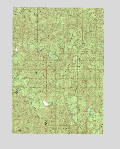
Clay Creek, OR USGS Topographic Map
Click on map above to begin viewing in our Map Viewer.

This topographic map contains these locations and features:
Feature Name Type Latitude Longitude GNIS ID View Map
Bierce CreekStreamN43.8982°W123.5462°1117576View Map
Bill Lewis CreekStreamN43.9429°W123.5668°1117696View Map
Burntwood CreekStreamN43.9135°W123.5429°1118365View Map
Clay CreekStreamN43.9037°W123.5687°1118988View Map
Clay Creek Recreation SiteParkN43.9040°W123.5720°1130753View Map
Clay Creek Recreational ReservoirReservoirN43.9066°W123.5634°1130752View Map
Collins CreekStreamN43.9012°W123.5998°1119150View Map
Cougar GulchValleyN43.9679°W123.5568°1130760View Map
Edris CreekStreamN43.9118°W123.5584°1120399View Map
Enfield (historical)LocaleN43.9943°W123.6220°1166299View Map
Farman FlatFlatN43.8915°W123.5123°1130755View Map
Fawn CreekStreamN43.9332°W123.6207°1120645View Map
Fowler CreekStreamN43.9985°W123.6129°1120931View Map
Gall CreekStreamN43.9618°W123.5343°1121042View Map
Haight Creek Picnic AreaParkN43.8760°W123.5005°1130761View Map
Haskins CreekStreamN43.8965°W123.5929°1143354View Map
Johnson CreekStreamN43.8865°W123.5390°1122468View Map
Joler (historical)LocaleN43.9968°W123.6137°1130759View Map
Larue CreekStreamN43.8998°W123.5859°1130756View Map
Layne CreekStreamN43.9010°W123.5190°1123622View Map
Lick CreekStreamN43.9451°W123.5720°1134543View Map
Mill CreekStreamN43.9046°W123.6009°1146237View Map
North CreekStreamN43.9132°W123.5959°1124737View Map
Oat CreekStreamN43.9615°W123.5340°1124929View Map
Pittenger CreekStreamN43.9660°W123.5520°1125451View Map
Pugh CreekStreamN43.9285°W123.6048°1125696View Map
Saleratus CreekStreamN43.9604°W123.5962°1126507View Map
Siuslaw Guard StationLocaleN43.9576°W123.6234°1130758View Map
Trail CreekStreamN43.9087°W123.6162°1155942View Map
Trail CreekStreamN43.9168°W123.6170°1134544View Map
Van Curen CreekStreamN43.9457°W123.5448°1128502View Map
Wolf CreekStreamN43.9548°W123.6237°1129276View Map

Note: Coordinates in the location and feature list above are referenced to NAD83 datum.


Copyright (C) 2008-2024 Ryan Niemi / Sunset Dynamics ... All Rights Reserved