TopoQuest Logo
Do you find TopoQuest useful?
Help keep TopoQuest running and adding new maps/features by donating!
Bitcoin:  19c7KJd3qBynnjoSw5npx9KScwjBe4ifkT
Litecoin:  LXs6TkuXGGXo1vDsWCkWVdjQX94eUKd6ui
Home View Maps Find Maps Find Places Resources & Links


Miller Grove, Texas Topographic Map

USGS Map Title: Miller Grove, TX
USGS Map MRC: 33095A7
DRG (GeoTIFF) Download: o33095a7.tif


Neighboring USGS Topographic Map Quads:


  Commerce South, TX  
33095B8
 

  Cumby, TX  
33095B7
 

  Gafford Chapel, TX  
33095B6
 

  Lone Oak North, TX  
33095A8
 

  Miller Grove, TX  
33095A7
 

  Brashear, TX  
33095A6
 

  Lone Oak South, TX  
32095H8
 

  Emory North, TX  
32095H7
 

  Arbala, TX  
32095H6


Map MRC Location:

N34°
W96°
N34°
W95°
H8 H7 H6 H5 H4 H3 H2 H1
G8 G7 G6 G5 G4 G3 G2 G1
F8 F7 F6 F5 F4 F3 F2 F1
E8 E7 E6 E5 E4 E3 E2 E1
D8 D7 D6 D5 D4 D3 D2 D1
C8 C7 C6 C5 C4 C3 C2 C1
B8 B7 B6 B5 B4 B3 B2 B1
A8 A7 A6 A5 A4 A3 A2 A1
N33°
W96°
N33°
W95°

Miller Grove, TX USGS 1:24K Topographic Map Preview:
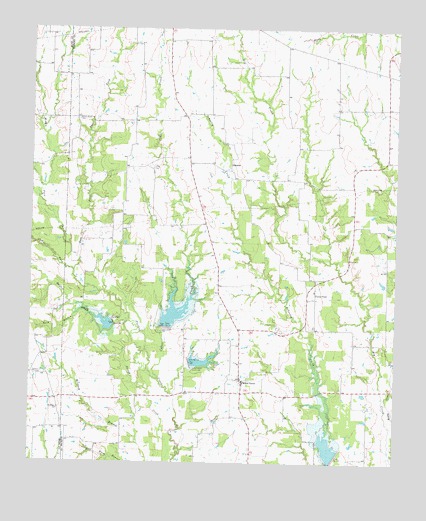
Miller Grove, TX USGS Topographic Map
Click on map above to begin viewing in our Map Viewer.

This topographic map contains these locations and features:
Feature Name Type Latitude Longitude GNIS ID View Map
Bone CemeteryCemeteryN33.0173°W95.7822°1344577View Map
Burk BranchStreamN33.0443°W95.8558°1331672View Map
Cedar CreekStreamN33.0246°W95.8311°1332416View Map
Center PointLocaleN33.0496°W95.7775°1332536View Map
Cumby DivisionCivilN33.1105°W95.7837°1938664View Map
Dam Number 12DamN33.0401°W95.8461°1333915View Map
Dam Number 13DamN33.0393°W95.8289°1333923View Map
Dam Number 14DamN33.0290°W95.8202°1333926View Map
Dam Number 28DamN33.0023°W95.7700°1333950View Map
Donelton CemeteryCemeteryN33.0254°W95.8733°1334482View Map
Donelton ChurchChurchN33.0154°W95.8652°1334483View Map
East Fork Turkey CreekStreamN33.0551°W95.8602°1334938View Map
Hughes CreekStreamN33.0329°W95.8352°1374171View Map
Jordan CemeteryCemeteryN33.0284°W95.8122°1338874View Map
Long CemeteryCemeteryN33.0848°W95.8336°1340446View Map
Middle Fork Turkey CreekStreamN33.0579°W95.8586°1341497View Map
Miller GrovePopulated PlaceN33.0243°W95.8027°1341655View Map
Miller Grove Volunteer Fire Department Station 13BuildingN33.0305°W95.8027°2655157View Map
PalestinePopulated PlaceN33.0846°W95.8066°1378821View Map
Schooley CreekStreamN33.0073°W95.7736°1346779View Map
Soil Conservation Service Site 12 DamDamN33.0359°W95.8484°1855542View Map
Soil Conservation Service Site 12 ReservoirReservoirN33.0401°W95.8452°1855543View Map
Soil Conservation Service Site 13 DamDamN33.0389°W95.8269°1855548View Map
Soil Conservation Service Site 13 ReservoirReservoirN33.0384°W95.8286°1855549View Map
Soil Conservation Service Site 14 DamDamN33.0289°W95.8205°1855550View Map
Soil Conservation Service Site 14 ReservoirReservoirN33.0284°W95.8219°1855551View Map
Soil Conservation Service Site 15a DamDamN33.0001°W95.8352°1862604View Map
Soil Conservation Service Site 15a ReservoirReservoirN33.0001°W95.8352°1862605View Map
Soil Conservation Service Site 16b DamDamN33.0868°W95.7569°1863026View Map
Soil Conservation Service Site 16b ReservoirReservoirN33.0868°W95.7569°1863027View Map
Soil Conservation Service Site 23 DamDamN33.0026°W95.7697°1855544View Map
Soil Conservation Service Site 23 ReservoirReservoirN33.0018°W95.7686°1855545View Map
Sunny Point CemeteryCemeteryN33.0990°W95.8594°1348073View Map
Texas No Name Number 37 DamDamN33.0468°W95.8419°1864780View Map
West Fork Turkey CreekStreamN33.0551°W95.8605°1376706View Map

Note: Coordinates in the location and feature list above are referenced to NAD83 datum.


Copyright (C) 2008-2024 Ryan Niemi / Sunset Dynamics ... All Rights Reserved