TopoQuest Logo
Do you find TopoQuest useful?
Help keep TopoQuest running and adding new maps/features by donating!
Bitcoin:  19c7KJd3qBynnjoSw5npx9KScwjBe4ifkT
Litecoin:  LXs6TkuXGGXo1vDsWCkWVdjQX94eUKd6ui
Home View Maps Find Maps Find Places Resources & Links


Brashear, Texas Topographic Map

USGS Map Title: Brashear, TX
USGS Map MRC: 33095A6
DRG (GeoTIFF) Download: o33095a6.tif


Neighboring USGS Topographic Map Quads:


  Cumby, TX  
33095B7
 

  Gafford Chapel, TX  
33095B6
 

  Sulphur Springs, TX  
33095B5
 

  Miller Grove, TX  
33095A7
 

  Brashear, TX  
33095A6
 

  Sulphur Springs SE, TX  
33095A5
 

  Emory North, TX  
32095H7
 

  Arbala, TX  
32095H6
 

  Yantis, TX  
32095H5


Map MRC Location:

N34°
W96°
N34°
W95°
H8 H7 H6 H5 H4 H3 H2 H1
G8 G7 G6 G5 G4 G3 G2 G1
F8 F7 F6 F5 F4 F3 F2 F1
E8 E7 E6 E5 E4 E3 E2 E1
D8 D7 D6 D5 D4 D3 D2 D1
C8 C7 C6 C5 C4 C3 C2 C1
B8 B7 B6 B5 B4 B3 B2 B1
A8 A7 A6 A5 A4 A3 A2 A1
N33°
W96°
N33°
W95°

Brashear, TX USGS 1:24K Topographic Map Preview:
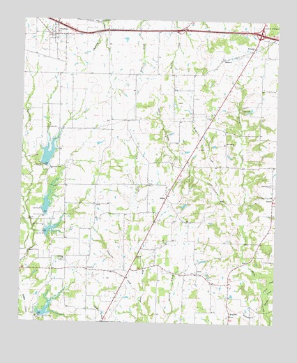
Brashear, TX USGS Topographic Map
Click on map above to begin viewing in our Map Viewer.

This topographic map contains these locations and features:
Feature Name Type Latitude Longitude GNIS ID View Map
Basset BranchStreamN33.0085°W95.6305°1372123View Map
BrashearPopulated PlaceN33.1187°W95.7336°1331201View Map
Brashear Post OfficePost OfficeN33.1226°W95.7330°2732365View Map
Camps LakeReservoirN33.0882°W95.6385°1332051View Map
Chaffin CreekStreamN33.0401°W95.6413°1332608View Map
Dam Number 17DamN33.0646°W95.7391°1333937View Map
Dam Number 18DamN33.0448°W95.7391°1333939View Map
Dam Number 19DamN33.0371°W95.7388°1333941View Map
Dam Number 8DamN33.0029°W95.7405°1334005View Map
DividePopulated PlaceN33.0487°W95.7130°2034653View Map
DivideLocaleN33.0487°W95.7136°1334395View Map
Gideon CreekStreamN33.0135°W95.6308°1336516View Map
GreenviewPopulated PlaceN33.0223°W95.7169°1378381View Map
Greenview ChurchChurchN33.0259°W95.7283°1336978View Map
Greenview CreekStreamN33.0107°W95.6908°1336979View Map
LibertyPopulated PlaceN33.0207°W95.6630°1378584View Map
New Hope ChurchChurchN33.0743°W95.6494°1342480View Map
Pleasant Hill ChurchChurchN33.0573°W95.6277°1344221View Map
RockdalePopulated PlaceN33.1132°W95.6375°1378972View Map
Rockdale ChurchChurchN33.1087°W95.6522°1345414View Map
ShirleyPopulated PlaceN33.0521°W95.6786°1379072View Map
Shirley ChurchChurchN33.0568°W95.6861°1347084View Map
Soil Conservation Service Lake 21ReservoirN33.0035°W95.7402°1855521View Map
Soil Conservation Service Site 16c DamDamN33.0851°W95.7469°1863028View Map
Soil Conservation Service Site 16c ReservoirReservoirN33.0851°W95.7469°1863029View Map
Soil Conservation Service Site 17 DamDamN33.0634°W95.7402°1855526View Map
Soil Conservation Service Site 17 ReservoirReservoirN33.0634°W95.7402°1855527View Map
Soil Conservation Service Site 18 DamDamN33.0458°W95.7399°1855524View Map
Soil Conservation Service Site 18 ReservoirReservoirN33.0451°W95.7402°1855525View Map
Soil Conservation Service Site 19 DamDamN33.0358°W95.7386°1855522View Map
Soil Conservation Service Site 19 ReservoirReservoirN33.0384°W95.7402°1855523View Map
Soil Conservation Service Site 21 DamDamN33.0026°W95.7405°1855520View Map
Wood CreekStreamN33.0562°W95.6536°1350510View Map

Note: Coordinates in the location and feature list above are referenced to NAD83 datum.


Copyright (C) 2008-2024 Ryan Niemi / Sunset Dynamics ... All Rights Reserved