TopoQuest Logo
Do you find TopoQuest useful?
Help keep TopoQuest running and adding new maps/features by donating!
Bitcoin:  19c7KJd3qBynnjoSw5npx9KScwjBe4ifkT
Litecoin:  LXs6TkuXGGXo1vDsWCkWVdjQX94eUKd6ui
Home View Maps Find Maps Find Places Resources & Links


Emory North, Texas Topographic Map

USGS Map Title: Emory North, TX
USGS Map MRC: 32095H7
DRG (GeoTIFF) Download: o32095h7.tif


Neighboring USGS Topographic Map Quads:


  Lone Oak North, TX  
33095A8
 

  Miller Grove, TX  
33095A7
 

  Brashear, TX  
33095A6
 

  Lone Oak South, TX  
32095H8
 

  Emory North, TX  
32095H7
 

  Arbala, TX  
32095H6
 

  Iron Bridge Dam, TX  
32095G8
 

  Emory South, TX  
32095G7
 

  Alba, TX  
32095G6


Map MRC Location:

N33°
W96°
N33°
W95°
H8 H7 H6 H5 H4 H3 H2 H1
G8 G7 G6 G5 G4 G3 G2 G1
F8 F7 F6 F5 F4 F3 F2 F1
E8 E7 E6 E5 E4 E3 E2 E1
D8 D7 D6 D5 D4 D3 D2 D1
C8 C7 C6 C5 C4 C3 C2 C1
B8 B7 B6 B5 B4 B3 B2 B1
A8 A7 A6 A5 A4 A3 A2 A1
N32°
W96°
N32°
W95°

Emory North, TX USGS 1:24K Topographic Map Preview:
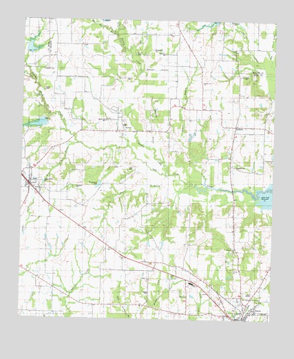
Emory North, TX USGS Topographic Map
Click on map above to begin viewing in our Map Viewer.

This topographic map contains these locations and features:
Feature Name Type Latitude Longitude GNIS ID View Map
Bellah CemeteryCemeteryN32.9704°W95.8644°1889935View Map
Brickkiln BranchStreamN32.9748°W95.8714°1372715View Map
Bucker FieldAirportN32.9536°W95.8669°2675956View Map
Buckeye BranchStreamN32.9410°W95.8047°1331503View Map
Burns LakeLakeN32.9860°W95.8194°1331705View Map
Church of the Living GodChurchN32.9540°W95.8280°1332823View Map
City of EmoryCivilN32.8766°W95.7677°2410438View Map
City of PointCivilN32.9302°W95.8689°2411448View Map
Clifton CemeteryCemeteryN32.9768°W95.7658°1332991View Map
Coats CemeteryCemeteryN32.9376°W95.8225°1889937View Map
County LinePopulated PlaceN32.9743°W95.7866°2034780View Map
County Line ChurchChurchN32.9743°W95.7858°1890015View Map
Dam NineDamN32.9576°W95.8633°1333895View Map
Dam TwentytwoDamN32.9998°W95.7780°1333894View Map
Daugherty Baptist ChurchChurchN32.9573°W95.7686°1334058View Map
Daugherty CemeteryCemeteryN32.9387°W95.7694°1334059View Map
Dement BranchStreamN32.9321°W95.7839°1334247View Map
DoughertyPopulated PlaceN32.9557°W95.7691°1378202View Map
Emory City HallBuildingN32.8751°W95.7653°2753523View Map
Emory Post OfficePost OfficeN32.8824°W95.7609°2731534View Map
Emory Volunteer Fire DepartmentBuildingN32.8753°W95.7658°2655191View Map
Forbis CemeteryCemeteryN32.8785°W95.7558°1889938View Map
Hill Pippin CemeteryCemeteryN32.9860°W95.8044°1337788View Map
Mitcham BranchStreamN32.9973°W95.8355°1341756View Map
Montgomery CemeteryCemeteryN32.9873°W95.8097°1341833View Map
Montgomery LakeReservoirN32.9315°W95.8364°1341835View Map
Montgomery Lake DamDamN32.9318°W95.8352°1855204View Map
Moss Wash BranchStreamN32.9948°W95.8291°1341977View Map
Parks CemeteryCemeteryN32.9757°W95.8219°1889989View Map
PointPopulated PlaceN32.9315°W95.8714°1375515View Map
Point City HallBuildingN32.9310°W95.8705°2753262View Map
Point Post OfficePost OfficeN32.9318°W95.8733°2732367View Map
Point Volunteer Fire DepartmentBuildingN32.9309°W95.8705°2655219View Map
Prairie Grove CemeteryCemeteryN32.9040°W95.7686°1344504View Map
Prairie Grove ChurchChurchN32.9046°W95.7686°1344507View Map
ProspectPopulated PlaceN32.8937°W95.8114°2034650View Map
Prospect CemeteryCemeteryN32.8912°W95.8116°1344590View Map
Prospect ChurchChurchN32.8912°W95.8116°1344592View Map
Rains BranchStreamN32.9310°W95.7830°1344717View Map
Rains County Constable's OfficeBuildingN32.8751°W95.7664°2751431View Map
Rains County Sheriff's OfficeBuildingN32.8757°W95.7667°2751192View Map
Rains High SchoolSchoolN32.8901°W95.7894°1344718View Map
Rice BranchStreamN32.9485°W95.8477°1345154View Map
RichlandPopulated PlaceN32.9540°W95.8272°2034751View Map
RichlandPopulated PlaceN32.9543°W95.8258°1889936View Map
Richland Baptist ChurchChurchN32.9596°W95.8261°1345183View Map
Richland-Benton Hill CemeteryCemeteryN32.9582°W95.8341°1330429View Map
Sand Flat Community CenterLocaleN32.9046°W95.7675°1346514View Map
Slough CreekStreamN32.9962°W95.8283°1376146View Map
Soil Conservation Service Site 22 DamDamN32.9985°W95.7769°1855546View Map
Soil Conservation Service Site 22 ReservoirReservoirN32.9985°W95.7769°1855547View Map
Soil Conservation Service Site 7 DamDamN32.9868°W95.8736°1855158View Map
Soil Conservation Service Site 7 ReservoirReservoirN32.9868°W95.8736°1855159View Map
Soil Conservation Service Site 9 DamDamN32.9585°W95.8636°1855206View Map
Soil Conservation Service Site 9 ReservoirReservoirN32.9585°W95.8636°1855207View Map
T Dam 7DamN32.9862°W95.8730°1348184View Map
Turkey CreekStreamN32.9360°W95.8022°1376529View Map
Worcester-Cooper CemeteryCemeteryN32.9298°W95.8480°1350589View Map

Note: Coordinates in the location and feature list above are referenced to NAD83 datum.


Copyright (C) 2008-2024 Ryan Niemi / Sunset Dynamics ... All Rights Reserved