TopoQuest Logo
Do you find TopoQuest useful?
Help keep TopoQuest running and adding new maps/features by donating!
Bitcoin:  19c7KJd3qBynnjoSw5npx9KScwjBe4ifkT
Litecoin:  LXs6TkuXGGXo1vDsWCkWVdjQX94eUKd6ui
Home View Maps Find Maps Find Places Resources & Links


Beaver Creek School, Montana Topographic Map

USGS Map Title: Beaver Creek School, MT
USGS Map MRC: 45106F1
DRG (GeoTIFF) Download: o45106f1.tif


Neighboring USGS Topographic Map Quads:


  Brandenberg, MT  
45106G2
 

  Hayes Point, MT  
45106G1
 

  North Stacey School, MT  
45105G8
 

  Cook Creek Reservoir, MT  
45106F2
 

  Beaver Creek School, MT  
45106F1
 

  Stacey, MT  
45105F8
 

  Willow Crossing, MT  
45106E2
 

  Coleman Draw, MT  
45106E1
 

  Home Creek Butte, MT  
45105E8


Map MRC Location:

N46°
W107°
N46°
W106°
H8 H7 H6 H5 H4 H3 H2 H1
G8 G7 G6 G5 G4 G3 G2 G1
F8 F7 F6 F5 F4 F3 F2 F1
E8 E7 E6 E5 E4 E3 E2 E1
D8 D7 D6 D5 D4 D3 D2 D1
C8 C7 C6 C5 C4 C3 C2 C1
B8 B7 B6 B5 B4 B3 B2 B1
A8 A7 A6 A5 A4 A3 A2 A1
N45°
W107°
N45°
W106°

Beaver Creek School, MT USGS 1:24K Topographic Map Preview:
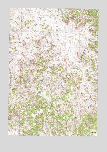
Beaver Creek School, MT USGS Topographic Map
Click on map above to begin viewing in our Map Viewer.

This topographic map contains these locations and features:
Feature Name Type Latitude Longitude GNIS ID View Map
01S45E25DDCA01 WellWellN45.7158°W106.1119°811362View Map
01S45E36DABC01 WellWellN45.7058°W106.1142°811290View Map
01S46E21DCBC01 WellWellN45.7297°W106.0564°811480View Map
01S46E27BCBC01 WellWellN45.7214°W106.0422°811410View Map
01S46E28ADDD01 WellWellN45.7197°W106.0478°811392View Map
01S46E28BAAB01 WellWellN45.7269°W106.0583°811460View Map
01S46E29BBDA01 WellWellN45.7250°W106.0836°811438View Map
01S46E30ADCA01 WellWellN45.7225°W106.0919°811415View Map
01S46E30ADCA02 WellWellN45.7225°W106.0919°811416View Map
01S46E30DBDC01 WellWellN45.7178°W106.0964°811376View Map
01S46E33DADB01 WellWellN45.7033°W106.0494°811276View Map
01S46E34CBDA01 WellWellN45.7033°W106.0425°811275View Map
02S46E02DBBB01 WellWellN45.6883°W106.0128°811149View Map
02S46E03CA__01 WellWellN45.6864°W106.0447°811123View Map
02S46E05AACB01 WellWellN45.6919°W106.0694°811183View Map
02S46E08CCCD01 SpringSpringN45.6664°W106.0822°810959View Map
02S46E09ACBD01 WellWellN45.6764°W106.0536°811040View Map
02S46E10DBDA01 SpringSpringN45.6722°W106.0300°811007View Map
02S46E15BDBC01 WellWellN45.6622°W106.0383°810914View Map
02S46E17BACA01 SpringSpringN45.6650°W106.0781°810946View Map
02S46E22DBCA01 SpringSpringN45.6431°W106.0319°810760View Map
Ash CreekStreamN45.7392°W106.0850°779157View Map
Beaver Creek School (historical)SchoolN45.7278°W106.0889°779617View Map
Beaver Creek SpringSpringN45.6614°W106.0141°779618View Map
Cabin CreekStreamN45.7114°W106.0403°780724View Map
Cabin Creek SpringSpringN45.6679°W106.0831°780737View Map
Cabin Creek WellWellN45.6936°W106.0692°780738View Map
Darling Draw SpringSpringN45.6429°W106.0319°782090View Map
Deer CreekStreamN45.7019°W106.0344°782231View Map
Deer Creek Reservoir Number OneReservoirN45.6921°W106.0359°782250View Map
Deer Creek Reservoir Number ThreeReservoirN45.6588°W106.0472°782252View Map
Deer Creek Reservoir Number TwoReservoirN45.6618°W106.0596°782251View Map
Deer Creek SpringSpringN45.6495°W106.0576°782253View Map
East Fork Beaver CreekStreamN45.7211°W106.0458°782801View Map
Funnel DrawValleyN45.6581°W106.0133°783786View Map
Lower Deer Creek WellWellN45.6867°W106.0444°786668View Map
Main Ash ReservoirReservoirN45.6863°W106.1245°786789View Map
Main Ash SpringSpringN45.6799°W106.1176°786790View Map
Maxwell CreekStreamN45.6717°W106.0231°786950View Map
Maxwell SpringSpringN45.6724°W106.0298°786951View Map
Maxwell WellWellN45.6625°W106.0381°786952View Map
North Fork Beaver CreekStreamN45.7208°W106.0456°1689986View Map
North Sartin DrawValleyN45.7261°W106.0242°788302View Map
Sartin DrawValleyN45.7228°W106.0406°790028View Map
Sartin Draw ReservoirReservoirN45.7198°W106.0050°790029View Map
Sawmill ReservoirReservoirN45.7324°W106.0134°790078View Map
Schiller CreekStreamN45.7289°W106.0914°790115View Map
Schiller ReservoirReservoirN45.6976°W106.0981°790116View Map
Sheep CreekStreamN45.6797°W106.0181°790327View Map
Straight CreekStreamN45.6914°W106.0200°791583View Map
Upper Deer Creek WellWellN45.6767°W106.0531°792626View Map
West Fork Ash CreekStreamN45.7003°W106.1183°792975View Map

Note: Coordinates in the location and feature list above are referenced to NAD83 datum.


Copyright (C) 2008-2025 Ryan Niemi / Sunset Dynamics ... All Rights Reserved