TopoQuest Logo
Do you find TopoQuest useful?
Help keep TopoQuest running and adding new maps/features by donating!
Bitcoin:  19c7KJd3qBynnjoSw5npx9KScwjBe4ifkT
Litecoin:  LXs6TkuXGGXo1vDsWCkWVdjQX94eUKd6ui
Home View Maps Find Maps Find Places Resources & Links


Home Creek Butte, Montana Topographic Map

USGS Map Title: Home Creek Butte, MT
USGS Map MRC: 45105E8
DRG (GeoTIFF) Download: o45105e8.tif


Neighboring USGS Topographic Map Quads:


  Beaver Creek School, MT  
45106F1
 

  Stacey, MT  
45105F8
 

  Elk Ridge, MT  
45105F7
 

  Coleman Draw, MT  
45106E1
 

  Home Creek Butte, MT  
45105E8
 

  Samuelson Ranch, MT  
45105E7
 

  Yager Butte, MT  
45106D1
 

  Threemile Buttes, MT  
45105D8
 

  Sonnette, MT  
45105D7


Map MRC Location:

N46°
W106°
N46°
W105°
H8 H7 H6 H5 H4 H3 H2 H1
G8 G7 G6 G5 G4 G3 G2 G1
F8 F7 F6 F5 F4 F3 F2 F1
E8 E7 E6 E5 E4 E3 E2 E1
D8 D7 D6 D5 D4 D3 D2 D1
C8 C7 C6 C5 C4 C3 C2 C1
B8 B7 B6 B5 B4 B3 B2 B1
A8 A7 A6 A5 A4 A3 A2 A1
N45°
W106°
N45°
W105°

Home Creek Butte, MT USGS 1:24K Topographic Map Preview:
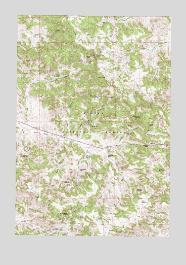
Home Creek Butte, MT USGS Topographic Map
Click on map above to begin viewing in our Map Viewer.

This topographic map contains these locations and features:
Feature Name Type Latitude Longitude GNIS ID View Map
03S46E12ADDC01 WellWellN45.5869°W105.9844°810282View Map
03S46E12ADDC02 SpringSpringN45.5869°W105.9833°810281View Map
03S47E28ACDA01 WellWellN45.5450°W105.9261°810051View Map
03S47E30DACB01 WellWellN45.5411°W105.9658°810043View Map
Barrel SpringSpringN45.6128°W105.9862°779379View Map
Big Tobin CreekStreamN45.5558°W105.9667°779893View Map
Big Tobin WellWellN45.5411°W105.9658°779894View Map
Boundary ReservoirReservoirN45.5377°W105.8849°780294View Map
Buffalo Head SpringSpringN45.5123°W105.9585°780545View Map
Cabin CreekStreamN45.5553°W105.9611°780723View Map
Cabin SpringSpringN45.5732°W105.9564°780745View Map
Camps PassGapN45.5519°W105.8928°780873View Map
East SpringSpringN45.5901°W105.9346°782957View Map
Fear SpringSpringN45.5106°W105.9479°783331View Map
Fly CreekStreamN45.5497°W105.9272°783567View Map
Fly Creek ReservoirReservoirN45.5647°W105.9378°783569View Map
Frary SpringSpringN45.5901°W105.9628°783694View Map
Hanson SpringSpringN45.6016°W105.9444°784532View Map
Hint ReservoirsReservoirN45.5203°W105.8950°784903View Map
Home Creek ButteSummitN45.6022°W105.9369°784962View Map
Houghlan SpringSpringN45.5576°W105.8896°785090View Map
Knudson ReservoirReservoirN45.5263°W105.9025°785817View Map
Lemonade SpringSpringN45.5454°W105.9262°786044View Map
Little Tobin CreekStreamN45.5497°W105.9414°786383View Map
Little Tobin SpringSpringN45.5373°W105.9488°786384View Map
Logging CreekStreamN45.5489°W105.9364°786453View Map
Logging Creek ReservoirReservoirN45.5584°W105.9115°786459View Map
Logging Creek SpringSpringN45.5677°W105.9005°786460View Map
Lower Wilbur ReservoirReservoirN45.5904°W105.9653°786687View Map
North Fork Threemile Creek WellWellN45.5075°W105.9936°788265View Map
Phillips ReservoirReservoirN45.5448°W105.9905°788820View Map
Rough CreekStreamN45.5622°W105.9964°789803View Map
Schoolhouse DrawValleyN45.5578°W105.9967°790128View Map
Smith ReservoirReservoirN45.5038°W105.9650°790734View Map
Spring Number OneSpringN45.5786°W105.9208°791315View Map
Spring Number TwoSpringN45.5623°W105.9394°791317View Map
Suicide PassGapN45.5619°W105.8936°791639View Map
Tobin ReservoirReservoirN45.5305°W105.9615°792226View Map
Trapper CreekStreamN45.5542°W105.9508°792337View Map
Upper Cabin SpringSpringN45.5790°W105.9375°792618View Map
Well ReservoirReservoirN45.5100°W105.9308°792935View Map
Wesco SpringSpringN45.5451°W105.9437°792946View Map
Wilbur CreekStreamN45.5631°W105.9931°793277View Map

Note: Coordinates in the location and feature list above are referenced to NAD83 datum.


Copyright (C) 2008-2025 Ryan Niemi / Sunset Dynamics ... All Rights Reserved