TopoQuest Logo
Do you find TopoQuest useful?
Help keep TopoQuest running and adding new maps/features by donating!
Bitcoin:  19c7KJd3qBynnjoSw5npx9KScwjBe4ifkT
Litecoin:  LXs6TkuXGGXo1vDsWCkWVdjQX94eUKd6ui
Home View Maps Find Maps Find Places Resources & Links


Millerville, Alabama Topographic Map

USGS Map Title: Millerville, AL
USGS Map MRC: 33085B8
DRG (GeoTIFF) Download: o33085b8.tif


Neighboring USGS Topographic Map Quads:


  Porter Gap, AL  
33086C1
 

  Clairmont Springs, AL  
33085C8
 

  Lineville West, AL  
33085C7
 

  Bulls Gap, AL  
33086B1
 

  Millerville, AL  
33085B8
 

  Gibsonville, AL  
33085B7
 

  Goodwater, AL  
33086A1
 

  Hackneyville, AL  
33085A8
 

  New Site, AL  
33085A7


Map MRC Location:

N34°
W86°
N34°
W85°
H8 H7 H6 H5 H4 H3 H2 H1
G8 G7 G6 G5 G4 G3 G2 G1
F8 F7 F6 F5 F4 F3 F2 F1
E8 E7 E6 E5 E4 E3 E2 E1
D8 D7 D6 D5 D4 D3 D2 D1
C8 C7 C6 C5 C4 C3 C2 C1
B8 B7 B6 B5 B4 B3 B2 B1
A8 A7 A6 A5 A4 A3 A2 A1
N33°
W86°
N33°
W85°

Millerville, AL USGS 1:24K Topographic Map Preview:
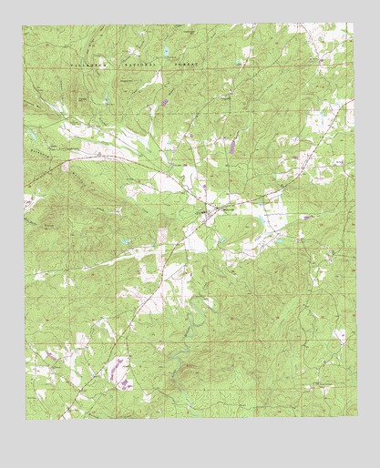
Millerville, AL USGS Topographic Map
Click on map above to begin viewing in our Map Viewer.

This topographic map contains these locations and features:
Feature Name Type Latitude Longitude GNIS ID View Map
Antioch CemeteryCemeteryN33.1929°W85.9461°1805365View Map
Antioch Church (historical)ChurchN33.1929°W85.9469°161984View Map
Atlas MineMineN33.2496°W85.9691°151065View Map
Backbone MountainSummitN33.2073°W85.9886°159099View Map
Bethel CemeteryCemeteryN33.2021°W85.8952°1805370View Map
Bethel ChurchChurchN33.2018°W85.8955°151059View Map
Big Spring ChurchChurchN33.2054°W85.8791°159186View Map
Big Springs CemeteryCemeteryN33.2054°W85.8783°1805373View Map
Blue CreekStreamN33.2096°W85.9533°159208View Map
Bolton LakeReservoirN33.2269°W85.9683°161369View Map
Cann CreekStreamN33.2140°W85.9550°159321View Map
Carr MillPopulated PlaceN33.2054°W85.9439°159330View Map
Center School (historical)SchoolN33.1268°W85.9922°161992View Map
Charles BranchStreamN33.2301°W85.9550°159368View Map
Clean Claw MountainSummitN33.2473°W85.9347°159412View Map
Dam Number OneDamN33.2254°W85.9683°159479View Map
Dam Number TwoDamN33.2401°W85.9458°159480View Map
Dennis CreekStreamN33.2115°W85.9536°159497View Map
Drake CreekStreamN33.1712°W85.9252°159513View Map
Dugout MountainSummitN33.2323°W85.9636°159536View Map
Empire MineMineN33.2468°W85.9577°151064View Map
Fairview ChurchChurchN33.2365°W85.9172°151060View Map
Gilberts Mill (historical)LocaleN33.1290°W85.9380°162009View Map
Gilpins LakeReservoirN33.2284°W85.9483°161368View Map
GladesPopulated PlaceN33.2112°W85.9897°159669View Map
Graves High SchoolSchoolN33.1904°W85.9325°159690View Map
Gutherie Chapel CemeteryCemeteryN33.1359°W85.8888°1805382View Map
Gutheries ChapelChurchN33.1354°W85.8891°159705View Map
Henderson ProspectMineN33.1510°W85.8891°163059View Map
Hillabee RidgeRidgeN33.1685°W85.9047°162015View Map
Hood-Graves MineMineN33.2351°W85.9741°151066View Map
Jacksons LakeReservoirN33.2143°W85.9193°161366View Map
Lake PruittReservoirN33.2412°W85.9458°161370View Map
Little CreekStreamN33.1884°W85.9422°159963View Map
Little Hillabee Watershed Dam Number 3DamN33.2284°W85.9483°161367View Map
Little Hillabee Watershed Dam Number 4DamN33.2134°W85.9183°161365View Map
Little Hillabee Watershed Dam Number 6DamN33.1884°W85.8933°161360View Map
Maranatha Christian AcademySchoolN33.2268°W85.9277°163638View Map
Martins LakeReservoirN33.1882°W85.8936°161359View Map
MillervillePopulated PlaceN33.1915°W85.9258°160110View Map
Millerville CemeteryCemeteryN33.1893°W85.9300°1805392View Map
Millerville Census Designated PlaceCensusN33.1926°W85.9302°2582687View Map
Millerville ChurchChurchN33.1896°W85.9302°151063View Map
Millerville ChurchChurchN33.1929°W85.9316°163639View Map
Millerville Elementary SchoolSchoolN33.1907°W85.9319°162030View Map
Millerville Volunteer Fire DepartmentBuildingN33.1915°W85.9272°2682683View Map
Mount Tabor United Methodist ChurchChurchN33.2107°W85.9830°160181View Map
Mount Zion CemeteryCemeteryN33.2393°W85.8888°1805400View Map
Mount Zion ChurchChurchN33.2384°W85.8883°160188View Map
Munroes Mill (historical)LocaleN33.1968°W85.9369°162031View Map
Oak Hill ChurchChurchN33.2179°W85.9739°160275View Map
Oak Hill School (historical)SchoolN33.2368°W85.9630°162032View Map
Oaks ChapelChurchN33.1318°W85.9952°160285View Map
Oaks Chapel CemeteryCemeteryN33.1315°W85.9955°1805405View Map
Old Millerville ChurchChurchN33.1915°W85.9283°163641View Map
Pleasant Hill CemeteryCemeteryN33.2265°W85.9255°1805407View Map
Pleasant Hill Methodist ChurchChurchN33.2271°W85.9236°160410View Map
Pleasant Home ChurchChurchN33.1276°W85.9839°160414View Map
Ray CreekStreamN33.1976°W85.9380°160473View Map
Rock Springs CemeteryCemeteryN33.1404°W85.9891°1805410View Map
Rock Springs ChurchChurchN33.1410°W85.9900°160514View Map
Roseline ChurchChurchN33.2109°W85.9822°164116View Map
Salem School (historical)SchoolN33.2046°W85.8800°162039View Map
Saxon CreekStreamN33.1257°W85.9683°160572View Map
Section Eighteen ProspectMineN33.1984°W85.9547°151062View Map
Simmons BranchStreamN33.2223°W85.9852°160612View Map
Simmons CemeteryCemeteryN33.2198°W85.9808°164123View Map
Tri - Community Volunteer Fire Department Goodwater StationBuildingN33.1454°W85.9774°2683460View Map
Triplett MountainSummitN33.2265°W85.9791°160758View Map
Water Mill (historical)LocaleN33.2496°W85.9464°162048View Map
Williams Store (historical)LocaleN33.2434°W85.9816°162051View Map
Williamsons School (historical)SchoolN33.1410°W85.9616°151067View Map
Wilsons CemeteryCemeteryN33.2084°W85.9547°151061View Map

Note: Coordinates in the location and feature list above are referenced to NAD83 datum.


Copyright (C) 2008-2024 Ryan Niemi / Sunset Dynamics ... All Rights Reserved