TopoQuest Logo
Do you find TopoQuest useful?
Help keep TopoQuest running and adding new maps/features by donating!
Bitcoin:  19c7KJd3qBynnjoSw5npx9KScwjBe4ifkT
Litecoin:  LXs6TkuXGGXo1vDsWCkWVdjQX94eUKd6ui
Home View Maps Find Maps Find Places Resources & Links


Gibsonville, Alabama Topographic Map

USGS Map Title: Gibsonville, AL
USGS Map MRC: 33085B7
DRG (GeoTIFF) Download: o33085b7.tif


Neighboring USGS Topographic Map Quads:


  Clairmont Springs, AL  
33085C8
 

  Lineville West, AL  
33085C7
 

  Lineville East, AL  
33085C6
 

  Millerville, AL  
33085B8
 

  Gibsonville, AL  
33085B7
 

  Mellow Valley, AL  
33085B6
 

  Hackneyville, AL  
33085A8
 

  New Site, AL  
33085A7
 

  Daviston, AL  
33085A6


Map MRC Location:

N34°
W86°
N34°
W85°
H8 H7 H6 H5 H4 H3 H2 H1
G8 G7 G6 G5 G4 G3 G2 G1
F8 F7 F6 F5 F4 F3 F2 F1
E8 E7 E6 E5 E4 E3 E2 E1
D8 D7 D6 D5 D4 D3 D2 D1
C8 C7 C6 C5 C4 C3 C2 C1
B8 B7 B6 B5 B4 B3 B2 B1
A8 A7 A6 A5 A4 A3 A2 A1
N33°
W86°
N33°
W85°

Gibsonville, AL USGS 1:24K Topographic Map Preview:
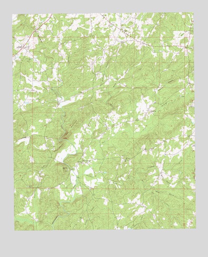
Gibsonville, AL USGS Topographic Map
Click on map above to begin viewing in our Map Viewer.

This topographic map contains these locations and features:
Feature Name Type Latitude Longitude GNIS ID View Map
Ashland DivisionCivilN33.2234°W85.8015°165702View Map
Bethel ChurchChurchN33.2001°W85.8577°139660View Map
Bishop MountainSummitN33.1607°W85.8425°114385View Map
Blair Lake Number 2ReservoirN33.2001°W85.8633°154070View Map
Blair Number 1 DamDamN33.2001°W85.8616°131298View Map
Blair Number 2 DamDamN33.2001°W85.8633°131299View Map
Bluff SpringsPopulated PlaceN33.1635°W85.8275°156086View Map
Bluff Springs Volunteer Fire DepartmentBuildingN33.1594°W85.8309°2683190View Map
Brown CemeteryCemeteryN33.1743°W85.8216°151057View Map
Burkhalter BranchStreamN33.2109°W85.8141°115232View Map
Carr CreekStreamN33.1798°W85.8044°115644View Map
Clonch CreekStreamN33.1276°W85.8486°161997View Map
Cooks Store (historical)LocaleN33.2065°W85.7522°139662View Map
County Line CemeteryCemeteryN33.1962°W85.7519°163633View Map
County Line ChurchChurchN33.1951°W85.7516°139663View Map
GibsonvillePopulated PlaceN33.1937°W85.7819°156405View Map
Gibsonville School (historical)SchoolN33.1843°W85.8097°1730271View Map
Harkins CrossroadsPopulated PlaceN33.2312°W85.8672°119735View Map
Hillabee Post Office (historical)Post OfficeN33.1923°W85.8422°166096View Map
Holdridge BranchStreamN33.1957°W85.7725°120221View Map
Jett MountainSummitN33.1865°W85.8322°120884View Map
Liberty Hill CemeteryCemeteryN33.2298°W85.8652°1805387View Map
Liberty Hill Methodist ChurchChurchN33.2307°W85.8666°121574View Map
Liberty Hill School (historical)SchoolN33.2446°W85.8516°139673View Map
Loombeam CreekStreamN33.1551°W85.7922°122024View Map
Lynch CreekStreamN33.2062°W85.8477°160012View Map
Lystra Baptist ChurchChurchN33.2334°W85.7991°122130View Map
Lystra CemeteryCemeteryN33.2329°W85.7997°1730209View Map
Mattox BranchStreamN33.2046°W85.8100°122396View Map
Metcalf CreekStreamN33.2132°W85.8444°160087View Map
Moore BranchStreamN33.1593°W85.7750°122986View Map
Mount Ararat CemeteryCemeteryN33.1596°W85.8377°123142View Map
Mount Carmel CemeteryCemeteryN33.1671°W85.7994°1805394View Map
Mount Carmel ChurchChurchN33.1654°W85.7977°123175View Map
Mount Moriah United Methodist ChurchChurchN33.1640°W85.8280°123259View Map
Mount Zion CemeteryCemeteryN33.1504°W85.8650°1805398View Map
Mount Zion ChurchChurchN33.1504°W85.8647°123478View Map
Mountain Volunteer Fire DepartmentBuildingN33.1259°W85.7556°2683191View Map
New Prospect CemeteryCemeteryN33.2040°W85.8269°1805402View Map
New Prospect School (historical)SchoolN33.2046°W85.8269°151056View Map
Old Liberty Hill CemeteryCemeteryN33.2232°W85.8633°124220View Map
Old Providence CemeteryCemeteryN33.2293°W85.7513°163642View Map
Parker BranchStreamN33.1501°W85.7847°124437View Map
Patterson CemeteryCemeteryN33.1501°W85.8300°151058View Map
Prospect ChurchChurchN33.2043°W85.8275°153072View Map
Providence Primitive Baptist ChurchChurchN33.2298°W85.7511°164197View Map
Rock Pile CreekStreamN33.1551°W85.7922°153182View Map
Sardis CemeteryCemeteryN33.1884°W85.7913°163643View Map
Sardis ChurchChurchN33.1879°W85.7908°126414View Map
Sarvis Church (historical)ChurchN33.1410°W85.8083°139682View Map
Shool CreekStreamN33.1546°W85.8319°126799View Map
Street CreekStreamN33.1276°W85.8489°160687View Map
Street MountainSummitN33.1743°W85.8422°127461View Map
Sweetwater CreekStreamN33.1571°W85.8272°127592View Map
Tanyard BranchStreamN33.1957°W85.7725°127675View Map
Vickers Store (historical)LocaleN33.1382°W85.7852°139684View Map
Victory ChurchChurchN33.2112°W85.7533°151054View Map
Webbs Store (historical)LocaleN33.2479°W85.8011°151055View Map
West Gin (historical)LocaleN33.2446°W85.7994°139685View Map
Wrights ChapelChurchN33.2398°W85.7980°154039View Map

Note: Coordinates in the location and feature list above are referenced to NAD83 datum.


Copyright (C) 2008-2024 Ryan Niemi / Sunset Dynamics ... All Rights Reserved