TopoQuest Logo
Do you find TopoQuest useful?
Help keep TopoQuest running and adding new maps/features by donating!
Bitcoin:  19c7KJd3qBynnjoSw5npx9KScwjBe4ifkT
Litecoin:  LXs6TkuXGGXo1vDsWCkWVdjQX94eUKd6ui
Home View Maps Find Maps Find Places Resources & Links


Milltown, Wisconsin Topographic Map

USGS Map Title: Milltown, WI
USGS Map MRC: 45092E5
DRG (GeoTIFF) Download: o45092e5.tif


Neighboring USGS Topographic Map Quads:


  Trade River, WI  
45092F6
 

  Trade Lake, WI  
45092F5
 

  Frederic, WI  
45092F4
 

  Cushing, WI  
45092E6
 

  Milltown, WI  
45092E5
 

  Luck, WI  
45092E4
 

  Saint Croix Dalles, WI  
45092D6
 

  Centuria, WI  
45092D5
 

  Balsam Lake, WI  
45092D4


Map MRC Location:

N46°
W93°
N46°
W92°
H8 H7 H6 H5 H4 H3 H2 H1
G8 G7 G6 G5 G4 G3 G2 G1
F8 F7 F6 F5 F4 F3 F2 F1
E8 E7 E6 E5 E4 E3 E2 E1
D8 D7 D6 D5 D4 D3 D2 D1
C8 C7 C6 C5 C4 C3 C2 C1
B8 B7 B6 B5 B4 B3 B2 B1
A8 A7 A6 A5 A4 A3 A2 A1
N45°
W93°
N45°
W92°

Milltown, WI USGS 1:24K Topographic Map Preview:
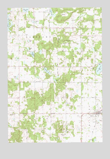
Milltown, WI USGS Topographic Map
Click on map above to begin viewing in our Map Viewer.

This topographic map contains these locations and features:
Feature Name Type Latitude Longitude GNIS ID View Map
Alabama LakeLakeN45.6132°W92.6241°1568584View Map
Alabama SchoolSchoolN45.6219°W92.6227°1560723View Map
Bullhead LakeLakeN45.6115°W92.5891°1562385View Map
Butternut CreekStreamN45.6180°W92.5999°1562479View Map
Camp Douglas LakeLakeN45.5020°W92.5105°1562600View Map
Clauson LakeLakeN45.5604°W92.6132°1563128View Map
Ellofson LakeLakeN45.5869°W92.5980°1564549View Map
Evergreen CemeteryCemeteryN45.5233°W92.5694°1564761View Map
Forsythe LakeLakeN45.6204°W92.5661°1565150View Map
Granum CemeteryCemeteryN45.5336°W92.5280°1565753View Map
Haustrup CemeteryCemeteryN45.6058°W92.5433°1566150View Map
Laketown ChurchChurchN45.6055°W92.6099°1567789View Map
Laketown TownhallBuildingN45.5997°W92.6008°1831823View Map
Lanesdale SchoolSchoolN45.5777°W92.6199°1567832View Map
Lees LakeLakeN45.5361°W92.5477°1567941View Map
Little Butternut LakeLakeN45.5681°W92.5021°1568215View Map
Little Mirror LakeLakeN45.5821°W92.5921°1571322View Map
Long Trade LakeLakeN45.6237°W92.6004°1568598View Map
MilltownPopulated PlaceN45.5261°W92.5085°1569527View Map
Milltown Police DepartmentBuildingN45.5236°W92.5084°2759475View Map
Milltown Volunteer Fire DepartmentBuildingN45.5309°W92.5012°2696733View Map
New Home CemeteryCemeteryN45.5258°W92.6216°1570221View Map
North Valley ChurchChurchN45.5261°W92.5669°1570516View Map
Oak Hill SchoolSchoolN45.6130°W92.5702°1570651View Map
Pleasant Valley SchoolSchoolN45.5555°W92.5908°1571661View Map
Sandhill LakeLakeN45.5664°W92.5731°1573675View Map
South Branch Trade RiverStreamN45.6180°W92.5044°1574416View Map
Spring LakeLakeN45.5577°W92.5628°1574674View Map
Town of EurekaCivilN45.5150°W92.6233°1583176View Map
Town of LaketownCivilN45.5993°W92.5901°1583519View Map
Trap Rock SchoolSchoolN45.5272°W92.5746°1575573View Map
Unity Area AmbulanceBuildingN45.5312°W92.5007°2698359View Map
Village of MilltownCivilN45.5264°W92.5012°1583718View Map
Wallin LakeLakeN45.5943°W92.5976°1576173View Map
West DenmarkPopulated PlaceN45.5700°W92.5096°1576495View Map

Note: Coordinates in the location and feature list above are referenced to NAD83 datum.


Copyright (C) 2008-2025 Ryan Niemi / Sunset Dynamics ... All Rights Reserved