TopoQuest Logo
Do you find TopoQuest useful?
Help keep TopoQuest running and adding new maps/features by donating!
Bitcoin:  19c7KJd3qBynnjoSw5npx9KScwjBe4ifkT
Litecoin:  LXs6TkuXGGXo1vDsWCkWVdjQX94eUKd6ui
Home View Maps Find Maps Find Places Resources & Links


Centuria, Wisconsin Topographic Map

USGS Map Title: Centuria, WI
USGS Map MRC: 45092D5
DRG (GeoTIFF) Download: o45092d5.tif


Neighboring USGS Topographic Map Quads:


  Cushing, WI  
45092E6
 

  Milltown, WI  
45092E5
 

  Luck, WI  
45092E4
 

  Saint Croix Dalles, WI  
45092D6
 

  Centuria, WI  
45092D5
 

  Balsam Lake, WI  
45092D4
 

  Osceola, WI  
45092C6
 

  Nye, WI  
45092C5
 

  Wapogasset Lake, WI  
45092C4


Map MRC Location:

N46°
W93°
N46°
W92°
H8 H7 H6 H5 H4 H3 H2 H1
G8 G7 G6 G5 G4 G3 G2 G1
F8 F7 F6 F5 F4 F3 F2 F1
E8 E7 E6 E5 E4 E3 E2 E1
D8 D7 D6 D5 D4 D3 D2 D1
C8 C7 C6 C5 C4 C3 C2 C1
B8 B7 B6 B5 B4 B3 B2 B1
A8 A7 A6 A5 A4 A3 A2 A1
N45°
W93°
N45°
W92°

Centuria, WI USGS 1:24K Topographic Map Preview:
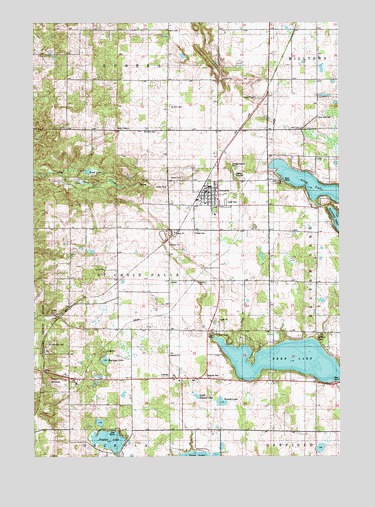
Centuria, WI USGS Topographic Map
Click on map above to begin viewing in our Map Viewer.

This topographic map contains these locations and features:
Feature Name Type Latitude Longitude GNIS ID View Map
Barneys LakeLakeN45.4028°W92.5962°1561187View Map
CenturiaPopulated PlaceN45.4513°W92.5541°1562913View Map
Centuria Police Department AdministrationBuildingN45.4520°W92.5541°2759442View Map
Centuria Volunteer Fire DepartmentBuildingN45.4519°W92.5542°2696827View Map
Deer LakeLakeN45.4027°W92.5227°1563855View Map
Flying J AirportAirportN45.4307°W92.6168°2444117View Map
Fristad CemeteryCemeteryN45.4398°W92.5597°1565340View Map
LamarPopulated PlaceN45.4258°W92.5702°1577689View Map
Little Round LakeLakeN45.3923°W92.5587°1568392View Map
Long LakeLakeN45.4538°W92.5133°1568583View Map
Long Lake CemeteryCemeteryN45.4724°W92.5094°1568586View Map
Long Lake ParkParkN45.4544°W92.5233°1568589View Map
McAskill CemeteryCemeteryN45.4691°W92.5797°1569164View Map
Poplar LakeLakeN45.3797°W92.5948°1571774View Map
Rock CreekStreamN45.4069°W92.5430°1572426View Map
Rock LakeLakeN45.4569°W92.6032°1572457View Map
Round LakeLakeN45.3907°W92.5489°1572654View Map
Saint Croix Falls CemeteryCemeteryN45.4073°W92.6202°1572911View Map
Saint Croix Falls TownhallBuildingN45.3983°W92.5705°1831843View Map
Saint John CemeteryCemeteryN45.4758°W92.5696°1573007View Map
Saint Pauls CampLocaleN45.4075°W92.5083°1573461View Map
South Milltown School (historical)SchoolN45.4830°W92.5085°1831849View Map
Town of Saint Croix FallsCivilN45.4276°W92.5892°1584086View Map
Village of CenturiaCivilN45.4497°W92.5578°1582944View Map
Woodrow School (historical)SchoolN45.4830°W92.5694°1831859View Map

Note: Coordinates in the location and feature list above are referenced to NAD83 datum.


Copyright (C) 2008-2025 Ryan Niemi / Sunset Dynamics ... All Rights Reserved