TopoQuest Logo
Do you find TopoQuest useful?
Help keep TopoQuest running and adding new maps/features by donating!
Bitcoin:  19c7KJd3qBynnjoSw5npx9KScwjBe4ifkT
Litecoin:  LXs6TkuXGGXo1vDsWCkWVdjQX94eUKd6ui
Home View Maps Find Maps Find Places Resources & Links


Millville, Michigan Topographic Map

USGS Map Title: Millville, MI
USGS Map MRC: 42084E2
DRG (GeoTIFF) Download: o42084e2.tif


Neighboring USGS Topographic Map Quads:


  Williamston, MI  
42084F3
 

  Webberville, MI  
42084F2
 

  Fowlerville, MI  
42084F1
 

  Dansville, MI  
42084E3
 

  Millville, MI  
42084E2
 

  Parkers Corners, MI  
42084E1
 

  Pleasant Lake, MI  
42084D3
 

  Stockbridge, MI  
42084D2
 

  Gregory, MI  
42084D1


Map MRC Location:

N43°
W85°
N43°
W84°
H8 H7 H6 H5 H4 H3 H2 H1
G8 G7 G6 G5 G4 G3 G2 G1
F8 F7 F6 F5 F4 F3 F2 F1
E8 E7 E6 E5 E4 E3 E2 E1
D8 D7 D6 D5 D4 D3 D2 D1
C8 C7 C6 C5 C4 C3 C2 C1
B8 B7 B6 B5 B4 B3 B2 B1
A8 A7 A6 A5 A4 A3 A2 A1
N42°
W85°
N42°
W84°

Millville, MI USGS 1:24K Topographic Map Preview:
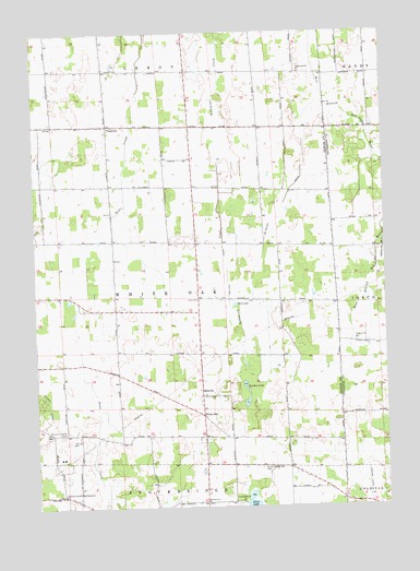
Millville, MI USGS Topographic Map
Click on map above to begin viewing in our Map Viewer.

This topographic map contains these locations and features:
Feature Name Type Latitude Longitude GNIS ID View Map
Burden LakeLakeN42.5322°W84.1755°622267View Map
Cloud Nine West AirportAirportN42.5493°W84.1283°2650898View Map
Good Shepherd MissionChurchN42.5093°W84.1580°2634957View Map
Harris Post Office (historical)Post OfficeN42.5833°W84.1672°2634298View Map
Holland DrainCanalN42.5606°W84.1811°628424View Map
McMahon DrainCanalN42.5828°W84.1589°631987View Map
Middletown Post Office (historical)Post OfficeN42.5542°W84.1422°2634297View Map
MillvillePopulated PlaceN42.5292°W84.1911°1617723View Map
Millville United Methodist ChurchChurchN42.5281°W84.1914°2634956View Map
Mount Olive ChurchChurchN42.5014°W84.1900°632823View Map
Mount Pleasant CemeteryCemeteryN42.5197°W84.2400°632836View Map
Mud LakeLakeN42.5534°W84.1786°632933View Map
North Stockbridge CemeteryCemeteryN42.5100°W84.1702°633664View Map
Northwest Stockbridge Community ChurchChurchN42.5031°W84.2408°633721View Map
Patrick DrainCanalN42.5273°W84.2461°634455View Map
Township of White OakCivilN42.5557°W84.2006°1627265View Map
VantownPopulated PlaceN42.6006°W84.2236°1615516View Map
Vantown Community ChurchChurchN42.6000°W84.2231°2634941View Map
Vantown Post Office (historical)Post OfficeN42.6006°W84.2236°2634288View Map
White OakPopulated PlaceN42.5242°W84.1908°1617939View Map
White Oak Township Hall Historical MarkerParkN42.5549°W84.1920°2633764View Map
Whiteoak Post Office (historical)Post OfficeN42.5242°W84.1908°2633969View Map

Note: Coordinates in the location and feature list above are referenced to NAD83 datum.


Copyright (C) 2008-2025 Ryan Niemi / Sunset Dynamics ... All Rights Reserved