TopoQuest Logo
Do you find TopoQuest useful?
Help keep TopoQuest running and adding new maps/features by donating!
Bitcoin:  19c7KJd3qBynnjoSw5npx9KScwjBe4ifkT
Litecoin:  LXs6TkuXGGXo1vDsWCkWVdjQX94eUKd6ui
Home View Maps Find Maps Find Places Resources & Links


Webberville, Michigan Topographic Map

USGS Map Title: Webberville, MI
USGS Map MRC: 42084F2
DRG (GeoTIFF) Download: o42084f2.tif


Neighboring USGS Topographic Map Quads:


  Shaftsburg, MI  
42084G3
 

  Perry, MI  
42084G2
 

  Corunna SE, MI  
42084G1
 

  Williamston, MI  
42084F3
 

  Webberville, MI  
42084F2
 

  Fowlerville, MI  
42084F1
 

  Dansville, MI  
42084E3
 

  Millville, MI  
42084E2
 

  Parkers Corners, MI  
42084E1


Map MRC Location:

N43°
W85°
N43°
W84°
H8 H7 H6 H5 H4 H3 H2 H1
G8 G7 G6 G5 G4 G3 G2 G1
F8 F7 F6 F5 F4 F3 F2 F1
E8 E7 E6 E5 E4 E3 E2 E1
D8 D7 D6 D5 D4 D3 D2 D1
C8 C7 C6 C5 C4 C3 C2 C1
B8 B7 B6 B5 B4 B3 B2 B1
A8 A7 A6 A5 A4 A3 A2 A1
N42°
W85°
N42°
W84°

Webberville, MI USGS 1:24K Topographic Map Preview:
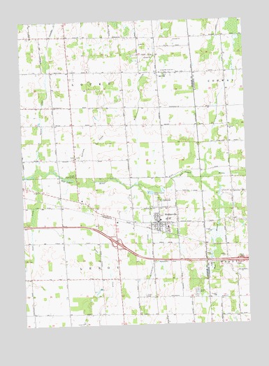
Webberville, MI USGS Topographic Map
Click on map above to begin viewing in our Map Viewer.

This topographic map contains these locations and features:
Feature Name Type Latitude Longitude GNIS ID View Map
Alchin Farm CemeteryCemeteryN42.6371°W84.1826°619912View Map
Bell OakPopulated PlaceN42.7286°W84.1736°621038View Map
Bell Oak CemeteryCemeteryN42.7291°W84.1718°628948View Map
Briggs CemeteryCemeteryN42.6285°W84.1309°2631039View Map
Browell Roadside ParkParkN42.6867°W84.2208°622060View Map
Calvary Baptist ChurchChurchN42.6719°W84.1767°2634930View Map
Church of ChristChurchN42.6694°W84.1750°2634932View Map
Coffey CemeteryCemeteryN42.6530°W84.1374°623537View Map
Conway ChurchChurchN42.7056°W84.1341°623722View Map
Conway Miller CemeteryCemeteryN42.7061°W84.1344°2631044View Map
Dietz CreekStreamN42.6648°W84.2452°624673View Map
Doan CreekStreamN42.6867°W84.2439°624717View Map
Hamlin Mobile Home CommunityPopulated PlaceN42.6389°W84.1533°2634940View Map
Interchange 122CrossingN42.6589°W84.1978°2633621View Map
Kalamink CreekStreamN42.6825°W84.1852°629447View Map
LeRoy Township District Number Six School Historical MarkerParkN42.6680°W84.1740°2633763View Map
Leroy Township Fire DepartmentBuildingN42.6647°W84.1776°2635966View Map
Locke Post Office (historical)Post OfficeN42.7286°W84.1736°2634296View Map
Mount Hope ChurchChurchN42.6796°W84.2317°2634928View Map
Oak Lane Golf ClubLocaleN42.6761°W84.1716°1623540View Map
Phelpstown Post Office (historical)Post OfficeN42.6828°W84.2472°2634290View Map
Rowley CemeteryCemeteryN42.6945°W84.2193°2633601View Map
Rowley ChurchChurchN42.6942°W84.2202°636347View Map
Squaw CreekStreamN42.6903°W84.2416°638669View Map
Sullivan CreekStreamN42.6859°W84.2264°639038View Map
Township of LeroyCivilN42.6430°W84.2045°1626608View Map
Township of LockeCivilN42.7312°W84.2105°1626634View Map
Village of WebbervilleCivilN42.6640°W84.1785°2400119View Map
Wayside Tabernacle ChurchChurchN42.6605°W84.1792°2634929View Map
Webbervilla Mobile Home ParkPopulated PlaceN42.6689°W84.1811°2634934View Map
WebbervillePopulated PlaceN42.6670°W84.1741°1615938View Map
Webberville CemeteryCemeteryN42.6728°W84.1894°2633600View Map
Webberville Elementary SchoolSchoolN42.6681°W84.1730°2634938View Map
Webberville High SchoolSchoolN42.6688°W84.1696°2634939View Map
Webberville LibraryBuildingN42.6667°W84.1736°2634937View Map
Webberville ParkParkN42.6675°W84.1777°2635066View Map
Webberville Police DepartmentBuildingN42.6664°W84.1737°2634936View Map
Webberville Post OfficePost OfficeN42.6672°W84.1760°2634935View Map
Webberville Station (historical)LocaleN42.6631°W84.1733°2634933View Map
Webberville United Methodist ChurchChurchN42.6681°W84.1756°2634931View Map
West Branch Red Cedar RiverStreamN42.6828°W84.1508°1616062View Map
Wolf CreekStreamN42.6831°W84.1858°1616688View Map

Note: Coordinates in the location and feature list above are referenced to NAD83 datum.


Copyright (C) 2008-2024 Ryan Niemi / Sunset Dynamics ... All Rights Reserved