TopoQuest Logo
Do you find TopoQuest useful?
Help keep TopoQuest running and adding new maps/features by donating!
Bitcoin:  19c7KJd3qBynnjoSw5npx9KScwjBe4ifkT
Litecoin:  LXs6TkuXGGXo1vDsWCkWVdjQX94eUKd6ui
Home View Maps Find Maps Find Places Resources & Links


Lake Mountain, California Topographic Map

USGS Map Title: Lake Mountain, CA
USGS Map MRC: 40123A4
DRG (GeoTIFF) Download: o40123a4.tif


Neighboring USGS Topographic Map Quads:


  Alderpoint, CA  
40123B5
 

  Zenia, CA  
40123B4
 

  Shannon Butte, CA  
40123B3
 

  Jewett Rock, CA  
40123A5
 

  Lake Mountain, CA  
40123A4
 

  Long Ridge, CA  
40123A3
 

  Bell Springs, CA  
39123H5
 

  Updegraff Ridge, CA  
39123H4
 

  Mina, CA  
39123H3


Map MRC Location:

N41°
W124°
N41°
W123°
H8 H7 H6 H5 H4 H3 H2 H1
G8 G7 G6 G5 G4 G3 G2 G1
F8 F7 F6 F5 F4 F3 F2 F1
E8 E7 E6 E5 E4 E3 E2 E1
D8 D7 D6 D5 D4 D3 D2 D1
C8 C7 C6 C5 C4 C3 C2 C1
B8 B7 B6 B5 B4 B3 B2 B1
A8 A7 A6 A5 A4 A3 A2 A1
N40°
W124°
N40°
W123°

Lake Mountain, CA USGS 1:24K Topographic Map Preview:
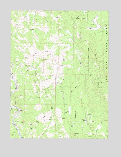
Lake Mountain, CA USGS Topographic Map
Click on map above to begin viewing in our Map Viewer.

This topographic map contains these locations and features:
Feature Name Type Latitude Longitude GNIS ID View Map
Bear CanyonValleyN40.0474°W123.4070°218791View Map
Boulder CreekStreamN40.0613°W123.4989°219684View Map
Dry LakeLakeN40.0124°W123.4203°222651View Map
Fenton RidgeRidgeN40.0174°W123.4625°223447View Map
Frazier GardensAreaN40.0476°W123.4456°223848View Map
Gummer PlaceLocaleN40.0393°W123.4122°1683030View Map
Haman RidgeRidgeN40.0593°W123.3878°261036View Map
Hoaglin School (historical)SchoolN40.1121°W123.4203°1665561View Map
Hoaglin ValleyValleyN40.1074°W123.3831°225372View Map
Horse Ranch PeakSummitN40.0035°W123.4192°225624View Map
Indian SpringsSpringN40.0196°W123.4305°225909View Map
Island MountainPopulated PlaceN40.0263°W123.4903°1658842View Map
Island Mountain MineMineN40.0326°W123.4986°1665562View Map
Jamison RanchLocaleN40.1176°W123.4809°226140View Map
Lake MountainSummitN40.0274°W123.4181°226799View Map
Lake Mountain Landing Strip (historical)AirportN40.0210°W123.4039°1665563View Map
Lake Mountain RanchLocaleN40.0168°W123.3967°226801View Map
Lake Mountain School (historical)SchoolN40.0174°W123.4061°1683044View Map
Lampley RanchLocaleN40.1188°W123.4400°226840View Map
Lone Pine CorralsLocaleN40.0532°W123.4409°227508View Map
Lost LakeLakeN40.0460°W123.4372°227709View Map
Lower LakeLakeN40.0162°W123.4919°227774View Map
Moose PeakSummitN40.0160°W123.4836°229033View Map
Pepperwood CorralsLocaleN40.0210°W123.4472°230513View Map
Pilot PeakSummitN40.0296°W123.4436°230665View Map
Pine FlatFlatN40.0490°W123.4525°230691View Map
Prather FlatFlatN40.0421°W123.4325°231027View Map
Rice LakeSwampN40.0279°W123.4247°231530View Map
Tunnel CreekStreamN40.0304°W123.4934°236627View Map
Turtle LakeLakeN40.0766°W123.4349°236667View Map
Upper LakeLakeN40.0098°W123.4727°236895View Map
Witter RanchLocaleN40.1049°W123.4303°276208View Map

Note: Coordinates in the location and feature list above are referenced to NAD83 datum.


Copyright (C) 2008-2025 Ryan Niemi / Sunset Dynamics ... All Rights Reserved