TopoQuest Logo
Do you find TopoQuest useful?
Help keep TopoQuest running and adding new maps/features by donating!
Bitcoin:  19c7KJd3qBynnjoSw5npx9KScwjBe4ifkT
Litecoin:  LXs6TkuXGGXo1vDsWCkWVdjQX94eUKd6ui
Home View Maps Find Maps Find Places Resources & Links


Beaverdam, Virginia Topographic Map

USGS Map Title: Beaverdam, VA
USGS Map MRC: 37077H6
DRG (GeoTIFF) Download: o37077h6.tif


Neighboring USGS Topographic Map Quads:


  Lake Anna West, VA  
38077A7
 

  Lake Anna East, VA  
38077A6
 

  Ladysmith, VA  
38077A5
 

  Buckner, VA  
37077H7
 

  Beaverdam, VA  
37077H6
 

  Hewlett, VA  
37077H5
 

  Dabneys, VA  
37077G7
 

  Montpelier, VA  
37077G6
 

  Hanover Academy, VA  
37077G5


Map MRC Location:

N38°
W78°
N38°
W77°
H8 H7 H6 H5 H4 H3 H2 H1
G8 G7 G6 G5 G4 G3 G2 G1
F8 F7 F6 F5 F4 F3 F2 F1
E8 E7 E6 E5 E4 E3 E2 E1
D8 D7 D6 D5 D4 D3 D2 D1
C8 C7 C6 C5 C4 C3 C2 C1
B8 B7 B6 B5 B4 B3 B2 B1
A8 A7 A6 A5 A4 A3 A2 A1
N37°
W78°
N37°
W77°

Beaverdam, VA USGS 1:24K Topographic Map Preview:
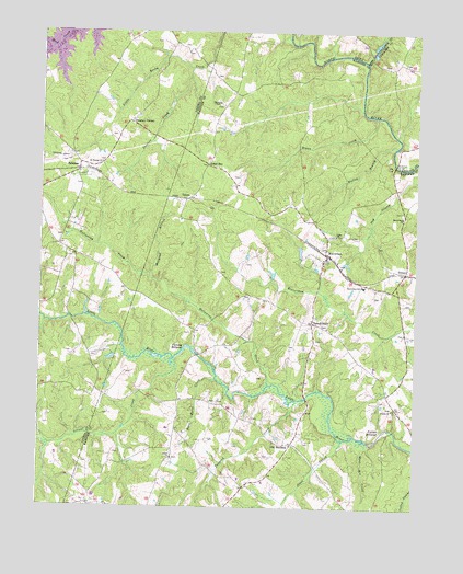
Beaverdam, VA USGS Topographic Map
Click on map above to begin viewing in our Map Viewer.

This topographic map contains these locations and features:
Feature Name Type Latitude Longitude GNIS ID View Map
Aaron Hall School (historical)SchoolN37.8815°W77.6800°1748895View Map
Anderson BridgeBridgeN37.9651°W77.6322°1462459View Map
Anderson Mill (historical)LocaleN37.9696°W77.6325°1739318View Map
BeaverdamPopulated PlaceN37.9413°W77.6544°1492536View Map
Beaverdam ChurchChurchN37.9515°W77.6292°1462951View Map
Beaverdam DepotBuildingN37.9410°W77.6536°1748898View Map
Beaverdam Elementary SchoolSchoolN37.9333°W77.6418°1462974View Map
Beaverdam Mills (historical)LocaleN37.9160°W77.6975°1748899View Map
Beaverdam Post OfficePost OfficeN37.9406°W77.6521°2767200View Map
BumpassPopulated PlaceN37.9635°W77.7372°1464090View Map
Buzzie CreekStreamN37.9957°W77.7461°1748940View Map
Fleming MillpondReservoirN37.9157°W77.6978°1466692View Map
Fulcher MillpondReservoirN37.8957°W77.6333°1466914View Map
Green BayPopulated PlaceN37.9651°W77.6947°1493028View Map
Greenes CornerPopulated PlaceN37.9760°W77.7200°1493032View Map
Hanover County Fire - EMS Company 2 - Beaverdam Volunteer Fire StationBuildingN37.9398°W77.6532°2075375View Map
Harris Store (historical)LocaleN37.9438°W77.7439°1494691View Map
Hogan CreekStreamN37.9779°W77.6380°1468117View Map
Hollowing CreekStreamN37.9071°W77.6736°1468152View Map
James DamDamN37.9951°W77.6397°1489352View Map
James PondReservoirN37.9962°W77.6390°1489353View Map
Jones SwampStreamN37.8926°W77.6486°1468864View Map
Lake Anna AirportAirportN37.9655°W77.7472°1498609View Map
Lake Anna RescueBuildingN37.9584°W77.7486°2075282View Map
Lazarus Chapel (historical)ChurchN37.9785°W77.6930°1748915View Map
Locust CreekStreamN37.9138°W77.7044°1469724View Map
Millpond BranchStreamN37.9363°W77.7133°1470576View Map
Mont Air CreekStreamN37.8926°W77.6414°1470683View Map
Old BandanaPopulated PlaceN37.8915°W77.6653°1471821View Map
Roan Horse CreekStreamN37.9085°W77.6908°1473288View Map
Rouzie ChapelChurchN37.9815°W77.6908°1473599View Map
Saint Thomas ChurchChurchN37.9651°W77.7297°1473926View Map
Shiloh ChurchChurchN37.8879°W77.7053°1474521View Map
Snelson (historical)Populated PlaceN37.9746°W77.6930°1748924View Map
Snelson CreekStreamN37.9904°W77.7000°1474808View Map
Tanyard CreekStreamN37.9032°W77.6639°1475470View Map
TemanPopulated PlaceN37.9371°W77.6286°1475531View Map
Terrell StorePopulated PlaceN37.9235°W77.6592°1493694View Map
Trinity ChurchChurchN37.9010°W77.6319°1475878View Map
TylersPopulated PlaceN37.9560°W77.7011°1476015View Map
Union Branch Church (historical)ChurchN37.9690°W77.6925°1748927View Map
Union ChurchChurchN37.9465°W77.6514°1476056View Map
Watleg BranchStreamN37.9701°W77.6314°1476386View Map

Note: Coordinates in the location and feature list above are referenced to NAD83 datum.


Copyright (C) 2008-2024 Ryan Niemi / Sunset Dynamics ... All Rights Reserved