TopoQuest Logo
Do you find TopoQuest useful?
Help keep TopoQuest running and adding new maps/features by donating!
Bitcoin:  19c7KJd3qBynnjoSw5npx9KScwjBe4ifkT
Litecoin:  LXs6TkuXGGXo1vDsWCkWVdjQX94eUKd6ui
Home View Maps Find Maps Find Places Resources & Links


Ladysmith, Virginia Topographic Map

USGS Map Title: Ladysmith, VA
USGS Map MRC: 38077A5
DRG (GeoTIFF) Download: o38077a5.tif


Neighboring USGS Topographic Map Quads:


  Brokenburg, VA  
38077B6
 

  Spotsylvania, VA  
38077B5
 

  Guinea, VA  
38077B4
 

  Lake Anna East, VA  
38077A6
 

  Ladysmith, VA  
38077A5
 

  Woodford, VA  
38077A4
 

  Beaverdam, VA  
37077H6
 

  Hewlett, VA  
37077H5
 

  Ruther Glen, VA  
37077H4


Map MRC Location:

N39°
W78°
N39°
W77°
H8 H7 H6 H5 H4 H3 H2 H1
G8 G7 G6 G5 G4 G3 G2 G1
F8 F7 F6 F5 F4 F3 F2 F1
E8 E7 E6 E5 E4 E3 E2 E1
D8 D7 D6 D5 D4 D3 D2 D1
C8 C7 C6 C5 C4 C3 C2 C1
B8 B7 B6 B5 B4 B3 B2 B1
A8 A7 A6 A5 A4 A3 A2 A1
N38°
W78°
N38°
W77°

Ladysmith, VA USGS 1:24K Topographic Map Preview:
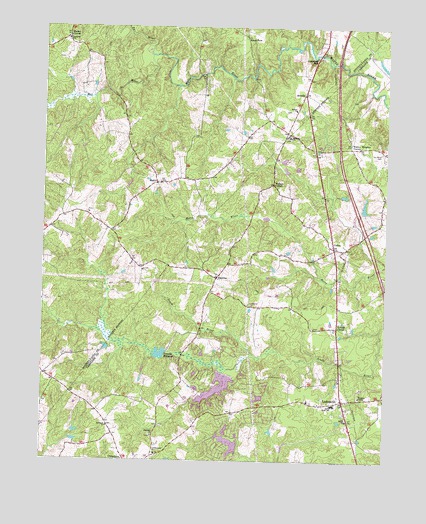
Ladysmith, VA USGS Topographic Map
Click on map above to begin viewing in our Map Viewer.

This topographic map contains these locations and features:
Feature Name Type Latitude Longitude GNIS ID View Map
Ann Wrights CornerPopulated PlaceN38.0901°W77.5261°1739320View Map
ArcadiaPopulated PlaceN38.1065°W77.5297°1477078View Map
Berkeley DistrictCivilN38.1155°W77.6015°1927092View Map
Berkeley Elementary SchoolSchoolN38.1209°W77.6168°1463093View Map
Bethany Baptist Church CemeteryCemeteryN38.0930°W77.5350°1739323View Map
Bethany ChurchChurchN38.0932°W77.5353°1463145View Map
Beulah Baptist Church CemeteryCemeteryN38.1012°W77.5350°1740260View Map
Beulah ChurchChurchN38.1012°W77.5330°1463276View Map
Blades CornerPopulated PlaceN38.1224°W77.6161°1477120View Map
BlantonsPopulated PlaceN38.0526°W77.5611°1477122View Map
Caroline County Fire and Rescue / Ladysmith Volunteer Fire Department Company 2BuildingN38.0218°W77.5151°2075530View Map
Caroline County Fire and Rescue / Ladysmith Volunteer Rescue Squad Rescue 2BuildingN38.0121°W77.5124°2331648View Map
CedonPopulated PlaceN38.0612°W77.5186°1477194View Map
Colemans MillPopulated PlaceN38.1162°W77.5242°1495410View Map
County Line Baptist Church CemeteryCemeteryN38.0014°W77.5826°1739339View Map
County Line ChurchChurchN38.0021°W77.5828°1465310View Map
Davis CornerPopulated PlaceN38.0487°W77.5636°1739340View Map
Ebenezer ChurchChurchN38.0074°W77.5844°1466156View Map
Hams FordPopulated PlaceN38.1224°W77.5514°1477391View Map
LadysmithPopulated PlaceN38.0176°W77.5153°1469093View Map
Ladysmith Baptist AcademySchoolN38.0117°W77.5134°2465438View Map
Ladysmith Elementary SchoolSchoolN38.0162°W77.5184°2465060View Map
Ladysmith Post OfficePost OfficeN38.0140°W77.5141°2766467View Map
Ladysmith VillagePopulated PlaceN38.0262°W77.5199°2574909View Map
Ladysmith Volunteer Rescue Squad R2BuildingN38.0125°W77.5131°2075531View Map
Lake DevoliaReservoirN38.0184°W77.5454°1489377View Map
Lake Devolia DamDamN38.0185°W77.5447°1489376View Map
Lake DoverReservoirN38.0090°W77.5575°1489381View Map
Lake Dover DamDamN38.0085°W77.5564°1489380View Map
Lake HeritageReservoirN38.0050°W77.5562°1489379View Map
Lake Heritage DamDamN38.0045°W77.5530°1489378View Map
Lake Land'Or Census Designated PlaceCensusN38.0170°W77.5593°2630779View Map
Lake LandorReservoirN38.0212°W77.5609°1489348View Map
Lake Landor DamDamN38.0250°W77.5579°1489347View Map
Lake SussexReservoirN38.0076°W77.5533°1739399View Map
Madison DistrictCivilN38.0102°W77.5619°1927383View Map
Maple SwampReservoirN38.0254°W77.5605°1470079View Map
Maple SwampStreamN38.0265°W77.5572°1739363View Map
MaryePopulated PlaceN38.0801°W77.5839°1495905View Map
Mat RiverStreamN38.1168°W77.5858°1470179View Map
Nancy Wrights CornerPopulated PlaceN38.0904°W77.5125°1495990View Map
Rehoboth ChurchChurchN38.0096°W77.6005°1473135View Map
Rehoboth United Methodist Church CemeteryCemeteryN38.0103°W77.6009°1739381View Map
Ryland CornerPopulated PlaceN38.0387°W77.5172°1477708View Map
Saint Marys CemeteryCemeteryN38.0890°W77.5018°1473827View Map
Smith ChurchChurchN38.0118°W77.5130°1474743View Map
Smith High SchoolSchoolN38.0165°W77.5180°1474755View Map
Ta RiverStreamN38.1165°W77.5855°1474286View Map
Temples MilldamDamN38.0312°W77.5794°1489349View Map
Temples MillpondReservoirN38.0315°W77.5845°1475538View Map
Terrell Brothers DamDamN38.0718°W77.5080°1489375View Map
Wallers CornerPopulated PlaceN38.0799°W77.5405°1477853View Map
Wrights ChapelChurchN38.0185°W77.5091°1474303View Map

Note: Coordinates in the location and feature list above are referenced to NAD83 datum.


Copyright (C) 2008-2024 Ryan Niemi / Sunset Dynamics ... All Rights Reserved