TopoQuest Logo
Do you find TopoQuest useful?
Help keep TopoQuest running and adding new maps/features by donating!
Bitcoin:  19c7KJd3qBynnjoSw5npx9KScwjBe4ifkT
Litecoin:  LXs6TkuXGGXo1vDsWCkWVdjQX94eUKd6ui
Home View Maps Find Maps Find Places Resources & Links


Mount Rae, Montana Topographic Map

USGS Map Title: Mount Rae, MT
USGS Map MRC: 45110E3
DRG (GeoTIFF) Download: o45110e3.tif


Neighboring USGS Topographic Map Quads:


  Mission, MT  
45110F4
 

  Elton, MT  
45110F3
 

  Springdale, MT  
45110F2
 

  Livingston Peak, MT  
45110E4
 

  Mount Rae, MT  
45110E3
 

  McLeod Basin, MT  
45110E2
 

  Mount Cowen, MT  
45110D4
 

  West Boulder Plateau, MT  
45110D3
 

  Chrome Mountain, MT  
45110D2


Map MRC Location:

N46°
W111°
N46°
W110°
H8 H7 H6 H5 H4 H3 H2 H1
G8 G7 G6 G5 G4 G3 G2 G1
F8 F7 F6 F5 F4 F3 F2 F1
E8 E7 E6 E5 E4 E3 E2 E1
D8 D7 D6 D5 D4 D3 D2 D1
C8 C7 C6 C5 C4 C3 C2 C1
B8 B7 B6 B5 B4 B3 B2 B1
A8 A7 A6 A5 A4 A3 A2 A1
N45°
W111°
N45°
W110°

Mount Rae, MT USGS 1:24K Topographic Map Preview:
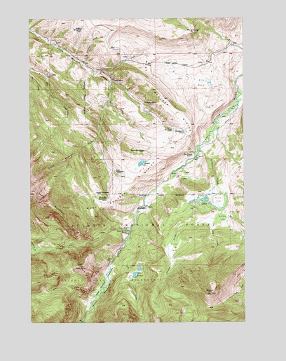
Mount Rae, MT USGS Topographic Map
Click on map above to begin viewing in our Map Viewer.

This topographic map contains these locations and features:
Feature Name Type Latitude Longitude GNIS ID View Map
Anderson CreekStreamN45.6058°W110.3449°779030View Map
Bar Twenty RanchLocaleN45.5683°W110.2810°779341View Map
Basin CreekStreamN45.5113°W110.3352°779416View Map
Bruffey HomesteadLocaleN45.6210°W110.3455°780476View Map
Bruffey School (historical)SchoolN45.6210°W110.3455°1743255View Map
Bruffeys Post Office (historical)Post OfficeN45.6208°W110.3452°1743202View Map
Bullis CreekStreamN45.6022°W110.3385°780589View Map
Burnt Leather RanchLocaleN45.5377°W110.3188°769422View Map
Burrls FlatFlatN45.5430°W110.2635°780661View Map
Canyon CreekStreamN45.5291°W110.3727°780901View Map
Crystal CreekStreamN45.5363°W110.3335°794452View Map
Davis CreekStreamN45.5377°W110.3177°782111View Map
Ellis BasinBasinN45.5985°W110.2752°783150View Map
Fisher HomesteadLocaleN45.5624°W110.3260°783454View Map
Gaylor HomesteadLocaleN45.5535°W110.3374°783870View Map
Gordan School (historical)SchoolN45.5994°W110.3280°784123View Map
Grouse CreekStreamN45.5716°W110.2782°784377View Map
Horseshoe LakeLakeN45.5784°W110.2863°785075View Map
Lamp HomesteadLocaleN45.5799°W110.2935°785943View Map
Lion MountainSummitN45.5230°W110.3474°786205View Map
Lost CreekStreamN45.5255°W110.3274°786581View Map
Lost LakesLakeN45.5202°W110.3146°786620View Map
McKnight HomesteadLocaleN45.5510°W110.3310°774034View Map
Mount GreeleySummitN45.6191°W110.2805°784265View Map
Mount RaeSummitN45.5122°W110.2696°789328View Map
Nurses LakesLakeN45.5508°W110.2741°788340View Map
Pruitt ParkParkN45.5308°W110.2921°789216View Map
Redfield LakeLakeN45.5655°W110.3105°789499View Map
Richards RanchLocaleN45.5838°W110.3027°789569View Map
Rogers HomesteadLocaleN45.5705°W110.3091°789745View Map
Sheep CreekStreamN45.5424°W110.2685°790318View Map
Swingley Post Office (historical)Post OfficeN45.5908°W110.3091°1743323View Map
Swingley RanchLocaleN45.5908°W110.3091°791826View Map
Taylor FlatFlatN45.5502°W110.2655°791919View Map
West Boulder DivideRidgeN45.5722°W110.2946°792949View Map
West Boulder MeadowsFlatN45.5180°W110.3321°792951View Map
West Boulder Ranger StationLocaleN45.5474°W110.3085°792953View Map
West Boulder RecreationLocaleN45.5497°W110.3110°794451View Map
West Boulder School (historical)SchoolN45.6108°W110.2502°792955View Map

Note: Coordinates in the location and feature list above are referenced to NAD83 datum.


Copyright (C) 2008-2025 Ryan Niemi / Sunset Dynamics ... All Rights Reserved