TopoQuest Logo
Do you find TopoQuest useful?
Help keep TopoQuest running and adding new maps/features by donating!
Bitcoin:  19c7KJd3qBynnjoSw5npx9KScwjBe4ifkT
Litecoin:  LXs6TkuXGGXo1vDsWCkWVdjQX94eUKd6ui
Home View Maps Find Maps Find Places Resources & Links


Monroe Butte, Idaho Topographic Map

USGS Map Title: Monroe Butte, ID
USGS Map MRC: 44117E1
DRG (GeoTIFF) Download: o44117e1.tif


Neighboring USGS Topographic Map Quads:


  Daly Creek, OR  
44117F2
 

  Sturgill Creek, ID  
44117F1
 

  Neil Gulch, ID  
44116F8
 

  Connor Creek, OR  
44117E2
 

  Monroe Butte, ID  
44117E1
 

  Sturgill Peak, ID  
44116E8
 

  Henley Basin, ID  
44117D2
 

  Olds Ferry NE, ID  
44117D1
 

  Mann Creek NW, ID  
44116D8


Map MRC Location:

N45°
W118°
N45°
W117°
H8 H7 H6 H5 H4 H3 H2 H1
G8 G7 G6 G5 G4 G3 G2 G1
F8 F7 F6 F5 F4 F3 F2 F1
E8 E7 E6 E5 E4 E3 E2 E1
D8 D7 D6 D5 D4 D3 D2 D1
C8 C7 C6 C5 C4 C3 C2 C1
B8 B7 B6 B5 B4 B3 B2 B1
A8 A7 A6 A5 A4 A3 A2 A1
N44°
W118°
N44°
W117°

Monroe Butte, ID USGS 1:24K Topographic Map Preview:
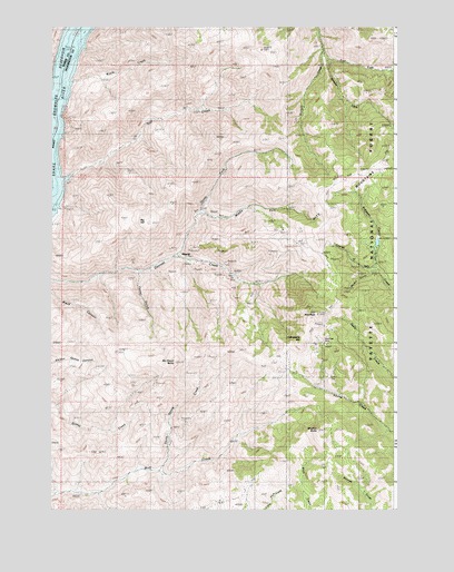
Monroe Butte, ID USGS Topographic Map
Click on map above to begin viewing in our Map Viewer.

This topographic map contains these locations and features:
Feature Name Type Latitude Longitude GNIS ID View Map
Barton GulchValleyN44.5616°W117.0099°376991View Map
Big HillSummitN44.5746°W117.0902°377546View Map
Chinamans HatSummitN44.5432°W117.0352°396282View Map
East Fork Sturgill CreekStreamN44.6168°W117.0257°381182View Map
Hitt MountainsRangeN44.5877°W117.0124°383226View Map
Iron MountainSummitN44.5504°W117.0285°383761View Map
McChord ButteSummitN44.5377°W117.0810°396864View Map
Middle Fork North Fork Dennett CreekStreamN44.5766°W117.0721°386830View Map
Middle Fork Sturgill CreekStreamN44.6193°W117.0268°386851View Map
MineralPopulated PlaceN44.5652°W117.0777°396901View Map
Monroe ButteSummitN44.5204°W117.0282°387086View Map
Mortimer MineMineN44.5432°W117.0271°387244View Map
North Fork Dennett CreekStreamN44.5654°W117.0807°387685View Map
Park (historical)LocaleN44.6207°W117.1202°1167802View Map
Raft CreekStreamN44.5854°W117.1241°389020View Map
Robinson CreekStreamN44.5616°W117.0068°389451View Map
Tartar GulchValleyN44.5613°W117.0938°391851View Map
Thorn Spring CreekStreamN44.5099°W117.0863°392059View Map
Wayle CreekStreamN44.6107°W117.1216°392958View Map

Note: Coordinates in the location and feature list above are referenced to NAD83 datum.


Copyright (C) 2008-2025 Ryan Niemi / Sunset Dynamics ... All Rights Reserved