TopoQuest Logo
Do you find TopoQuest useful?
Help keep TopoQuest running and adding new maps/features by donating!
Bitcoin:  19c7KJd3qBynnjoSw5npx9KScwjBe4ifkT
Litecoin:  LXs6TkuXGGXo1vDsWCkWVdjQX94eUKd6ui
Home View Maps Find Maps Find Places Resources & Links


Daly Creek, Oregon Topographic Map

USGS Map Title: Daly Creek, OR
USGS Map MRC: 44117F2
DRG (GeoTIFF) Download: o44117f2.tif


Neighboring USGS Topographic Map Quads:


  Sparta, OR  
44117G3
 

  Richland, OR  
44117G2
 

  Posy Valley, OR  
44117G1
 

  Little Lookout Mountain, OR  
44117F3
 

  Daly Creek, OR  
44117F2
 

  Sturgill Creek, ID  
44117F1
 

  Big Lookout Mountain, OR  
44117E3
 

  Connor Creek, OR  
44117E2
 

  Monroe Butte, ID  
44117E1


Map MRC Location:

N45°
W118°
N45°
W117°
H8 H7 H6 H5 H4 H3 H2 H1
G8 G7 G6 G5 G4 G3 G2 G1
F8 F7 F6 F5 F4 F3 F2 F1
E8 E7 E6 E5 E4 E3 E2 E1
D8 D7 D6 D5 D4 D3 D2 D1
C8 C7 C6 C5 C4 C3 C2 C1
B8 B7 B6 B5 B4 B3 B2 B1
A8 A7 A6 A5 A4 A3 A2 A1
N44°
W118°
N44°
W117°

Daly Creek, OR USGS 1:24K Topographic Map Preview:
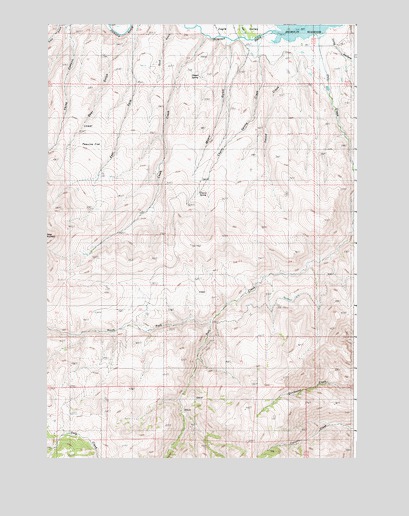
Daly Creek, OR USGS Topographic Map
Click on map above to begin viewing in our Map Viewer.

This topographic map contains these locations and features:
Feature Name Type Latitude Longitude GNIS ID View Map
Badland CreekStreamN44.6568°W117.2246°1129560View Map
Brady CreekStreamN44.6332°W117.2441°1129559View Map
Chalk CreekStreamN44.7466°W117.1885°1118800View Map
Cherry SpringSpringN44.7015°W117.1886°1118867View Map
Cherry Spring CreekStreamN44.7402°W117.1671°1118870View Map
Daly CreekStreamN44.7463°W117.1457°1140606View Map
Deer GulchValleyN44.7477°W117.2163°1119832View Map
Eagle CreekStreamN44.7457°W117.1724°1141468View Map
Eagle ValleyValleyN44.7249°W117.1366°1141497View Map
East Long HollowValleyN44.7318°W117.1252°1141626View Map
Háawpa CreekStreamN44.7471°W117.1482°1127483View Map
Kirby CreekStreamN44.7468°W117.1835°1158309View Map
Long HollowValleyN44.7479°W117.1385°1145412View Map
Lower Peavine FlatFlatN44.7171°W117.2335°1123577View Map
Myers GulchValleyN44.7452°W117.1780°1124575View Map
North Fork Daly CreekStreamN44.6646°W117.1855°1124766View Map
Poison SpringSpringN44.7356°W117.1894°1125510View Map
Siegle DitchCanalN44.7304°W117.1316°1129562View Map
Soda LakeLakeN44.6318°W117.1843°1161775View Map
Wilkins CreekStreamN44.6568°W117.2246°1129561View Map

Note: Coordinates in the location and feature list above are referenced to NAD83 datum.


Copyright (C) 2008-2025 Ryan Niemi / Sunset Dynamics ... All Rights Reserved