TopoQuest Logo
Do you find TopoQuest useful?
Help keep TopoQuest running and adding new maps/features by donating!
Bitcoin:  19c7KJd3qBynnjoSw5npx9KScwjBe4ifkT
Litecoin:  LXs6TkuXGGXo1vDsWCkWVdjQX94eUKd6ui
Home View Maps Find Maps Find Places Resources & Links


Mont Clare, South Carolina Topographic Map

USGS Map Title: Mont Clare, SC
USGS Map MRC: 34079D7
DRG (GeoTIFF) Download: o34079d7.tif


Neighboring USGS Topographic Map Quads:


  Cash, SC  
34079E8
 

  Society Hill, SC  
34079E7
 

  Bennettsville South, SC  
34079E6
 

  Dovesville, SC  
34079D8
 

  Mont Clare, SC  
34079D7
 

  Drake, SC  
34079D6
 

  Darlington West, SC  
34079C8
 

  Darlington East, SC  
34079C7
 

  Witherspoon Island, SC  
34079C6


Map MRC Location:

N35°
W80°
N35°
W79°
H8 H7 H6 H5 H4 H3 H2 H1
G8 G7 G6 G5 G4 G3 G2 G1
F8 F7 F6 F5 F4 F3 F2 F1
E8 E7 E6 E5 E4 E3 E2 E1
D8 D7 D6 D5 D4 D3 D2 D1
C8 C7 C6 C5 C4 C3 C2 C1
B8 B7 B6 B5 B4 B3 B2 B1
A8 A7 A6 A5 A4 A3 A2 A1
N34°
W80°
N34°
W79°

Mont Clare, SC USGS 1:24K Topographic Map Preview:
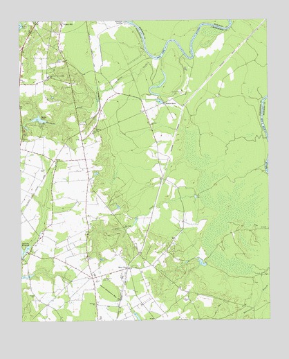
Mont Clare, SC USGS Topographic Map
Click on map above to begin viewing in our Map Viewer.

This topographic map contains these locations and features:
Feature Name Type Latitude Longitude GNIS ID View Map
Barn Plantation (historical)LocaleN34.4849°W79.7845°1240801View Map
Buckholtz CreekStreamN34.4729°W79.8073°1247044View Map
Charles Mill (historical)LocaleN34.3788°W79.7578°1240823View Map
Cockers FallsFallsN34.4865°W79.7873°1240836View Map
Coker PondLakeN34.4978°W79.8746°1221665View Map
Devils Woodyard BayBasinN34.3868°W79.8312°1222008View Map
Flat Creek ChurchChurchN34.4140°W79.8226°1222432View Map
GandyPopulated PlaceN34.4415°W79.8567°1227905View Map
Gandy CemeteryCemeteryN34.4382°W79.8645°1222633View Map
Georgetown School (historical)SchoolN34.4132°W79.8412°1240874View Map
Governor Williams CemeteryCemeteryN34.4699°W79.7923°1222788View Map
Jeffords MillpondReservoirN34.4053°W79.8747°1223527View Map
Jeffords Pond Dam D-3541DamN34.3935°W79.8748°1240053View Map
Lumber (historical)Populated PlaceN34.4179°W79.8090°1240996View Map
Mont ClarePopulated PlaceN34.3968°W79.8212°1246713View Map
Mont Clare Lookout TowerTowerN34.3838°W79.7906°1240926View Map
Montclare School (historical)SchoolN34.3974°W79.8198°1240927View Map
Mount Clare Baptist ChurchChurchN34.3971°W79.8173°1240925View Map
Mount Rona ChurchChurchN34.4538°W79.8370°1224791View Map
Parnell CemeteryCemeteryN34.3857°W79.8678°1225308View Map
Red Hill ChurchChurchN34.4568°W79.8084°1225787View Map
Red Hill School (historical)SchoolN34.4563°W79.8087°1240964View Map
Robbins NeckPopulated PlaceN34.4657°W79.8020°1250402View Map
Robbins Neck Station (historical)LocaleN34.4640°W79.7923°1240965View Map
Rosewald Consolidated SchoolSchoolN34.4768°W79.8598°1226031View Map
Round O CemeteryCemeteryN34.3924°W79.8326°1226046View Map
Round O ChurchChurchN34.3821°W79.8373°1250475View Map
Round O School (historical)SchoolN34.3818°W79.8212°1240968View Map
Round O School (historical)SchoolN34.3857°W79.8378°1240969View Map
Smiths Mill (historical)LocaleN34.4038°W79.8709°1240992View Map
Society Hill DivisionCivilN34.4415°W79.8405°1938426View Map
South Carolina Noname 16008 D-3540 DamDamN34.3985°W79.7815°1238454View Map
South Carolina Noname 16024 D-3539 DamDamN34.4585°W79.8615°1238469View Map
Spring LakeReservoirN34.4582°W79.8615°1226830View Map
Wilbur Flowers PondReservoirN34.4590°W79.8653°1238470View Map
Williams LakeLakeN34.4692°W79.8051°1241025View Map

Note: Coordinates in the location and feature list above are referenced to NAD83 datum.


Copyright (C) 2008-2025 Ryan Niemi / Sunset Dynamics ... All Rights Reserved