TopoQuest Logo
Do you find TopoQuest useful?
Help keep TopoQuest running and adding new maps/features by donating!
Bitcoin:  19c7KJd3qBynnjoSw5npx9KScwjBe4ifkT
Litecoin:  LXs6TkuXGGXo1vDsWCkWVdjQX94eUKd6ui
Home View Maps Find Maps Find Places Resources & Links


Monterey SE, Virginia Topographic Map

USGS Map Title: Monterey SE, VA
USGS Map MRC: 38079C5
DRG (GeoTIFF) Download: o38079c5.tif


Neighboring USGS Topographic Map Quads:


  Hightown, VA  
38079D6
 

  Monterey, VA  
38079D5
 

  Doe Hill, VA  
38079D4
 

  Mustoe, VA  
38079C6
 

  Monterey SE, VA  
38079C5
 

  McDowell, VA  
38079C4
 

  Burnsville, VA  
38079B6
 

  Williamsville, VA  
38079B5
 

  Deerfield, VA  
38079B4


Map MRC Location:

N39°
W80°
N39°
W79°
H8 H7 H6 H5 H4 H3 H2 H1
G8 G7 G6 G5 G4 G3 G2 G1
F8 F7 F6 F5 F4 F3 F2 F1
E8 E7 E6 E5 E4 E3 E2 E1
D8 D7 D6 D5 D4 D3 D2 D1
C8 C7 C6 C5 C4 C3 C2 C1
B8 B7 B6 B5 B4 B3 B2 B1
A8 A7 A6 A5 A4 A3 A2 A1
N38°
W80°
N38°
W79°

Monterey SE, VA USGS 1:24K Topographic Map Preview:
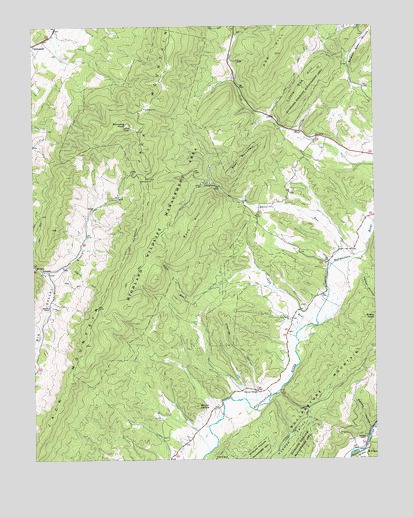
Monterey SE, VA USGS Topographic Map
Click on map above to begin viewing in our Map Viewer.

This topographic map contains these locations and features:
Feature Name Type Latitude Longitude GNIS ID View Map
Bear MountainSummitN38.3368°W79.5484°1495244View Map
Buck HillSummitN38.3173°W79.5662°1482110View Map
Claylick HollowValleyN38.2705°W79.5445°1482557View Map
Clover CreekPopulated PlaceN38.2701°W79.5489°1495400View Map
Clover Creek Presbyterian ChurchChurchN38.2701°W79.5434°1673766View Map
Crab RunStreamN38.2854°W79.5289°1482785View Map
Davis RunStreamN38.3068°W79.5148°1482950View Map
Hamilton ChapelChurchN38.2946°W79.6187°1483916View Map
Highland CountyCivilN38.3623°W79.5685°1673774View Map
Highland Wildlife Management AreaParkN38.3182°W79.5775°1484099View Map
Jack MountainRangeN38.3398°W79.5839°1484379View Map
Little Doe HillSummitN38.3635°W79.5192°1484896View Map
Meadow DraftValleyN38.2526°W79.5044°1485337View Map
Monterey DistrictCivilN38.3555°W79.6006°1927411View Map
Mount CarlyleSummitN38.2657°W79.5648°1482324View Map
New Salem ChurchChurchN38.2904°W79.5309°1485860View Map
Seldom Seen HollowValleyN38.3608°W79.5085°1486995View Map
Smith Field (historical)AirportN38.3026°W79.5081°1498741View Map
Sounding KnobSummitN38.3465°W79.5898°1496241View Map
Southall ChapelChurchN38.2562°W79.5034°1487423View Map
Stillhouse RunStreamN38.2501°W79.5095°1487585View Map
Swope HollowValleyN38.2589°W79.5016°1487758View Map
TrimblePopulated PlaceN38.3046°W79.6189°1496325View Map
Vance HollowValleyN38.3035°W79.5055°1488106View Map

Note: Coordinates in the location and feature list above are referenced to NAD83 datum.


Copyright (C) 2008-2025 Ryan Niemi / Sunset Dynamics ... All Rights Reserved