TopoQuest Logo
Do you find TopoQuest useful?
Help keep TopoQuest running and adding new maps/features by donating!
Bitcoin:  19c7KJd3qBynnjoSw5npx9KScwjBe4ifkT
Litecoin:  LXs6TkuXGGXo1vDsWCkWVdjQX94eUKd6ui
Home View Maps Find Maps Find Places Resources & Links


Monticello NE, Florida Topographic Map

USGS Map Title: Monticello NE, FL
USGS Map MRC: 30083F7
DRG (GeoTIFF) Download: o30083f7.tif


Neighboring USGS Topographic Map Quads:


  Thomasville, GA  
30083G8
 

  Boston, GA  
30083G7
 

  Dixie, GA  
30083G6
 

  Metcalf, GA  
30083F8
 

  Monticello NE, FL  
30083F7
 

  Grooverville, GA  
30083F6
 

  Lake Miccosukee, FL  
30083E8
 

  Monticello, FL  
30083E7
 

  Ashville, FL  
30083E6


Map MRC Location:

N31°
W84°
N31°
W83°
H8 H7 H6 H5 H4 H3 H2 H1
G8 G7 G6 G5 G4 G3 G2 G1
F8 F7 F6 F5 F4 F3 F2 F1
E8 E7 E6 E5 E4 E3 E2 E1
D8 D7 D6 D5 D4 D3 D2 D1
C8 C7 C6 C5 C4 C3 C2 C1
B8 B7 B6 B5 B4 B3 B2 B1
A8 A7 A6 A5 A4 A3 A2 A1
N30°
W84°
N30°
W83°

Monticello NE, FL USGS 1:24K Topographic Map Preview:
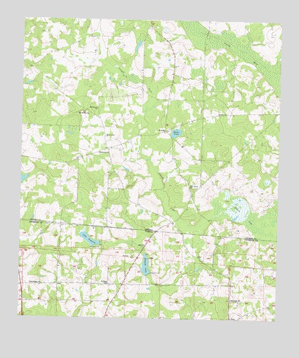
Monticello NE, FL USGS Topographic Map
Click on map above to begin viewing in our Map Viewer.

This topographic map contains these locations and features:
Feature Name Type Latitude Longitude GNIS ID View Map
Alagood LakeLakeN30.6474°W83.8134°277719View Map
Aucilla (historical)Populated PlaceN30.6655°W83.8013°343677View Map
Connell CreekStreamN30.6666°W83.7838°312902View Map
Ebeneezer ChurchChurchN30.6946°W83.8366°313808View Map
Elizabeth SchoolSchoolN30.6333°W83.7718°282160View Map
EverettPopulated PlaceN30.7041°W83.8043°326272View Map
Foxfire Plantation Airport (historical)AirportN30.6580°W83.8671°309703View Map
Laffittee CemeteryCemeteryN30.6780°W83.7921°343745View Map
Lake FontaineLakeN30.6579°W83.8409°282647View Map
Linton LakeSwampN30.6707°W83.7699°316913View Map
Little Flock CemeteryCemeteryN30.6855°W83.8285°317069View Map
Macadonia ChurchChurchN30.7127°W83.8374°317510View Map
Madre PondReservoirN30.7030°W83.8000°317597View Map
Madre Pond DamDamN30.7010°W83.8010°342101View Map
Mallette CemeteryCemeteryN30.7307°W83.8007°317646View Map
Mount Homer ChurchChurchN30.7108°W83.8421°318662View Map
Oak Grove ChurchChurchN30.6805°W83.7924°319756View Map
Olive ChurchChurchN30.6549°W83.8143°288139View Map
Philadelphia ChurchChurchN30.6391°W83.8643°288759View Map
Reichertville Volunteer Fire Department Station 12BuildingN30.7080°W83.8375°2603753View Map
Saint Elam ChurchChurchN30.6394°W83.8313°290171View Map
Saint Paul ChurchChurchN30.7110°W83.7754°322228View Map
Union SchoolSchoolN30.7010°W83.8329°324579View Map

Note: Coordinates in the location and feature list above are referenced to NAD83 datum.


Copyright (C) 2008-2025 Ryan Niemi / Sunset Dynamics ... All Rights Reserved