TopoQuest Logo
Do you find TopoQuest useful?
Help keep TopoQuest running and adding new maps/features by donating!
Bitcoin:  19c7KJd3qBynnjoSw5npx9KScwjBe4ifkT
Litecoin:  LXs6TkuXGGXo1vDsWCkWVdjQX94eUKd6ui
Home View Maps Find Maps Find Places Resources & Links


Metcalf, Georgia Topographic Map

USGS Map Title: Metcalf, GA
USGS Map MRC: 30083F8
DRG (GeoTIFF) Download: o30083f8.tif


Neighboring USGS Topographic Map Quads:


  Pine Park, GA  
30084G1
 

  Thomasville, GA  
30083G8
 

  Boston, GA  
30083G7
 

  Miccosukee NE, GA  
30084F1
 

  Metcalf, GA  
30083F8
 

  Monticello NE, FL  
30083F7
 

  Miccosukee, FL  
30084E1
 

  Lake Miccosukee, FL  
30083E8
 

  Monticello, FL  
30083E7


Map MRC Location:

N31°
W84°
N31°
W83°
H8 H7 H6 H5 H4 H3 H2 H1
G8 G7 G6 G5 G4 G3 G2 G1
F8 F7 F6 F5 F4 F3 F2 F1
E8 E7 E6 E5 E4 E3 E2 E1
D8 D7 D6 D5 D4 D3 D2 D1
C8 C7 C6 C5 C4 C3 C2 C1
B8 B7 B6 B5 B4 B3 B2 B1
A8 A7 A6 A5 A4 A3 A2 A1
N30°
W84°
N30°
W83°

Metcalf, GA USGS 1:24K Topographic Map Preview:
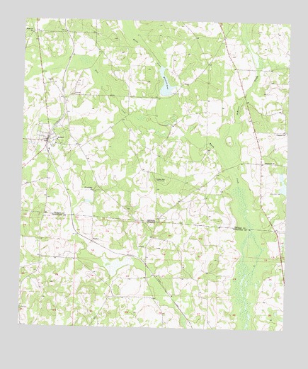
Metcalf, GA USGS Topographic Map
Click on map above to begin viewing in our Map Viewer.

This topographic map contains these locations and features:
Feature Name Type Latitude Longitude GNIS ID View Map
Balfour LakeReservoirN30.6818°W83.8758°342100View Map
Balfour Lake DamDamN30.6802°W83.8766°342099View Map
FincherPopulated PlaceN30.6602°W83.9660°295278View Map
Friendship ChurchChurchN30.6805°W83.9657°355920View Map
Galilee SchoolLocaleN30.6858°W83.9360°314490View Map
GlasgowPopulated PlaceN30.7224°W83.8754°343733View Map
Glasgow CemeteryCemeteryN30.7219°W83.8757°343734View Map
Glasgow ChurchChurchN30.7055°W83.8768°356031View Map
Hall CemeteryCemeteryN30.7438°W83.9946°343738View Map
Hicks CemeteryCemeteryN30.7196°W83.9754°315376View Map
Horne CemeteryCemeteryN30.7257°W83.9866°315673View Map
Kellys PondLakeN30.6507°W83.9550°300041View Map
Magnolia SchoolSchoolN30.7446°W83.9960°317620View Map
McKeever SloughStreamN30.6883°W83.8988°317938View Map
MetcalfPopulated PlaceN30.7002°W83.9879°318056View Map
Metcalfe Volunteer Fire Department Station 5BuildingN30.7013°W83.9892°2604765View Map
Mikasuki (historical)Populated PlaceN30.6335°W83.9832°294511View Map
Mitchell PondReservoirN30.7243°W83.9332°318348View Map
Mitchell Pond DamDamN30.7202°W83.9324°342097View Map
New Hope CemeteryCemeteryN30.7435°W83.9066°343778View Map
New Hope Church (historical)ChurchN30.7433°W83.9066°343780View Map
New Hope Volunteer Fire Department Station 14BuildingN30.7457°W83.9068°2604135View Map
Pine CreekStreamN30.7035°W83.9252°320549View Map
Roddenberry (historical)Populated PlaceN30.6733°W83.9357°343802View Map
Roddenberry CemeteryCemeteryN30.6771°W83.9654°343804View Map
Sanctum ChurchChurchN30.6930°W83.8852°322402View Map
Union CemeteryCemeteryN30.6330°W83.9999°292651View Map
WBGM-FM (Tallahassee)TowerN30.6705°W83.9404°310264View Map
WCTV-TV (Thomasville)TowerN30.6705°W83.9404°352868View Map
WFSU-FM (Tallahassee)TowerN30.6705°W83.9404°310263View Map

Note: Coordinates in the location and feature list above are referenced to NAD83 datum.


Copyright (C) 2008-2025 Ryan Niemi / Sunset Dynamics ... All Rights Reserved