TopoQuest Logo
Do you find TopoQuest useful?
Help keep TopoQuest running and adding new maps/features by donating!
Bitcoin:  19c7KJd3qBynnjoSw5npx9KScwjBe4ifkT
Litecoin:  LXs6TkuXGGXo1vDsWCkWVdjQX94eUKd6ui
Home View Maps Find Maps Find Places Resources & Links


Moose Creek, Montana Topographic Map

USGS Map Title: Moose Creek, MT
USGS Map MRC: 46112H7
DRG (GeoTIFF) Download: o46112h7.tif


Neighboring USGS Topographic Map Quads:


  Coopers Lake, MT  
47112A8
 

  Arrastra Mountain, MT  
47112A7
 

  Stonewall Mountain, MT  
47112A6
 

  Marcum Mountain, MT  
46112H8
 

  Moose Creek, MT  
46112H7
 

  Lincoln, MT  
46112H6
 

  Helmville, MT  
46112G8
 

  Nevada Lake, MT  
46112G7
 

  Finn, MT  
46112G6


Map MRC Location:

N47°
W113°
N47°
W112°
H8 H7 H6 H5 H4 H3 H2 H1
G8 G7 G6 G5 G4 G3 G2 G1
F8 F7 F6 F5 F4 F3 F2 F1
E8 E7 E6 E5 E4 E3 E2 E1
D8 D7 D6 D5 D4 D3 D2 D1
C8 C7 C6 C5 C4 C3 C2 C1
B8 B7 B6 B5 B4 B3 B2 B1
A8 A7 A6 A5 A4 A3 A2 A1
N46°
W113°
N46°
W112°

Moose Creek, MT USGS 1:24K Topographic Map Preview:
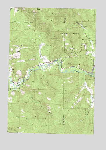
Moose Creek, MT USGS Topographic Map
Click on map above to begin viewing in our Map Viewer.

This topographic map contains these locations and features:
Feature Name Type Latitude Longitude GNIS ID View Map
14N09W17ACBD01 WellWellN46.9680°W112.7620°819814View Map
14N09W17ACDD01 WellWellN46.9658°W112.7589°819794View Map
Black MountainSummitN46.9988°W112.8364°780010View Map
Blackfoot Canyon CampgroundLocaleN46.9280°W112.8525°780034View Map
Blackfoot Canyon Fishing AccessLocaleN46.9263°W112.8531°794770View Map
Blackfoot MineMineN46.9438°W112.7573°800474View Map
Blackfoot TailingsMineN46.9424°W112.7537°803988View Map
Kershaw MountainSummitN46.9563°W112.8645°785696View Map
Lincoln GulchValleyN46.9441°W112.7514°801065View Map
Lincoln Gulch CemeteryCemeteryN46.9824°W112.7698°794765View Map
Little Moose CreekStreamN46.9385°W112.8256°786331View Map
Long PointSummitN46.9458°W112.7881°801096View Map
Moose CreekStreamN46.9252°W112.8598°787627View Map
Patterson PrairieFlatN46.9558°W112.8289°788701View Map
Sauerkraut CreekStreamN46.9374°W112.7667°801406View Map
Site of Old LincolnLocaleN46.9758°W112.7692°794771View Map
Willow CreekStreamN46.9347°W112.7612°801702View Map

Note: Coordinates in the location and feature list above are referenced to NAD83 datum.


Copyright (C) 2008-2025 Ryan Niemi / Sunset Dynamics ... All Rights Reserved