TopoQuest Logo
Do you find TopoQuest useful?
Help keep TopoQuest running and adding new maps/features by donating!
Bitcoin:  19c7KJd3qBynnjoSw5npx9KScwjBe4ifkT
Litecoin:  LXs6TkuXGGXo1vDsWCkWVdjQX94eUKd6ui
Home View Maps Find Maps Find Places Resources & Links


Coopers Lake, Montana Topographic Map

USGS Map Title: Coopers Lake, MT
USGS Map MRC: 47112A8
DRG (GeoTIFF) Download: o47112a8.tif


Neighboring USGS Topographic Map Quads:


  Spread Mountain, MT  
47113B1
 

  Lake Mountain, MT  
47112B8
 

  Olson Peak, MT  
47112B7
 

  Ovando Mountain, MT  
47113A1
 

  Coopers Lake, MT  
47112A8
 

  Arrastra Mountain, MT  
47112A7
 

  Browns Lake, MT  
46113H1
 

  Marcum Mountain, MT  
46112H8
 

  Moose Creek, MT  
46112H7


Map MRC Location:

N48°
W113°
N48°
W112°
H8 H7 H6 H5 H4 H3 H2 H1
G8 G7 G6 G5 G4 G3 G2 G1
F8 F7 F6 F5 F4 F3 F2 F1
E8 E7 E6 E5 E4 E3 E2 E1
D8 D7 D6 D5 D4 D3 D2 D1
C8 C7 C6 C5 C4 C3 C2 C1
B8 B7 B6 B5 B4 B3 B2 B1
A8 A7 A6 A5 A4 A3 A2 A1
N47°
W113°
N47°
W112°

Coopers Lake, MT USGS 1:24K Topographic Map Preview:
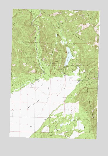
Coopers Lake, MT USGS Topographic Map
Click on map above to begin viewing in our Map Viewer.

This topographic map contains these locations and features:
Feature Name Type Latitude Longitude GNIS ID View Map
15N11W02BCBA01 WellWellN47.0886°W112.9628°820664View Map
15N11W02CBBD01 WellWellN47.0841°W112.9628°820641View Map
15N11W28DBBC01 WellWellN47.0261°W112.9951°820241View Map
Bear CreekGutN47.0602°W112.9403°779477View Map
Bear LakeLakeN47.1001°W112.9366°779545View Map
Big Nelson CampgroundLocaleN47.0708°W112.9214°779848View Map
Bull CreekStreamN47.0049°W112.9339°780561View Map
Callahan CreekStreamN47.0052°W112.9237°780789View Map
Coopers LakeLakeN47.0798°W112.9188°781635View Map
Copenhaver RanchLocaleN47.0594°W112.9159°781640View Map
Day Creek Livestock Trail HeadLocaleN47.0569°W112.8914°794737View Map
Deer ParkFlatN47.0155°W112.8964°782267View Map
Dry CreekStreamN47.0569°W112.8912°782581View Map
Echo MountainSummitN47.1047°W112.8795°782972View Map
Echo PassGapN47.1124°W112.8889°782973View Map
Jorgenson DitchCanalN47.0536°W112.9617°785571View Map
Kleinschmidt FlatFlatN47.0263°W112.9798°785788View Map
Lake CreekStreamN47.1138°W112.9698°801028View Map
Madison MeadowSwampN47.0658°W112.9064°786767View Map
McDermott CreekStreamN47.0891°W112.9220°787023View Map
Mineral Creek TrailTrailN47.1213°W112.9114°787459View Map
Old Lund DitchCanalN47.0616°W112.9484°788420View Map
Salmon CreekStreamN47.0505°W112.9128°789968View Map
Salmon Creek School (historical)SchoolN47.0574°W112.9025°789969View Map
Spawn LakeLakeN47.0636°W112.9268°791139View Map
Spieker DitchCanalN47.0391°W112.9453°791153View Map
Tupper LakeLakeN47.0184°W112.9108°792460View Map
White Tail RanchLocaleN47.0627°W112.9212°793217View Map

Note: Coordinates in the location and feature list above are referenced to NAD83 datum.


Copyright (C) 2008-2024 Ryan Niemi / Sunset Dynamics ... All Rights Reserved