TopoQuest Logo
Do you find TopoQuest useful?
Help keep TopoQuest running and adding new maps/features by donating!
Bitcoin:  19c7KJd3qBynnjoSw5npx9KScwjBe4ifkT
Litecoin:  LXs6TkuXGGXo1vDsWCkWVdjQX94eUKd6ui
Home View Maps Find Maps Find Places Resources & Links


Marcum Mountain, Montana Topographic Map

USGS Map Title: Marcum Mountain, MT
USGS Map MRC: 46112H8
DRG (GeoTIFF) Download: o46112h8.tif


Neighboring USGS Topographic Map Quads:


  Ovando Mountain, MT  
47113A1
 

  Coopers Lake, MT  
47112A8
 

  Arrastra Mountain, MT  
47112A7
 

  Browns Lake, MT  
46113H1
 

  Marcum Mountain, MT  
46112H8
 

  Moose Creek, MT  
46112H7
 

  Chimney Lakes, MT  
46113G1
 

  Helmville, MT  
46112G8
 

  Nevada Lake, MT  
46112G7


Map MRC Location:

N47°
W113°
N47°
W112°
H8 H7 H6 H5 H4 H3 H2 H1
G8 G7 G6 G5 G4 G3 G2 G1
F8 F7 F6 F5 F4 F3 F2 F1
E8 E7 E6 E5 E4 E3 E2 E1
D8 D7 D6 D5 D4 D3 D2 D1
C8 C7 C6 C5 C4 C3 C2 C1
B8 B7 B6 B5 B4 B3 B2 B1
A8 A7 A6 A5 A4 A3 A2 A1
N46°
W113°
N46°
W112°

Marcum Mountain, MT USGS 1:24K Topographic Map Preview:
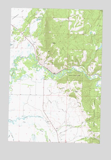
Marcum Mountain, MT USGS Topographic Map
Click on map above to begin viewing in our Map Viewer.

This topographic map contains these locations and features:
Feature Name Type Latitude Longitude GNIS ID View Map
13N11W02ADCA01 WellWellN46.9124°W112.9473°819342View Map
13N11W15DCDC01 WellWellN46.8760°W112.9720°819011View Map
14N11W16AAAD01 WellWellN46.9752°W112.9862°819864View Map
14N11W33BDD_01 WellWellN46.9266°W112.9987°819430View Map
14N11W33CDAC01 WellWellN46.9208°W112.9976°819391View Map
14N11W34ACCA01 WellWellN46.9266°W112.9731°819429View Map
14N11W35BAAA01 WellWellN46.9327°W112.9545°819467View Map
Arrastra CreekStreamN46.9422°W112.9059°800361View Map
Copenhagen DamDamN46.9649°W112.8809°798564View Map
Cottonwood CreekStreamN46.8838°W112.9981°781731View Map
CoughlinPopulated PlaceN46.9335°W112.9537°798949View Map
Deadmans LakeLakeN46.9892°W112.9649°782161View Map
French Town MineMineN46.9366°W112.9876°802840View Map
Hungry Hill MineMineN46.9305°W112.9289°802837View Map
Lincoln Canyon Fishing Access SiteLocaleN46.9397°W112.9328°1744394View Map
Lincoln SloughStreamN46.8783°W112.9462°786169View Map
Marcum MountainSummitN46.9680°W112.9442°786835View Map
Mineral HillSummitN46.9480°W112.9426°787461View Map
Mineral Hill Sportsmans AccessLocaleN46.9416°W112.9473°798950View Map
Nevada MineMineN46.9491°W112.9481°805068View Map
North Helmville CanalCanalN46.8897°W112.9112°788288View Map
NW NE Section 17 MineMineN46.8910°W112.8842°804015View Map
NW SE Section 9 MineMineN46.9360°W112.9523°802838View Map
Powell County Waterfowl Production AreaParkN46.9621°W112.9777°2765464View Map
Republican MineMineN46.9491°W112.9523°805070View Map
Shores CreekStreamN46.8783°W112.8773°790438View Map
Spring CreekStreamN46.8941°W112.9906°791233View Map
Steeles Dude RanchLocaleN46.9799°W112.8912°794769View Map
Trapper MountainSummitN46.9230°W112.9117°792351View Map
Wasson CreekStreamN46.8833°W112.9401°792862View Map

Note: Coordinates in the location and feature list above are referenced to NAD83 datum.


Copyright (C) 2008-2024 Ryan Niemi / Sunset Dynamics ... All Rights Reserved