TopoQuest Logo
Do you find TopoQuest useful?
Help keep TopoQuest running and adding new maps/features by donating!
Bitcoin:  19c7KJd3qBynnjoSw5npx9KScwjBe4ifkT
Litecoin:  LXs6TkuXGGXo1vDsWCkWVdjQX94eUKd6ui
Home View Maps Find Maps Find Places Resources & Links


Nevada Lake, Montana Topographic Map

USGS Map Title: Nevada Lake, MT
USGS Map MRC: 46112G7
DRG (GeoTIFF) Download: o46112g7.tif


Neighboring USGS Topographic Map Quads:


  Marcum Mountain, MT  
46112H8
 

  Moose Creek, MT  
46112H7
 

  Lincoln, MT  
46112H6
 

  Helmville, MT  
46112G8
 

  Nevada Lake, MT  
46112G7
 

  Finn, MT  
46112G6
 

  Bailey Mountain, MT  
46112F8
 

  Windy Rock, MT  
46112F7
 

  Gravely Mountain, MT  
46112F6


Map MRC Location:

N47°
W113°
N47°
W112°
H8 H7 H6 H5 H4 H3 H2 H1
G8 G7 G6 G5 G4 G3 G2 G1
F8 F7 F6 F5 F4 F3 F2 F1
E8 E7 E6 E5 E4 E3 E2 E1
D8 D7 D6 D5 D4 D3 D2 D1
C8 C7 C6 C5 C4 C3 C2 C1
B8 B7 B6 B5 B4 B3 B2 B1
A8 A7 A6 A5 A4 A3 A2 A1
N46°
W113°
N46°
W112°

Nevada Lake, MT USGS 1:24K Topographic Map Preview:
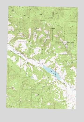
Nevada Lake, MT USGS Topographic Map
Click on map above to begin viewing in our Map Viewer.

This topographic map contains these locations and features:
Feature Name Type Latitude Longitude GNIS ID View Map
12N10W10CAAA01 WellWellN46.8088°W112.8417°818440View Map
Blackfoot MineMineN46.8630°W112.8462°805064View Map
Braziel CreekStreamN46.8113°W112.8406°780373View Map
Braziel LakeLakeN46.7885°W112.8306°780374View Map
Buffalo GulchValleyN46.7877°W112.7795°800505View Map
Chicken CreekStreamN46.8030°W112.8153°781208View Map
Clear CreekStreamN46.8072°W112.7595°800601View Map
Cooper CreekStreamN46.8172°W112.8542°781631View Map
Deer CreekStreamN46.8110°W112.8389°782233View Map
East Fork Indian CreekStreamN46.7813°W112.7939°782861View Map
Harrisburgh Post Office (historical)Post OfficeN46.8110°W112.7514°1803393View Map
Higgins MineMineN46.8685°W112.8662°805065View Map
Indian CreekStreamN46.7883°W112.7850°785246View Map
Isabel Post Office (historical)Post OfficeN46.7902°W112.7787°1803392View Map
Jefferson Gulch (historical)LocaleN46.7833°W112.7759°1803391View Map
MannixPopulated PlaceN46.7747°W112.7681°794792View Map
NE NW Section 21 MineMineN46.8727°W112.8745°805069View Map
Nevada Creek DamDamN46.8016°W112.8125°794981View Map
Nevada LakeReservoirN46.7947°W112.7944°787955View Map
No Name CreekStreamN46.7755°W112.7570°788037View Map
Ogden MountainSummitN46.8652°W112.8170°788392View Map
Rhea City (historical)LocaleN46.7833°W112.7759°1803370View Map
Rossin GulchValleyN46.8260°W112.8737°794801View Map
SW NW Section 26 MineMineN46.8474°W112.8092°805063View Map
SW SE Section 24 MineMineN46.8602°W112.8003°805066View Map
West Fork Indian CreekStreamN46.7813°W112.7945°793031View Map

Note: Coordinates in the location and feature list above are referenced to NAD83 datum.


Copyright (C) 2008-2025 Ryan Niemi / Sunset Dynamics ... All Rights Reserved