TopoQuest Logo
Do you find TopoQuest useful?
Help keep TopoQuest running and adding new maps/features by donating!
Bitcoin:  19c7KJd3qBynnjoSw5npx9KScwjBe4ifkT
Litecoin:  LXs6TkuXGGXo1vDsWCkWVdjQX94eUKd6ui
Home View Maps Find Maps Find Places Resources & Links


Moose Ear Lake, Wisconsin Topographic Map

USGS Map Title: Moose Ear Lake, WI
USGS Map MRC: 45091C5
DRG (GeoTIFF) Download: o45091c5.tif


Neighboring USGS Topographic Map Quads:


  Rice Lake South, WI  
45091D6
 

  Strickland, WI  
45091D5
 

  Weyerhaeuser, WI  
45091D4
 

  Chetek, WI  
45091C6
 

  Moose Ear Lake, WI  
45091C5
 

  Chain Lake, WI  
45091C4
 

  Sand Creek, WI  
45091B6
 

  New Auburn, WI  
45091B5
 

  Marsh-Miller Lake, WI  
45091B4


Map MRC Location:

N46°
W92°
N46°
W91°
H8 H7 H6 H5 H4 H3 H2 H1
G8 G7 G6 G5 G4 G3 G2 G1
F8 F7 F6 F5 F4 F3 F2 F1
E8 E7 E6 E5 E4 E3 E2 E1
D8 D7 D6 D5 D4 D3 D2 D1
C8 C7 C6 C5 C4 C3 C2 C1
B8 B7 B6 B5 B4 B3 B2 B1
A8 A7 A6 A5 A4 A3 A2 A1
N45°
W92°
N45°
W91°

Moose Ear Lake, WI USGS 1:24K Topographic Map Preview:
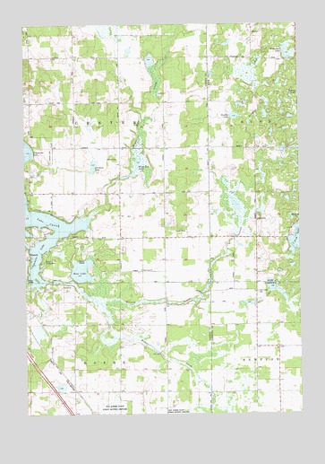
Moose Ear Lake, WI USGS Topographic Map
Click on map above to begin viewing in our Map Viewer.

This topographic map contains these locations and features:
Feature Name Type Latitude Longitude GNIS ID View Map
Barron County ParkParkN45.2994°W91.6171°1561203View Map
Bass LakeLakeN45.2961°W91.5996°1561237View Map
Bass Lake ChurchChurchN45.2961°W91.5724°1837879View Map
Bass Lake School (historical)SchoolN45.2961°W91.5724°1837880View Map
Beaver CreekStreamN45.2925°W91.6046°1561451View Map
Cloud Dancer Private AirportAirportN45.3124°W91.5880°2444115View Map
East Dovre School (historical)SchoolN45.2580°W91.5832°1837916View Map
Edgewood School (historical)SchoolN45.3358°W91.6016°1837918View Map
Eyk E2980 DamDamN45.3616°W91.5685°1792565View Map
Fish LakeLakeN45.3058°W91.5008°1565002View Map
Horseshoe LakeLakeN45.3647°W91.5048°1566736View Map
Jacobson LakeLakeN45.3294°W91.5940°1567085View Map
Jerdet FarmsLocaleN45.2797°W91.5889°2711408View Map
Johnson CemeteryCemeteryN45.3316°W91.5821°1567210View Map
Koehler LakeLakeN45.3454°W91.5291°1567597View Map
Lake 11 2 0.3ReservoirN45.3636°W91.5676°1792566View Map
Moose Ear CreekStreamN45.3130°W91.5949°1569708View Map
Moose Ear LakeLakeN45.3262°W91.5786°1569709View Map
Moose Ear School (historical)SchoolN45.3211°W91.5618°1837973View Map
Oakland School (historical)SchoolN45.3641°W91.5907°1837976View Map
Pleasant Valley School (historical)SchoolN45.2608°W91.5107°1842870View Map
Tenmile CreekStreamN45.2858°W91.5913°1575306View Map
Tenmile LakeLakeN45.2927°W91.6150°1575308View Map
Town of ChetekCivilN45.3372°W91.5994°1582952View Map
Town of DovreCivilN45.2503°W91.6038°1583095View Map
Twin Lake School (historical)SchoolN45.2891°W91.5204°1842918View Map
Twin LakesLakeN45.2872°W91.5174°1575799View Map
Twin Lakes CemeteryCemeteryN45.2888°W91.5193°1575816View Map
Twin Lakes RanchLocaleN45.2844°W91.5211°2711415View Map

Note: Coordinates in the location and feature list above are referenced to NAD83 datum.


Copyright (C) 2008-2025 Ryan Niemi / Sunset Dynamics ... All Rights Reserved