TopoQuest Logo
Do you find TopoQuest useful?
Help keep TopoQuest running and adding new maps/features by donating!
Bitcoin:  19c7KJd3qBynnjoSw5npx9KScwjBe4ifkT
Litecoin:  LXs6TkuXGGXo1vDsWCkWVdjQX94eUKd6ui
Home View Maps Find Maps Find Places Resources & Links


Moose Mountain, Montana Topographic Map

USGS Map Title: Moose Mountain, MT
USGS Map MRC: 46110G7
DRG (GeoTIFF) Download: o46110g7.tif


Neighboring USGS Topographic Map Quads:


  Bubbling Springs, MT  
46110H8
 

  Belt Park Butte, MT  
46110H7
 

  Neihart, MT  
46110H6
 

  Strawberry Butte, MT  
46110G8
 

  Moose Mountain, MT  
46110G7
 

  Kings Hill, MT  
46110G6
 

  Coxcombe Butte, MT  
46110F8
 

  Charcoal Gulch, MT  
46110F7
 

  Volcano Butte, MT  
46110F6


Map MRC Location:

N47°
W111°
N47°
W110°
H8 H7 H6 H5 H4 H3 H2 H1
G8 G7 G6 G5 G4 G3 G2 G1
F8 F7 F6 F5 F4 F3 F2 F1
E8 E7 E6 E5 E4 E3 E2 E1
D8 D7 D6 D5 D4 D3 D2 D1
C8 C7 C6 C5 C4 C3 C2 C1
B8 B7 B6 B5 B4 B3 B2 B1
A8 A7 A6 A5 A4 A3 A2 A1
N46°
W111°
N46°
W110°

Moose Mountain, MT USGS 1:24K Topographic Map Preview:
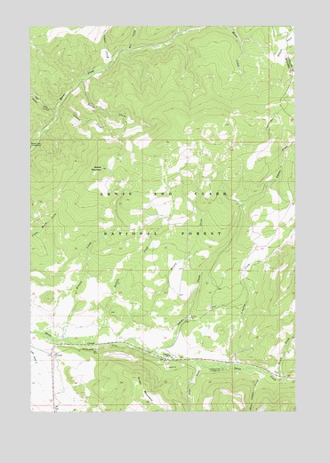
Moose Mountain, MT USGS Topographic Map
Click on map above to begin viewing in our Map Viewer.

This topographic map contains these locations and features:
Feature Name Type Latitude Longitude GNIS ID View Map
Adams CreekStreamN46.7691°W110.8166°778867View Map
Allan CreekStreamN46.8475°W110.8638°778954View Map
Allen GulchValleyN46.7641°W110.7969°778958View Map
Barzee Post Office (historical)Post OfficeN46.7688°W110.8091°1762699View Map
Barzee School (historical)SchoolN46.7688°W110.8091°1762822View Map
Bottle CreekStreamN46.8577°W110.8516°780244View Map
Cook RanchLocaleN46.7747°W110.8605°798875View Map
Coyote CreekStreamN46.8613°W110.8402°781816View Map
Culvert CreekStreamN46.8491°W110.8622°781985View Map
Daniels CreekStreamN46.7719°W110.8505°782075View Map
Green MountainSummitN46.7533°W110.8199°784290View Map
Holmstrom DitchCanalN46.7697°W110.8527°778807View Map
Jumping CreekStreamN46.7647°W110.7822°785603View Map
Jumping Creek CampgroundLocaleN46.7638°W110.7855°785604View Map
Kinney CreekStreamN46.7736°W110.8594°785758View Map
Moose Creek CampgroundLocaleN46.8358°W110.8749°787644View Map
Moose MountainSummitN46.8288°W110.8419°787663View Map
Moose ParkFlatN46.8694°W110.7555°787667View Map
Ranch CreekStreamN46.7600°W110.7580°789377View Map
SW SW Section 28 MineMineN46.7686°W110.8641°804681View Map
Three Cabins CreekStreamN46.7638°W110.7697°792119View Map
Wet CreekStreamN46.8663°W110.8294°793145View Map
WolseyPopulated PlaceN46.7763°W110.8174°767961View Map
Wolsey (historical)LocaleN46.7741°W110.8058°1762727View Map
Wolsey CreekStreamN46.7730°W110.8355°793465View Map
Wolsey Post Office (historical)Post OfficeN46.7741°W110.8058°1762723View Map
Woolsey School (historical)SchoolN46.7741°W110.8058°1762726View Map

Note: Coordinates in the location and feature list above are referenced to NAD83 datum.


Copyright (C) 2008-2025 Ryan Niemi / Sunset Dynamics ... All Rights Reserved