TopoQuest Logo
Do you find TopoQuest useful?
Help keep TopoQuest running and adding new maps/features by donating!
Bitcoin:  19c7KJd3qBynnjoSw5npx9KScwjBe4ifkT
Litecoin:  LXs6TkuXGGXo1vDsWCkWVdjQX94eUKd6ui
Home View Maps Find Maps Find Places Resources & Links


Bubbling Springs, Montana Topographic Map

USGS Map Title: Bubbling Springs, MT
USGS Map MRC: 46110H8
DRG (GeoTIFF) Download: o46110h8.tif


Neighboring USGS Topographic Map Quads:


  Blankenbaker Flats, MT  
47111A1
 

  Thunder Mountain, MT  
47110A8
 

  Monarch, MT  
47110A7
 

  Monument Peak, MT  
46111H1
 

  Bubbling Springs, MT  
46110H8
 

  Belt Park Butte, MT  
46110H7
 

  Sheep Mountain, MT  
46111G1
 

  Strawberry Butte, MT  
46110G8
 

  Moose Mountain, MT  
46110G7


Map MRC Location:

N47°
W111°
N47°
W110°
H8 H7 H6 H5 H4 H3 H2 H1
G8 G7 G6 G5 G4 G3 G2 G1
F8 F7 F6 F5 F4 F3 F2 F1
E8 E7 E6 E5 E4 E3 E2 E1
D8 D7 D6 D5 D4 D3 D2 D1
C8 C7 C6 C5 C4 C3 C2 C1
B8 B7 B6 B5 B4 B3 B2 B1
A8 A7 A6 A5 A4 A3 A2 A1
N46°
W111°
N46°
W110°

Bubbling Springs, MT USGS 1:24K Topographic Map Preview:
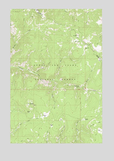
Bubbling Springs, MT USGS Topographic Map
Click on map above to begin viewing in our Map Viewer.

This topographic map contains these locations and features:
Feature Name Type Latitude Longitude GNIS ID View Map
Bubbling SpringsSpringN46.8971°W110.8992°780502View Map
Central ParkFlatN46.9691°W110.9108°781135View Map
Crescent ParkFlatN46.8913°W110.9444°781886View Map
Deer ParkFlatN46.9805°W110.9191°782266View Map
Dry ParkFlatN46.9530°W110.8788°782661View Map
Green MountainSummitN46.9988°W110.9666°784291View Map
Iron Mines CreekStreamN46.9338°W110.9397°785331View Map
Iron Mines ParkFlatN46.9650°W110.8991°785332View Map
Iron MountainSummitN46.9752°W110.9088°785337View Map
Island ParkFlatN46.8866°W110.8780°785357View Map
Link ParkFlatN46.8966°W110.9319°786184View Map
Lonesome CreekStreamN46.9333°W110.9413°786506View Map
Lost Stove CreekStreamN46.9388°W110.9647°786636View Map
McKay SpringSpringN46.9042°W110.9742°787077View Map
Placer CreekStreamN46.9672°W110.9922°788974View Map
Stringer CreekStreamN46.9266°W110.9027°791605View Map
Tenderfoot Creek Experimental ForestParkN46.9258°W110.8919°794637View Map
Twin Cabins CreekStreamN46.9772°W110.9811°792501View Map
Williams MountainSummitN46.9116°W110.9744°793327View Map
Williams ParkFlatN46.9016°W110.9527°793328View Map

Note: Coordinates in the location and feature list above are referenced to NAD83 datum.


Copyright (C) 2008-2025 Ryan Niemi / Sunset Dynamics ... All Rights Reserved