TopoQuest Logo
Do you find TopoQuest useful?
Help keep TopoQuest running and adding new maps/features by donating!
Bitcoin:  19c7KJd3qBynnjoSw5npx9KScwjBe4ifkT
Litecoin:  LXs6TkuXGGXo1vDsWCkWVdjQX94eUKd6ui
Home View Maps Find Maps Find Places Resources & Links


Moravia, New York Topographic Map

USGS Map Title: Moravia, NY
USGS Map MRC: 42076F4
DRG (GeoTIFF) Download: o42076f4.tif


Neighboring USGS Topographic Map Quads:


  Scipio Center, NY  
42076G5
 

  Owasco, NY  
42076G4
 

  Spafford, NY  
42076G3
 

  Genoa, NY  
42076F5
 

  Moravia, NY  
42076F4
 

  Sempronius, NY  
42076F3
 

  Ludlowville, NY  
42076E5
 

  West Groton, NY  
42076E4
 

  Groton, NY  
42076E3


Map MRC Location:

N43°
W77°
N43°
W76°
H8 H7 H6 H5 H4 H3 H2 H1
G8 G7 G6 G5 G4 G3 G2 G1
F8 F7 F6 F5 F4 F3 F2 F1
E8 E7 E6 E5 E4 E3 E2 E1
D8 D7 D6 D5 D4 D3 D2 D1
C8 C7 C6 C5 C4 C3 C2 C1
B8 B7 B6 B5 B4 B3 B2 B1
A8 A7 A6 A5 A4 A3 A2 A1
N42°
W77°
N42°
W76°

Moravia, NY USGS 1:24K Topographic Map Preview:
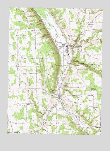
Moravia, NY USGS Topographic Map
Click on map above to begin viewing in our Map Viewer.

This topographic map contains these locations and features:
Feature Name Type Latitude Longitude GNIS ID View Map
Ancient Oaks FarmLocaleN42.6983°W76.4231°2544716View Map
Baker CemeteryCemeteryN42.6945°W76.4625°942822View Map
Bird CemeteryCemeteryN42.6367°W76.4331°944020View Map
Cayuga Correctional FacilityBuildingN42.7218°W76.3964°2756181View Map
Cayuga Lake Estates Mobile Home ParkPopulated PlaceN42.6913°W76.4204°2598482View Map
Chipman CornersPopulated PlaceN42.6328°W76.3752°946589View Map
Christ United Methodist ChurchChurchN42.7100°W76.4172°2493639View Map
Decker CreekStreamN42.7156°W76.4102°948160View Map
Dresserville CreekStreamN42.7156°W76.4105°948645View Map
Dry Creek CemeteryCemeteryN42.7017°W76.4169°2519266View Map
Edsall CemeteryCemeteryN42.6366°W76.4493°2120935View Map
Edsall CemeteryCemeteryN42.6366°W76.4492°2519264View Map
Fillmore Glen State ParkParkN42.6940°W76.3960°950054View Map
Fillmore Golf ClubLocaleN42.6893°W76.4111°2598509View Map
First Baptist ChurchChurchN42.7108°W76.4169°2493635View Map
First Methodist Episcopal Church (historical)ChurchN42.7111°W76.4181°2493633View Map
Four Town First Aid SquadBuildingN42.7111°W76.4218°2719239View Map
GoosetreePopulated PlaceN42.6548°W76.4747°972555View Map
Grisamore FarmsLocaleN42.6542°W76.4753°2514928View Map
Hemlock CreekStreamN42.6592°W76.4285°952557View Map
Howd Nursing HomeBuildingN42.7144°W76.4230°2598494View Map
Indian Mound CemeteryCemeteryN42.7129°W76.4109°953677View Map
Jewett HillSummitN42.6995°W76.4433°954026View Map
LockePopulated PlaceN42.6606°W76.4308°955778View Map
Locke Fire DepartmentBuildingN42.6618°W76.4302°2700956View Map
Mill CreekStreamN42.7115°W76.4335°957219View Map
Millard Fillmore Elementary SchoolSchoolN42.7075°W76.4197°2493628View Map
Monaghan CemeteryCemeteryN42.6587°W76.3872°957501View Map
MontvillePopulated PlaceN42.7145°W76.4033°957567View Map
Montville FallsFallsN42.7173°W76.4091°970362View Map
MoraviaPopulated PlaceN42.7126°W76.4216°957642View Map
Moravia Fire DepartmentBuildingN42.7157°W76.4267°2493630View Map
Moravia High School (historical)SchoolN42.7103°W76.4156°2493636View Map
Moravia Junior-Senior High SchoolSchoolN42.7039°W76.4197°2493640View Map
Moravia Municipal BuildingBuildingN42.7131°W76.4219°2493629View Map
Moravia Post OfficePost OfficeN42.7105°W76.4210°2598475View Map
Moravia Village Police DepartmentBuildingN42.7151°W76.4279°2781217View Map
Morse FarmLocaleN42.7058°W76.4194°2576229View Map
Old Settlers CemeteryCemeteryN42.6601°W76.4329°2519265View Map
Owasco AirportAirportN42.7363°W76.4844°2443165View Map
Owasco FlatsFlatN42.7201°W76.4327°959666View Map
Owasco HillPopulated PlaceN42.7276°W76.4647°959667View Map
Parson FallsFallsN42.7228°W76.4516°970456View Map
Perkins CornersLocaleN42.7145°W76.4641°960192View Map
Pine HollowPopulated PlaceN42.6695°W76.4783°972947View Map
Pine Hollow CemeteryCemeteryN42.6625°W76.4736°2519263View Map
Pine Hollow CreekStreamN42.6453°W76.4452°960485View Map
Powers Public LibraryBuildingN42.7111°W76.4183°2493634View Map
Quaker Church CemeteryCemeteryN42.7353°W76.3957°2519267View Map
Rafferty CornersLocaleN42.7134°W76.4883°962127View Map
Saint Mathew's Episcopal ChurchChurchN42.7103°W76.4203°2493638View Map
Saint Patrick's Roman Catholic ChurchChurchN42.7094°W76.4242°2493637View Map
Saint Patricks CemeteryCemeteryN42.7139°W76.4091°964060View Map
Satterly CornersLocaleN42.6645°W76.3869°964500View Map
School Number 1 (historical)SchoolN42.6389°W76.4053°2120936View Map
School Number 2 (historical)SchoolN42.6761°W76.3986°2120937View Map
School Number 4 (historical)SchoolN42.6575°W76.4342°2120938View Map
School Number 5 (historical)SchoolN42.6514°W76.3836°2120939View Map
School Number 6 (historical)SchoolN42.6997°W76.4628°2120940View Map
School Number 7 (historical)SchoolN42.6911°W76.4878°2120941View Map
School Number 7 (historical)SchoolN42.7347°W76.3950°2120942View Map
School Number 8 (historical)SchoolN42.6339°W76.4394°2120943View Map
School Number 8 (historical)SchoolN42.6703°W76.4667°2120944View Map
School Number 9 (historical)SchoolN42.6544°W76.4750°2120945View Map
School Number 9 (historical)SchoolN42.7292°W76.4664°2120946View Map
Shaw CornersLocaleN42.6520°W76.3852°964972View Map
Toll Gate CornersPopulated PlaceN42.6956°W76.4202°967601View Map
Town of LockeCivilN42.6568°W76.4135°979163View Map
Town of MoraviaCivilN42.7378°W76.4189°979235View Map
Vans Airport (historical)AirportN42.7028°W76.4241°978162View Map
Veterans Memorial BuildingBuildingN42.7120°W76.4220°2493632View Map
Village of MoraviaCivilN42.7120°W76.4219°2390995View Map
Wilson CornersPopulated PlaceN42.7348°W76.3933°971413View Map

Note: Coordinates in the location and feature list above are referenced to NAD83 datum.


Copyright (C) 2008-2025 Ryan Niemi / Sunset Dynamics ... All Rights Reserved