TopoQuest Logo
Do you find TopoQuest useful?
Help keep TopoQuest running and adding new maps/features by donating!
Bitcoin:  19c7KJd3qBynnjoSw5npx9KScwjBe4ifkT
Litecoin:  LXs6TkuXGGXo1vDsWCkWVdjQX94eUKd6ui
Home View Maps Find Maps Find Places Resources & Links


Morristown, New York Topographic Map

USGS Map Title: Morristown, NY
USGS Map MRC: 44075E6
DRG (GeoTIFF) Download: o44075e6.tif


Neighboring USGS Topographic Map Quads:


  Ogdensburg West, NY  
44075F5


  Morristown, NY  
44075E6
 

  Edwardsville, NY  
44075E5
 

  Chippewa Bay, NY  
44075D7
 

  Hammond, NY  
44075D6
 

  Pope Mills, NY  
44075D5


Map MRC Location:

N45°
W76°
N45°
W75°
H8 H7 H6 H5 H4 H3 H2 H1
G8 G7 G6 G5 G4 G3 G2 G1
F8 F7 F6 F5 F4 F3 F2 F1
E8 E7 E6 E5 E4 E3 E2 E1
D8 D7 D6 D5 D4 D3 D2 D1
C8 C7 C6 C5 C4 C3 C2 C1
B8 B7 B6 B5 B4 B3 B2 B1
A8 A7 A6 A5 A4 A3 A2 A1
N44°
W76°
N44°
W75°

Morristown, NY USGS 1:24K Topographic Map Preview:
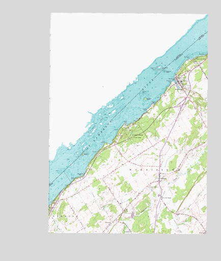
Morristown, NY USGS Topographic Map
Click on map above to begin viewing in our Map Viewer.

This topographic map contains these locations and features:
Feature Name Type Latitude Longitude GNIS ID View Map
American IslandIslandN44.5448°W75.7239°975895View Map
Bay State ShoalBarN44.5062°W75.7394°975868View Map
Birch PointCapeN44.5312°W75.7294°975976View Map
Blackstone BayBayN44.5340°W75.7239°975986View Map
Bogardus IslandIslandN44.5920°W75.6591°975847View Map
Brier HillPopulated PlaceN44.5314°W75.6627°976026View Map
Brier Hill Fire DepartmentBuildingN44.5848°W75.6470°2718587View Map
Brier Hill Fire DepartmentBuildingN44.5314°W75.6622°2718683View Map
Brier Hill Post OfficePost OfficeN44.5344°W75.6589°2598997View Map
Brier Hill StationLocaleN44.5206°W75.6611°976027View Map
Brockville RockIslandN44.5801°W75.6766°976030View Map
Central SchoolSchoolN44.5867°W75.6458°976106View Map
Chapman PointCapeN44.5859°W75.6541°976118View Map
Chippewa Station ChurchChurchN44.5051°W75.7022°976134View Map
Delack PointCapeN44.5626°W75.6894°976241View Map
Eagers BayBayN44.5758°W75.6654°976263View Map
Edgewater ParkPopulated PlaceN44.6001°W75.6350°976281View Map
Greenwood CemeteryCemeteryN44.5828°W75.6444°976375View Map
Halls DockLocaleN44.5462°W75.7125°976400View Map
Holmes PointCapeN44.5703°W75.6730°976448View Map
Jacques Cartier State ParkParkN44.5551°W75.6802°976484View Map
Louce CreekStreamN44.5823°W75.6494°975845View Map
MorristownPopulated PlaceN44.5864°W75.6483°976680View Map
Morristown BayBayN44.5858°W75.6503°976681View Map
Morristown Fire DepartmentBuildingN44.5902°W75.6439°2718375View Map
Morristown PointCapeN44.5995°W75.6394°976683View Map
Morristown Post OfficePost OfficeN44.5871°W75.6489°2599008View Map
Morristown Public LibraryBuildingN44.5887°W75.6505°2599066View Map
Oak Point ShoalBarN44.5245°W75.7486°975846View Map
Old Man IslandIslandN44.5767°W75.6744°976763View Map
Perch BayBayN44.6020°W75.6282°976806View Map
Pine Hill CemeteryCemeteryN44.5840°W75.6425°976819View Map
Point ComfortCapeN44.5514°W75.7058°976842View Map
Saint John's ChurchChurchN44.5855°W75.6457°2597607View Map
Saint Johns SchoolSchoolN44.5884°W75.6475°976925View Map
School Number 11 (historical)SchoolN44.5408°W75.6878°2120409View Map
School Number 14 (historical)SchoolN44.5117°W75.6439°2120410View Map
School Number 4 (historical)SchoolN44.5003°W75.6267°2120407View Map
School Number 9 (historical)SchoolN44.5150°W75.7069°2120408View Map
Sunnyside CemeteryCemeteryN44.5856°W75.6452°977090View Map
Terrace ParkPopulated PlaceN44.5981°W75.6350°977102View Map
Thibert FieldAirportN44.5692°W75.6355°2717026View Map
Three Sisters IslandsIslandN44.5926°W75.6591°977119View Map
Town of MorristownCivilN44.5368°W75.6371°979240View Map
Village of MorristownCivilN44.5842°W75.6453°2390997View Map
Whaleback ShoalBarN44.5081°W75.7355°975867View Map
Wright's MarinaLocaleN44.5875°W75.6516°2599073View Map

Note: Coordinates in the location and feature list above are referenced to NAD83 datum.


Copyright (C) 2008-2025 Ryan Niemi / Sunset Dynamics ... All Rights Reserved