TopoQuest Logo
Do you find TopoQuest useful?
Help keep TopoQuest running and adding new maps/features by donating!
Bitcoin:  19c7KJd3qBynnjoSw5npx9KScwjBe4ifkT
Litecoin:  LXs6TkuXGGXo1vDsWCkWVdjQX94eUKd6ui
Home View Maps Find Maps Find Places Resources & Links


Mortarstone Bluff, Montana Topographic Map

USGS Map Title: Mortarstone Bluff, MT
USGS Map MRC: 48104A8
DRG (GeoTIFF) Download: o48104a8.tif


Neighboring USGS Topographic Map Quads:


  Poplar NE, MT  
48105B1
 

  Brockton, MT  
48104B8
 

  Calais, MT  
48104B7
 

  Sprole, MT  
48105A1
 

  Mortarstone Bluff, MT  
48104A8
 

  Frog Coulee, MT  
48104A7
 

  Duplisse Creek North, MT  
47105H1
 

  Elmdale NW, MT  
47104H8
 

  Elmdale, MT  
47104H7


Map MRC Location:

N49°
W105°
N49°
W104°
H8 H7 H6 H5 H4 H3 H2 H1
G8 G7 G6 G5 G4 G3 G2 G1
F8 F7 F6 F5 F4 F3 F2 F1
E8 E7 E6 E5 E4 E3 E2 E1
D8 D7 D6 D5 D4 D3 D2 D1
C8 C7 C6 C5 C4 C3 C2 C1
B8 B7 B6 B5 B4 B3 B2 B1
A8 A7 A6 A5 A4 A3 A2 A1
N48°
W105°
N48°
W104°

Mortarstone Bluff, MT USGS 1:24K Topographic Map Preview:
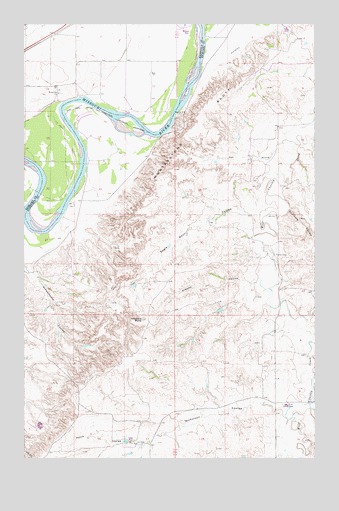
Mortarstone Bluff, MT USGS Topographic Map
Click on map above to begin viewing in our Map Viewer.

This topographic map contains these locations and features:
Feature Name Type Latitude Longitude GNIS ID View Map
26N53E07DACC01 WellWellN48.0167°W104.9191°825555View Map
27N52E02CA__01 WellWellN48.1214°W104.9705°826440View Map
27N52E02DA__01 WellWellN48.1214°W104.9597°826439View Map
27N52E02DD__01 WellWellN48.1178°W104.9597°826408View Map
27N52E10BC__01 WellWellN48.1106°W104.9972°826333View Map
27N52E10CC__01 WellWellN48.1034°W104.9972°826262View Map
27N52E10DA__01 WellWellN48.1070°W104.9811°826295View Map
27N52E10DC__01 WellWellN48.1034°W104.9866°826261View Map
27N52E11BA__01 WellWellN48.1142°W104.9705°826370View Map
27N52E11BC__01 WellWellN48.1106°W104.9758°826332View Map
27N52E11BD__01 WellWellN48.1106°W104.9705°826331View Map
27N52E11CA__01 WellWellN48.1070°W104.9705°826294View Map
27N52E15BB__01 WellWellN48.0997°W104.9972°826223View Map
27N53E07AA__01 WellWellN48.1128°W104.9164°826360View Map
27N53E20CCDC01 WellWellN48.0703°W104.9089°825988View Map
Atkinson (historical)LocaleN48.1220°W104.9883°1669423View Map
Big Basin CouleeValleyN48.0142°W104.8769°768744View Map
Coalmine CouleeValleyN48.0722°W104.8858°769999View Map
Eagles Nest CouleeValleyN48.0814°W104.8964°770960View Map
Fisher CemeteryCemeteryN48.0587°W104.8925°771394View Map
Haystack ButteSummitN48.0403°W104.9491°772278View Map
Mortarstone BluffCliffN48.0945°W104.9272°774400View Map
Nicholson CouleeValleyN48.0147°W104.8894°774624View Map
Patch CouleeValleyN48.0042°W104.9527°775110View Map
Riverside ChurchChurchN48.1050°W104.9850°775791View Map
Riverside School (historical)SchoolN48.1045°W104.9866°1669300View Map
Schoolhouse CouleeValleyN48.0559°W104.9991°776280View Map
Simons CouleeValleyN48.0514°W104.9069°776568View Map
Soo ProngStreamN48.0892°W104.8850°776743View Map

Note: Coordinates in the location and feature list above are referenced to NAD83 datum.


Copyright (C) 2008-2025 Ryan Niemi / Sunset Dynamics ... All Rights Reserved