TopoQuest Logo
Do you find TopoQuest useful?
Help keep TopoQuest running and adding new maps/features by donating!
Bitcoin:  19c7KJd3qBynnjoSw5npx9KScwjBe4ifkT
Litecoin:  LXs6TkuXGGXo1vDsWCkWVdjQX94eUKd6ui
Home View Maps Find Maps Find Places Resources & Links


Brockton, Montana Topographic Map

USGS Map Title: Brockton, MT
USGS Map MRC: 48104B8
DRG (GeoTIFF) Download: o48104b8.tif


Neighboring USGS Topographic Map Quads:


  Geddart Lake, MT  
48105C1
 

  Smoke Creek SW, MT  
48104C8
 

  Coyote Coulee, MT  
48104C7
 

  Poplar NE, MT  
48105B1
 

  Brockton, MT  
48104B8
 

  Calais, MT  
48104B7
 

  Sprole, MT  
48105A1
 

  Mortarstone Bluff, MT  
48104A8
 

  Frog Coulee, MT  
48104A7


Map MRC Location:

N49°
W105°
N49°
W104°
H8 H7 H6 H5 H4 H3 H2 H1
G8 G7 G6 G5 G4 G3 G2 G1
F8 F7 F6 F5 F4 F3 F2 F1
E8 E7 E6 E5 E4 E3 E2 E1
D8 D7 D6 D5 D4 D3 D2 D1
C8 C7 C6 C5 C4 C3 C2 C1
B8 B7 B6 B5 B4 B3 B2 B1
A8 A7 A6 A5 A4 A3 A2 A1
N48°
W105°
N48°
W104°

Brockton, MT USGS 1:24K Topographic Map Preview:
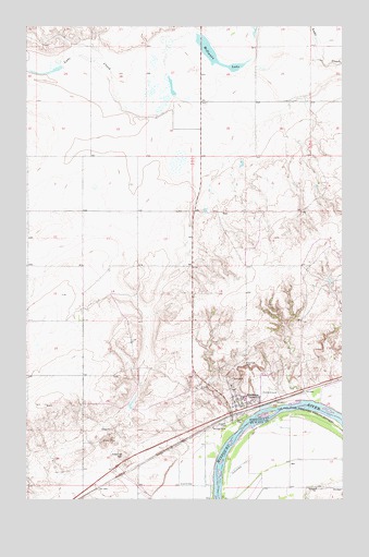
Brockton, MT USGS Topographic Map
Click on map above to begin viewing in our Map Viewer.

This topographic map contains these locations and features:
Feature Name Type Latitude Longitude GNIS ID View Map
27N52E01BC__01 WellWellN48.1250°W104.9544°826472View Map
27N52E01BC__02 WellWellN48.1250°W104.9544°826473View Map
27N52E02AA__01 WellWellN48.1286°W104.9597°826509View Map
27N52E02AC__01 WellWellN48.1250°W104.9653°826474View Map
27N53E04BB__01 WellWellN48.1272°W104.8891°826498View Map
27N53E04BB__02 WellWellN48.1272°W104.8891°826499View Map
27N53E04BB__03 WellWellN48.1272°W104.8891°826500View Map
27N53E06BA__01 WellWellN48.1272°W104.9272°826501View Map
28N52E11CCCC01 WellWellN48.1870°W104.9775°1633953View Map
28N52E13AACA01 WellWellN48.1842°W104.9389°1633920View Map
28N52E14ADDA01 WellWellN48.1806°W104.9569°1633882View Map
28N52E15DD__01 WellWellN48.1739°W104.9816°1633841View Map
28N52E15DDAA01 WellWellN48.1750°W104.9789°1633847View Map
28N52E23CD__01 WellWellN48.1597°W104.9708°826847View Map
28N52E23CD__02 WellWellN48.1597°W104.9708°826848View Map
28N52E25CA__01 WellWellN48.1489°W104.9494°826733View Map
28N52E34CD__01 WellWellN48.1309°W104.9925°826531View Map
28N52E34DD__02 WellWellN48.1309°W104.9816°826530View Map
28N53E06BBAB01 WellWellN48.2150°W104.9316°1634182View Map
28N53E19BCCB01 WellWellN48.1667°W104.9344°1633783View Map
28N53E19CD__01 WellWellN48.1614°W104.9269°826862View Map
28N53E20DC__01 WellWellN48.1614°W104.9000°826861View Map
28N53E29BC__01 WellWellN48.1542°W104.9108°826789View Map
28N53E29BC__02 WellWellN48.1542°W104.9108°826790View Map
28N53E29CB__01 WellWellN48.1506°W104.9108°826744View Map
28N53E29CB__02 WellWellN48.1506°W104.9108°826745View Map
28N53E29DC__01 WellWellN48.1470°W104.9000°826711View Map
28N53E30AD__01 WellWellN48.1542°W104.9161°826791View Map
28N53E30AD__02 WellWellN48.1542°W104.9161°826792View Map
28N53E30AD__03 WellWellN48.1542°W104.9161°826793View Map
28N53E30AD__04 WellWellN48.1542°W104.9161°826794View Map
28N53E30AD__05 WellWellN48.1542°W104.9161°826795View Map
28N53E30AD__06 WellWellN48.1542°W104.9161°826796View Map
28N53E30AD__07 WellWellN48.1542°W104.9161°826797View Map
28N53E30AD__08 WellWellN48.1542°W104.9161°826798View Map
28N53E30DA__01 WellWellN48.1506°W104.9161°826746View Map
28N53E30DA__02 WellWellN48.1506°W104.9161°826747View Map
28N53E30DA__03 WellWellN48.1506°W104.9161°826748View Map
28N53E30DA__04 WellWellN48.1506°W104.9161°826749View Map
28N53E30DA__05 WellWellN48.1506°W104.9161°826750View Map
28N53E30DA__06 WellWellN48.1506°W104.9161°826751View Map
28N53E30DA__07 WellWellN48.1506°W104.9161°826752View Map
28N53E30DA__08 WellWellN48.1506°W104.9161°826753View Map
28N53E30DB__01 WellWellN48.1506°W104.9214°826754View Map
28N53E30DD__01 WellWellN48.1470°W104.9161°826712View Map
28N53E30DDBB01 WellWellN48.1467°W104.9177°826708View Map
28N53E31BB__01 WellWellN48.1434°W104.9322°826661View Map
28N53E32AD__01 WellWellN48.1397°W104.8944°826615View Map
28N53E32AD__02 WellWellN48.1397°W104.8944°826616View Map
28N53E32BC__01 WellWellN48.1397°W104.9108°826617View Map
28N53E32DA__01 WellWellN48.1361°W104.8944°826587View Map
28N53E32DABC01 WellWellN48.1345°W104.8966°826574View Map
28N53E33CD__01 WellWellN48.1325°W104.8839°826552View Map
28N53E33CD__02 WellWellN48.1325°W104.8839°826553View Map
29N52E27DADC01 WellWellN48.2353°W104.9325°1634328View Map
29N52E27DADC02 WellWellN48.2353°W104.9325°1634329View Map
29N52E34BCAC01 WellWellN48.2256°W104.9494°1634252View Map
29N52E35CBBB02 WellWellN48.2222°W104.9305°1634229View Map
BrocktonLocaleN48.1486°W104.9177°1669425View Map
BrocktonPopulated PlaceN48.1514°W104.9169°769244View Map
Brockton ChapelChurchN48.1514°W104.9177°1669348View Map
Brockton Post OfficePost OfficeN48.1496°W104.9177°1669426View Map
Brockton SchoolSchoolN48.1520°W104.9147°1669264View Map
Brockton Volunteer Fire DepartmentBuildingN48.1500°W104.9176°2546719View Map
Harvest States Cooperatives ElevatorLocaleN48.1484°W104.9177°1669353View Map
McIlwain LakeLakeN48.2426°W104.9257°774024View Map
Occident Elevator (historical)LocaleN48.1484°W104.9191°1669352View Map
Our Saviors Lutheran ChurchChurchN48.1514°W104.9177°1669346View Map
Riverview CemeteryCemeteryN48.1611°W104.9144°775799View Map
Ruffato SchoolSchoolN48.1278°W104.8855°776009View Map
Saint Thomas Catholic ChurchChurchN48.1514°W104.9177°1669347View Map
Town of BrocktonCivilN48.1498°W104.9143°2411730View Map
Treasure State Elevator (historical)LocaleN48.1484°W104.9191°1669351View Map
Twomile HillSummitN48.1364°W104.9619°802223View Map

Note: Coordinates in the location and feature list above are referenced to NAD83 datum.


Copyright (C) 2008-2025 Ryan Niemi / Sunset Dynamics ... All Rights Reserved