TopoQuest Logo
Do you find TopoQuest useful?
Help keep TopoQuest running and adding new maps/features by donating!
Bitcoin:  19c7KJd3qBynnjoSw5npx9KScwjBe4ifkT
Litecoin:  LXs6TkuXGGXo1vDsWCkWVdjQX94eUKd6ui
Home View Maps Find Maps Find Places Resources & Links


Poplar NE, Montana Topographic Map

USGS Map Title: Poplar NE, MT
USGS Map MRC: 48105B1
DRG (GeoTIFF) Download: o48105b1.tif


Neighboring USGS Topographic Map Quads:


  Long Creek East, MT  
48105C2
 

  Geddart Lake, MT  
48105C1
 

  Smoke Creek SW, MT  
48104C8
 

  Badger Creek, MT  
48105B2
 

  Poplar NE, MT  
48105B1
 

  Brockton, MT  
48104B8
 

  Poplar, MT  
48105A2
 

  Sprole, MT  
48105A1
 

  Mortarstone Bluff, MT  
48104A8


Map MRC Location:

N49°
W106°
N49°
W105°
H8 H7 H6 H5 H4 H3 H2 H1
G8 G7 G6 G5 G4 G3 G2 G1
F8 F7 F6 F5 F4 F3 F2 F1
E8 E7 E6 E5 E4 E3 E2 E1
D8 D7 D6 D5 D4 D3 D2 D1
C8 C7 C6 C5 C4 C3 C2 C1
B8 B7 B6 B5 B4 B3 B2 B1
A8 A7 A6 A5 A4 A3 A2 A1
N48°
W106°
N48°
W105°

Poplar NE, MT USGS 1:24K Topographic Map Preview:
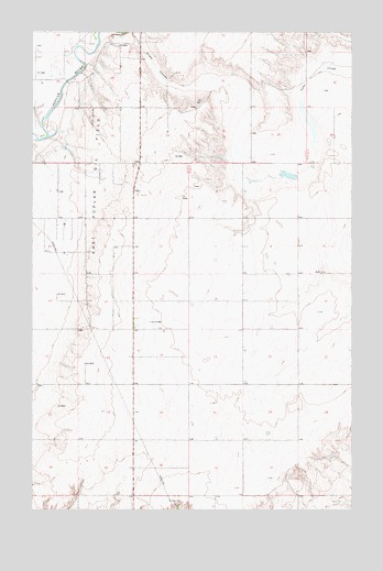
Poplar NE, MT USGS Topographic Map
Click on map above to begin viewing in our Map Viewer.

This topographic map contains these locations and features:
Feature Name Type Latitude Longitude GNIS ID View Map
27N51E01BA__01 WellWellN48.1284°W105.0791°826505View Map
28N51E01BBBB01 WellWellN48.2153°W105.0853°1634183View Map
28N51E02AC__01 WellWellN48.2103°W105.0953°1634142View Map
28N51E12CC__01 WellWellN48.1886°W105.0844°1633973View Map
28N51E13CCCA01 WellWellN48.1736°W105.0841°1633836View Map
28N51E13CCCA02 WellWellN48.1734°W105.0841°1633822View Map
28N51E13CCCC01 WellWellN48.1728°W105.0850°1633819View Map
28N51E22CDCC01 WellWellN48.1584°W105.1230°826831View Map
28N51E22CDCC02 WellWellN48.1584°W105.1228°826830View Map
28N51E25AC__01 WellWellN48.1528°W105.0736°826782View Map
28N51E27ABAA01 WellWellN48.1561°W105.1133°826815View Map
28N51E27AC__01 WellWellN48.1528°W105.1166°826783View Map
28N52E18AC__01 WellWellN48.1811°W105.0516°1633893View Map
28N52E19AA__01 WellWellN48.1706°W105.0464°1633807View Map
28N52E19AA__02 WellWellN48.1706°W105.0464°1633808View Map
28N52E20BBBB01 WellWellN48.1717°W105.0425°1633815View Map
28N52E20CCCC01 WellWellN48.1589°W105.0428°826834View Map
28N52E29CD__01 WellWellN48.1453°W105.0355°826698View Map
28N52E29CD__02 WellWellN48.1453°W105.0355°826699View Map
28N52E30DDDD01 WellWellN48.1436°W105.0439°826663View Map
29N51E21DDAC01 WellWellN48.2472°W105.0850°1634396View Map
29N51E29CBBB01 WellWellN48.2375°W105.1180°1634336View Map
29N51E31AABB01 WellWellN48.2300°W105.1236°1634298View Map
29N51E32ABAC01 WellWellN48.2286°W105.1125°1634285View Map
29N51E32ACCA01 WellWellN48.2239°W105.1136°1634236View Map
29N51E32BAAD01 WellWellN48.2286°W105.1166°1634286View Map
29N51E32BABB01 WellWellN48.2295°W105.1191°1634289View Map
29N51E32BABB02 WellWellN48.2295°W105.1191°1634290View Map
29N51E32BBAA01 WellWellN48.2300°W105.1214°1634297View Map
29N51E32BBBA01 WellWellN48.2297°W105.1244°1634293View Map
29N51E32BBBA02 WellWellN48.2297°W105.1244°1634294View Map
29N51E32BBBA03 WellWellN48.2295°W105.1230°1634291View Map
29N51E32BBBA04 WellWellN48.2295°W105.1230°1634292View Map
29N51E32BBBB01 WellWellN48.2300°W105.1180°1634296View Map
29N51E32BCCA01 WellWellN48.2245°W105.1247°1634248View Map
29N51E32BCCA02 WellWellN48.2245°W105.1247°1634249View Map
29N51E36CBBB01 WellWellN48.2234°W105.0391°1634235View Map
29N51E36CCCC01 WellWellN48.2172°W105.0389°1634199View Map
East Poplar Oil FieldOilfieldN48.2072°W105.1044°771100View Map

Note: Coordinates in the location and feature list above are referenced to NAD83 datum.


Copyright (C) 2008-2025 Ryan Niemi / Sunset Dynamics ... All Rights Reserved