TopoQuest Logo
Do you find TopoQuest useful?
Help keep TopoQuest running and adding new maps/features by donating!
Bitcoin:  19c7KJd3qBynnjoSw5npx9KScwjBe4ifkT
Litecoin:  LXs6TkuXGGXo1vDsWCkWVdjQX94eUKd6ui
Home View Maps Find Maps Find Places Resources & Links


Moscow West, Idaho Topographic Map

USGS Map Title: Moscow West, ID
USGS Map MRC: 46117F1
DRG (GeoTIFF) Download: o46117f1.tif


Neighboring USGS Topographic Map Quads:


  Albion, WA  
46117G2
 

  Viola, ID  
46117G1
 

  Robinson Lake, ID  
46116G8
 

  Pullman, WA  
46117F2
 

  Moscow West, ID  
46117F1
 

  Moscow East, ID  
46116F8
 

  Colton, WA  
46117E2
 

  Uniontown, WA  
46117E1
 

  Genesee, ID  
46116E8


Map MRC Location:

N47°
W118°
N47°
W117°
H8 H7 H6 H5 H4 H3 H2 H1
G8 G7 G6 G5 G4 G3 G2 G1
F8 F7 F6 F5 F4 F3 F2 F1
E8 E7 E6 E5 E4 E3 E2 E1
D8 D7 D6 D5 D4 D3 D2 D1
C8 C7 C6 C5 C4 C3 C2 C1
B8 B7 B6 B5 B4 B3 B2 B1
A8 A7 A6 A5 A4 A3 A2 A1
N46°
W118°
N46°
W117°

Moscow West, ID USGS 1:24K Topographic Map Preview:
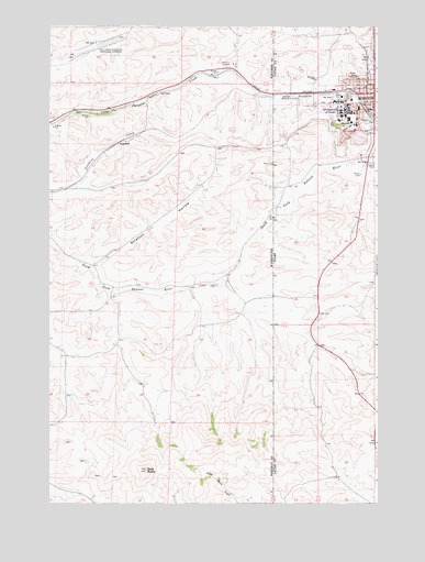
Moscow West, ID USGS Topographic Map
Click on map above to begin viewing in our Map Viewer.

This topographic map contains these locations and features:
Feature Name Type Latitude Longitude GNIS ID View Map
Appaloosa Horse Club and MuseumBuildingN46.7329°W117.0396°399565View Map
Bald ButteSummitN46.6335°W117.0879°1511981View Map
Canterbury HallBuildingN46.7289°W117.0078°2356853View Map
Central Fire StationBuildingN46.7297°W117.0017°2356836View Map
Chrisman HallBuildingN46.7283°W117.0128°2356850View Map
Church of the NazareneChurchN46.7325°W117.0042°2356838View Map
First Baptist ChurchChurchN46.7333°W117.0025°2356831View Map
First Church of Christ ScientistChurchN46.7283°W117.0003°2356837View Map
French HallBuildingN46.7239°W117.0089°2356856View Map
GarrisonLocaleN46.7329°W117.0832°1511472View Map
Gritman Medical CenterHospitalN46.7285°W117.0006°399539View Map
HollandLocaleN46.7254°W117.1238°1511471View Map
Hotel MoscowBuildingN46.7319°W117.0017°2356832View Map
Kenworthy TheatreBuildingN46.7308°W117.0011°2356834View Map
Korns Shopping CenterLocaleN46.7379°W117.0032°395560View Map
KRLF-FM (Pullman)TowerN46.6335°W117.0879°1534538View Map
KRPL-AM (Moscow)TowerN46.7463°W117.0193°401849View Map
KUOI-FM (Moscow)TowerN46.7285°W117.0041°401870View Map
Lindley HallBuildingN46.7275°W117.0100°2356854View Map
McConnell HallBuildingN46.7300°W117.0147°2356849View Map
Morrill HallBuildingN46.7281°W117.0108°2356852View Map
MoscowPopulated PlaceN46.7324°W117.0002°400006View Map
Moscow City HallBuildingN46.7317°W117.0011°2356833View Map
Moscow Police DepartmentBuildingN46.7319°W117.0004°2722447View Map
Moscow Police Department University of IdahoBuildingN46.7275°W117.0126°2722387View Map
Moscow Volunteer Fire Department Station 1BuildingN46.7296°W117.0018°2618979View Map
Moscow Volunteer Fire Department Station 3BuildingN46.7469°W117.0011°2619312View Map
Neale Stadium (historical)ParkN46.7264°W117.0175°2351845View Map
Palouse Empire MallLocaleN46.7335°W117.0254°394890View Map
Pullman/Moscow Regional AirportAirportN46.7439°W117.1096°1533904View Map
Ridenbaugh HallBuildingN46.7242°W117.0089°2356855View Map
Seventh Day Adventist ChurchChurchN46.7325°W117.0036°2356839View Map
Stratton HollowValleyN46.6874°W117.1082°1508767View Map
SunshinePopulated PlaceN46.7196°W117.0960°1511349View Map
University of IdahoSchoolN46.7259°W117.0114°375665View Map
University of Idaho HeliportAirportN46.7271°W117.0238°400881View Map
University Post OfficePost OfficeN46.7285°W117.0063°2781772View Map
West Park Elementary SchoolSchoolN46.7309°W117.0101°399704View Map
Willis Sweet HallBuildingN46.7281°W117.0125°2356851View Map

Note: Coordinates in the location and feature list above are referenced to NAD83 datum.


Copyright (C) 2008-2024 Ryan Niemi / Sunset Dynamics ... All Rights Reserved