TopoQuest Logo
Do you find TopoQuest useful?
Help keep TopoQuest running and adding new maps/features by donating!
Bitcoin:  19c7KJd3qBynnjoSw5npx9KScwjBe4ifkT
Litecoin:  LXs6TkuXGGXo1vDsWCkWVdjQX94eUKd6ui
Home View Maps Find Maps Find Places Resources & Links


Viola, Idaho Topographic Map

USGS Map Title: Viola, ID
USGS Map MRC: 46117G1
DRG (GeoTIFF) Download: o46117g1.tif


Neighboring USGS Topographic Map Quads:


  Elberton, WA  
46117H2
 

  Palouse, WA  
46117H1
 

  Potlatch, ID  
46116H8
 

  Albion, WA  
46117G2
 

  Viola, ID  
46117G1
 

  Robinson Lake, ID  
46116G8
 

  Pullman, WA  
46117F2
 

  Moscow West, ID  
46117F1
 

  Moscow East, ID  
46116F8


Map MRC Location:

N47°
W118°
N47°
W117°
H8 H7 H6 H5 H4 H3 H2 H1
G8 G7 G6 G5 G4 G3 G2 G1
F8 F7 F6 F5 F4 F3 F2 F1
E8 E7 E6 E5 E4 E3 E2 E1
D8 D7 D6 D5 D4 D3 D2 D1
C8 C7 C6 C5 C4 C3 C2 C1
B8 B7 B6 B5 B4 B3 B2 B1
A8 A7 A6 A5 A4 A3 A2 A1
N46°
W118°
N46°
W117°

Viola, ID USGS 1:24K Topographic Map Preview:
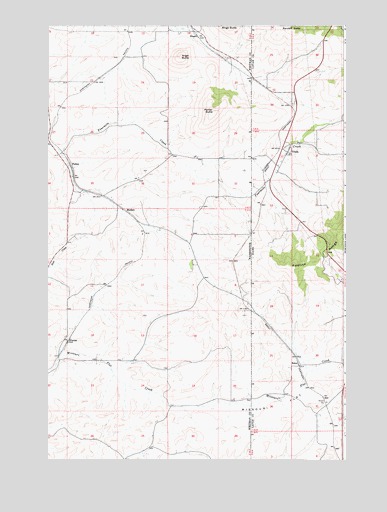
Viola, ID USGS Topographic Map
Click on map above to begin viewing in our Map Viewer.

This topographic map contains these locations and features:
Feature Name Type Latitude Longitude GNIS ID View Map
Angel ButteSummitN46.8660°W117.0691°1503036View Map
AyerLocaleN46.7913°W117.0368°399427View Map
Buswell (historical)Populated PlaceN46.8329°W117.0282°399371View Map
CoveLocaleN46.7841°W117.0268°399445View Map
EstesPopulated PlaceN46.7777°W117.0199°397689View Map
Estes StationLocaleN46.7766°W117.0238°395580View Map
FallonPopulated PlaceN46.8346°W117.1157°1510961View Map
Hill AirportAirportN46.8415°W117.0594°2443419View Map
MadsonPopulated PlaceN46.8218°W117.0938°1511114View Map
Missouri FlatFlatN46.7649°W117.0310°373978View Map
Missouri FlatFlatN46.7635°W117.0346°1506738View Map
Parker ButteSummitN46.8504°W117.0554°1507304View Map
PoeLocaleN46.8152°W117.0396°394947View Map
Randall ButteSummitN46.8732°W117.0213°374570View Map
RingoPopulated PlaceN46.8716°W117.0618°1511259View Map
ViolaPopulated PlaceN46.8385°W117.0246°398309View Map
Viola Post OfficePost OfficeN46.8393°W117.0245°2781732View Map
WhelanPopulated PlaceN46.7841°W117.1166°1511424View Map
Whitman County Fire District 12 Station 12 - 3BuildingN46.7782°W117.0958°2643906View Map

Note: Coordinates in the location and feature list above are referenced to NAD83 datum.


Copyright (C) 2008-2025 Ryan Niemi / Sunset Dynamics ... All Rights Reserved