TopoQuest Logo
Do you find TopoQuest useful?
Help keep TopoQuest running and adding new maps/features by donating!
Bitcoin:  19c7KJd3qBynnjoSw5npx9KScwjBe4ifkT
Litecoin:  LXs6TkuXGGXo1vDsWCkWVdjQX94eUKd6ui
Home View Maps Find Maps Find Places Resources & Links


Moss, Mississippi Topographic Map

USGS Map Title: Moss, MS
USGS Map MRC: 31089G2
DRG (GeoTIFF) Download: o31089g2.tif


Neighboring USGS Topographic Map Quads:


  Bay Springs, MS  
31089H3
 

  Lake Como, MS  
31089H2
 

  Waldrup, MS  
31089H1
 

  Soso, MS  
31089G3
 

  Moss, MS  
31089G2
 

  Sandersville, MS  
31089G1
 

  Hebron, MS  
31089F3
 

  Laurel West, MS  
31089F2
 

  Laurel East, MS  
31089F1


Map MRC Location:

N32°
W90°
N32°
W89°
H8 H7 H6 H5 H4 H3 H2 H1
G8 G7 G6 G5 G4 G3 G2 G1
F8 F7 F6 F5 F4 F3 F2 F1
E8 E7 E6 E5 E4 E3 E2 E1
D8 D7 D6 D5 D4 D3 D2 D1
C8 C7 C6 C5 C4 C3 C2 C1
B8 B7 B6 B5 B4 B3 B2 B1
A8 A7 A6 A5 A4 A3 A2 A1
N31°
W90°
N31°
W89°

Moss, MS USGS 1:24K Topographic Map Preview:
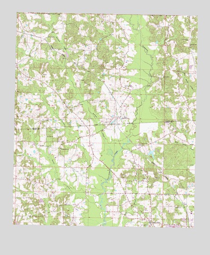
Moss, MS USGS Topographic Map
Click on map above to begin viewing in our Map Viewer.

This topographic map contains these locations and features:
Feature Name Type Latitude Longitude GNIS ID View Map
Andersons Mill (historical)LocaleN31.8460°W89.1709°686627View Map
Brushy CreekStreamN31.7632°W89.1903°667684View Map
County Line CemeteryCemeteryN31.8110°W89.1878°668866View Map
Cypress CreekStreamN31.7782°W89.1870°669047View Map
East Tallahoma ChurchChurchN31.7985°W89.1612°669613View Map
Friendship ChurchChurchN31.7621°W89.1384°670224View Map
Good Hope Baptist ChurchChurchN31.8610°W89.2284°670471View Map
Graham CemeteryCemeteryN31.8688°W89.1534°670568View Map
Heritage Lake DamDamN31.8185°W89.1817°680904View Map
HoyPopulated PlaceN31.7649°W89.1326°691946View Map
Joe Welch Lake DamDamN31.7718°W89.2284°680884View Map
Lamar School (historical)SchoolN31.7821°W89.1487°685522View Map
Martin Raegan Lake DamDamN31.7918°W89.1584°680894View Map
MatthewsPopulated PlaceN31.7960°W89.2181°685530View Map
Matthews CemeteryCemeteryN31.7943°W89.2184°707363View Map
Memory Gardens CemeteryCemeteryN31.8321°W89.1756°673473View Map
MossPopulated PlaceN31.8152°W89.1778°673873View Map
Moss Chapel (historical)ChurchN31.8077°W89.1998°685538View Map
Moss Chapel School (historical)SchoolN31.8077°W89.2001°707367View Map
Moss Lake DamDamN31.8102°W89.1867°680902View Map
Moss Post OfficePost OfficeN31.8143°W89.1778°712658View Map
Mossville Volunteer Fire DepartmentBuildingN31.8314°W89.1677°2668048View Map
Newhope School (historical)SchoolN31.8210°W89.1303°686642View Map
Pleasant Grove ChurchChurchN31.8396°W89.1484°676002View Map
Pleasant Home Baptist ChurchChurchN31.7952°W89.2181°676093View Map
Poore Store (historical)LocaleN31.8021°W89.1345°685572View Map
Roy Valley ChurchChurchN31.8027°W89.2276°676939View Map
Sandridge School (historical)SchoolN31.8104°W89.1853°686646View Map
Shady GrovePopulated PlaceN31.7527°W89.1539°677540View Map
Shady Grove CemeteryCemeteryN31.7521°W89.1545°707392View Map
Shady Grove ChurchChurchN31.7527°W89.1551°685590View Map
Shady Grove Elementary SchoolSchoolN31.7535°W89.1556°707393View Map
Shady Grove Volunteer Fire DepartmentBuildingN31.7625°W89.1680°2668077View Map
Sun Light Baptist ChurchChurchN31.7635°W89.1326°685602View Map
Supervisor District 1CivilN31.7682°W89.1323°711919View Map
Terrapin CreekStreamN31.7913°W89.1817°678634View Map
Union Seminary CemeteryCemeteryN31.8607°W89.1317°679115View Map
Union Seminary Missionary Baptist ChurchChurchN31.8571°W89.1303°679116View Map
Welborn CemeteryCemeteryN31.7993°W89.1626°679428View Map

Note: Coordinates in the location and feature list above are referenced to NAD83 datum.


Copyright (C) 2008-2025 Ryan Niemi / Sunset Dynamics ... All Rights Reserved